SMC Creek
| Rating: | |||||||||||||||||||||||||||||||
|---|---|---|---|---|---|---|---|---|---|---|---|---|---|---|---|---|---|---|---|---|---|---|---|---|---|---|---|---|---|---|---|
| | Raps:7, max ↨148ft
Red Tape:Permit required Shuttle: Vehicle:Passenger | ||||||||||||||||||||||||||||||
| Start: | |||||||||||||||||||||||||||||||
| Parking: | |||||||||||||||||||||||||||||||
| Condition Reports: | 3 Jun 2025
"First descent of SMC and lower falls. 5 hours car to car. We did a sneak approach on the logging road (47.54994, -121.70274) that brings you to SMC fa |
||||||||||||||||||||||||||||||
| Best season: | spring-fall
|
||||||||||||||||||||||||||||||
| Regions: | |||||||||||||||||||||||||||||||
Introduction[edit]
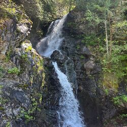
SMC Creek is located within the Snoqualmie Tree Farm (private forest land) in King County, Washington. Sourced by SMC Lake, one of the three Crown Lakes within the Mount Si Natural Resources Conservation Area, it is a tributary of the North Fork Snoqualmie River. The segment of canyoning is located where the stream descends the Moon Wall escarpment—about 1,200 ft (365 m) vertical in 0.3 mile.
Waterflow[edit]
Waterflow analysis indicates that SMC Creek has approximately half the average flow volume of nearby Rachor Creek, and twice that of Change Creek. Based on collective knowledge of those two creeks, SMC Creek may be less exciting than Rachor Creek but will likely provide several good months of canyoning opportunity from spring through fall.
Approach[edit]
Drive[edit]
From North Bend Bar and Grill, drive north on Ballarat Ave N, which turns east and becomes SE 108th St, turns north and becomes 428th Ave SE, and turns northeast and becomes N Fork Rd SE. At Ernie's Grove, the road forks—stay left on N Fork Rd SE to go up the hill. The pavement ends, and N Fork Rd SE makes a sharp left switchback and becomes NF-5700. The road passable in a passenger car as of November 2016, although there are some large potholes. After 2.5 miles, a major road intersects NF-5700. Gate 11 is on the right; park near the intersection, but do not block the gate.
Bicycle and Hike[edit]
From Gate 11:
- Bicycle or hike 2.7 mi (4.3 km)
- This section is relatively flat and well suited to bicycling. Travel east 1.4 mi (2.3 km) on the mainline road, across the bridge over the N. Fork Snoqualmie River, to a junction just beyond the bridge. Turn right (south) at the junction, and travel 1.3 mi (2.1 km) on the mainline, staying straight at the T-intersection, to a Y-junction. Park bicycles here.
- Hike 4.7 mi (7.5 km), 2,100 ft (640 m) elev. gain
- From the Y-junction, bear left to go uphill on the mainline road. In 0.6 mi (1 km), the road goes over SMC Creek at SMC Falls; this is a good checkpoint for waterflow. Continue up the mainline to the plateau and a large clear cut. Leave the road (turn left), and bushwhack down about 450 ft (140 m) elev. into the SMC Creek drainage as indicated on the map. From the topo map and satellite imagery, the bushwhack appears to be mostly across the clear cut and then a short distance through possibly brushy new-growth forest.
Descent[edit]
SMC Plateau Falls[edit]
According to a report on NW Hikers, the creek descends 70-80 ft (21-24 m) from the plateau, makes a hard turn to the left, squeezes itself into a steep slot canyon for 20+ ft (6+ m), and emerges from the slot into a series of tiers which descend for another 40-50 ft (12-15 m).
Junction Falls[edit]
Per second report, a team descended this section in 2023 then exited above SMC falls. Three tiers: 29 ft (9 m), 56 ft (17 m), and 33 ft (10 m).
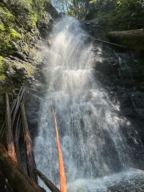
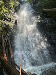
SMC and Lower Falls[edit]
The sneak approach brings you directly to SMC falls.
R1 down canyon right: 45 m
R2 center right horizontal log: 15 m
R3 Boulder down Canyon left: 15 m. We chose the boulder in order to rap under the rooster tail, but it's awkward to get on rap here.
Walk under bridge
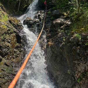
R4 down canyon right: 25 m
R5 horizontal log down canyon right: 40 m
R6 down canyon right: 10 m
R7 center canyon between the split of the river: 40 m
Exit[edit]
Soon after descending Lower SMC Falls, the creek passes under the access road for the Black Creek Hydroelectric Plant.
- Hike 0.5 mi (0.8 km)
- Exit the creek at the bridge, and turn right (north) on the road. Follow the road to the Y-junction with the mainline road. This is the bicycle parking location.
- Bicycle or hike 2.7 mi (4.3 km)
- Follow the mainline road north 1.3 mi (2.1 km) to the T-junction. Turn left (west), and follow the mainline back across the bridge over the N. Fork Snoqualmie River for 1.4 mi (2.3 km) to Gate 11.
Red tape[edit]
SMC Creek is located within the Snoqualmie Tree Farm—a vast area owned and managed by commercial timber company Campbell Global as of late 2015 (previously Hancock, and Weyerhauser prior to that). Nonmotorized day use permits are $8 per person and are required to access the approach, descent, and exit described on this page. Annual motorized permits and gate keys are $250 and are required to drive or ride in a motorized vehicle beyond Campbell Global's gates; in other words, every vehicle occupant must possess a motorized permit (see Snoqualmie Forest Recreation Program Rules and Regulations). Thus, the property owners have made it financially prohibitive for the vast majority of recreation users to access areas within the property in a motorized vehicle. Permits are available online at sqrecreation.com.
Beta sites[edit]
Trip reports and media[edit]
Background[edit]
The naming of SMC Lake was derived from a cadastral survey map of the Crown Lakes, based on work done from 1897-1902, which indicated a Special Meandering Corner (a type of land survey designation) on the lakeshore with the letters "S.M.C."—a marking unrelated to the word "Lake" written just below it. Over time, the lake, which on other old maps had been labeled as Skie Lake, took on the name SMC Lake. Although the outlet creek and falls are not labeled on official USGS maps, they are widely referred to as SMC Creek and SMC Falls.


