San Jacinto River (North Fork)
| Rating: | |||||||||||||||||||||||||||||||
|---|---|---|---|---|---|---|---|---|---|---|---|---|---|---|---|---|---|---|---|---|---|---|---|---|---|---|---|---|---|---|---|
| | Difficulty:3B II (v3a2 II) Raps:8, max ↨100ft
Red Tape: Shuttle:Required 15 min Vehicle:4WD | ||||||||||||||||||||||||||||||
| Location: | |||||||||||||||||||||||||||||||
| Condition Reports: | 23 Dec 2018
"Water was low, as expected, yet there was a significant flash flood recently. We did the full route just to check out R1 and R2. All the anchor webb |
||||||||||||||||||||||||||||||
| Best season: | All year;BEST in Mar - Jun
|
||||||||||||||||||||||||||||||
| Regions: | |||||||||||||||||||||||||||||||
Introduction[edit]
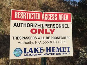
ADVISORY: The area below rap #2 is the private property of the Lake Hemet Municipal Water District. Representatives from the District confirmed that it is a restricted area and that tresspassers will be fined. AmericanCanyoneers contacted the water district to negotiate a permit system, but it was turned down.
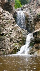
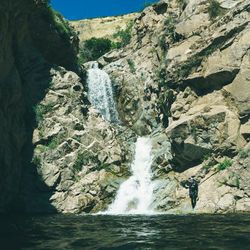
This is a neat little canyon located in the South Face of San Jacinto. The final gorge is very beautiful, with features reminiscent of canyons usually found in the High Sierras.
This canyon is mellow in low flows, but may be quite challenging and even very dangerous in higher flows. The San Jacinto River is gauged, so make sure you check the flow before you go. The final section of the canyon has several large swimmer pools that may require use of wetsuits except for summer. Plan on picking up some trash to improve the area for the next visitors.
Approach[edit]
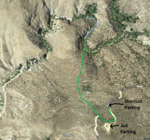
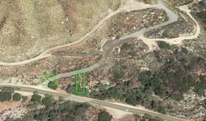
The canyon can be accessed by following the old dirt road up to Fisherman Point shown on the map. Parking along this old road is limited, so it's recommended to park extra vehicles along the highway at the bottom of the mountain. Most highway parking spots have "Emergency Parking Only" signs, with the exception of a fenced road near the bridge over the San Jacinto river and at the beginning of the dirt road up the mountain, both shown on the map. Wherever you park, make sure you don't block incoming/outgoing traffic.
After parking extra vehicles at the bottom of the mountain, pile up in one car and drive up the old dirt road. A 4WD is recommended, but the road may be 2WD passable in good conditions. Park at "Parking Short" for a short descent or "Parking Full" for the full descent.
No car shuttle is required if using the Short Approach and Climb Up Exit.
- Full Approach: There is a use trail that connects the first rappel to a knoll up the mountain and keeps going up towards the road. Descend directly from the Full Approach parking and stay on the ridge lines. This route involves some navigational skills but is quite passable with a little bit of bushwhacking. Long pants will help protect the legs.
- Short Approach: This shortcut approach bypasses the first two rappels and a significant amount of walking through the creek. You enter the canyon just before the interesting and fun part of the canyon. Do not be discouraged by the view from the road. The vegetation is densest within the first couple hundred feet of the road and becomes much more straightforward after that. Connect clearings between the scrub to virtually eliminate all bushwhacking. Car to river took us 20 minutes at a relaxed pace.
Descent[edit]
Wetsuits are needed only for the final gorge section (R4-R8), which includes several big pool swims. The first section of the descent is open and sunny and requires just strong waterproof windbreakers or neoprene jackets. If you decide to don a wetsuit at the first rappel make sure to open it up or take off the top to avoid overheating during the walk between R2 and R3. Watch out for poison oak along the edge of the river.
The Full descent includes two extra waterfalls but also has extra 3/4 mile of stream walk between R2 and R3 that, however, can be reduced to 1/4 mile by taking a saddle shortcut:
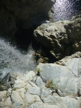
- R1: ~25ft from cairn anchor in middle of stream, rappel in full flow down into a pothole and to a pool beyond . Potential jump, but beware the pool is not too full of sand.
- R2: ~30ft from thin tree DCR, rappel in full flow down an overhanging chute. Alternatively rappel from the large tree in the middle of the canyon which ends with about 10ft of free hanging.
Saddle shortcut: this route bypasses a large meander of the river, saving 30-45 minutes of uninteresting stream walk. The shortcut is easy and efficient and feels pretty much like "teleporting". It starts when the river sharply turns left after the second rappel, it's easy to miss if you don't pay attention. Follow a game trail trough the bushes and when you reach the top of the saddle look for a use trail going down to the river.
The Short descent includes only the final gorge:
- Slide: slide 20ft down an inclined slab into a sandy pool (very shallow, check pool first), or easy down climb DCL even in high flow.
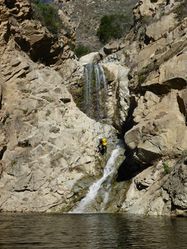
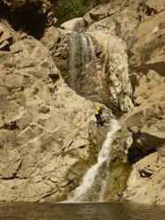
- R3: ~100ft from big (1 foot quickly tapers to 8 inch) tree DCR, rappel in full flow down an incline that overhangs in the last segment. Cross the water flow near the top to reach tree which is a bit hidden by rock cliff on right side.
- R4-R5: This can be rappelled in one 130ft shot, but is better to rappel in two stages to avoid getting ropes stuck which is highly likely if done in one shot. Be prepared to do R4 and R5 in one shot in case there is no anchor at R5. Or be prepared to build a new anchor at R5 in case it is not present.
- R4: 80ft from choke knot DCL or a large dead tree DCR (careful with knots and biners jamming at notch formed by boulder in front of tree), rappel in full flow down overhanging wall into a large pool.
- R5: 40ft from rock anchor DCL accessed from behind the waterfall (webbing replaced June 2017), rappel in full flow into a deep pool. Potential jump, but beware of underwater rock ledges. Repeatable 10ft jump on true left of pool.
- R6: ~30ft from tree in water DCR well back from drop in willows, rappel in full flow. Potential jump if you aim right, but beware of large underwater boulders in the pool.
- R7: ~70ft from bush (really a cluster of small trees) coming up from crack in middle of large slab of rock, rappel down this cascade in full flow into a hanging fern cove.
- R8: ~15ft from mini tree DCL (or chockstone pinch in stream, webbing underwater left there May 2017). Potential jump if aimed properly, but beware depth of pool. There is an excellent repeatable 15ft jump on the true left of the pool accessed from below (check depth first).
Exit[edit]
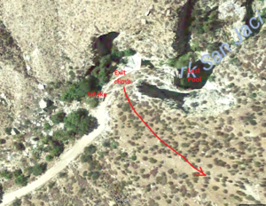
- Climb Up Exit: From the final pool below R8 follow the use trail around the corner on canyon left immediately before the dam. Begin climbing the hillside at the first place it looks possible (a steep and loose slope), just before the aqueduct intake. Try not to step on the neat succulents. Continue up and left (towards the "Short Approach" ridge) following the path of least resistance. This route is scrubbier than the "Short Approach", and steep and loose in places. Some reported loose cliffs that "totally suck" so choose your route carefully. After about 1000ft of elevation gain @ 35% grade (according to CalTopo) and about 60 minutes you should reach your vehicle. If you parked at the "Long Approach" it is about 0.5 miles of easy hiking once you hit the road.
- Walk Out Exit: Exiting the canyon by following the dirt road that goes from the dam to the highway is forbidden, as this route crosses water district property (shown in red on the map) and may be subject to a trespassing citation. Follow the dirt road until it turns into a paved road, follow the paved road to the gate; the gate/fence is protected by barbed and razor wire. There is a very easy bypass trail approx. 40-50' before the gate - from the road, the trail drops down into the bushes and leads you to the leftmost edge of the fence where it can easily be walked around. A shuttle car can be parked across the street on the large dirt shoulder. See Red Tape for more details.
Red tape[edit]
The Lake Hemet Municipal Water District claims to own section 17 (shown in red on the map), which encompasses rappel 3 to the end.
The area where the river reaches the highway is clearly fenced off with "No Trespassing" signs claiming to protect the waters from pollution. This claim is questionable, as the North Fork of the San Jacinto River flows through the center of several recreational facilities, such as Lowler Park, where access to the river is encouraged. The most likely reason for the fences and no trespassing signs is liability: to avoid locals from accessing the waterfalls, where several accidents and fatalities have occured over the years.
The water department is known to hire "security guards" to enforce the access closure. Guards are most likely to be present during the hot summer months, when locals flock to the swimming holes created by the waterfalls. They will often station at the end of the road to the dam with the mission to intercept, cite and escort out anyone trying to access the swimming holes. The guards have reportedly harassed canyoneers coming out of the canyon too, even though the canyoneering route never crosses any fence or not trespassing signs.
The two first waterfalls are outside the forbidden zone and thus completely legal to access. It's also possible to continue further down canyon for a while, unfortunately the limits of the private property are not properly marked and without a GPS you may inadvertently find yourself into the forbidden zone. If needed, you can exit up the hillside for most parts of the canyon. If you reach a concrete dam you have definitely gone too far! If you have any encounters with water district personnel be courteous and polite.
There is a "temporary" closure order renewed every year since 2005 that seasonally closes parts of the river upstream of the technical section, but this closure DOES NOT affect canyon access. See the closure order for 2015 for more details.
Beta sites[edit]
Trip reports and media[edit]
3.29.15 Descent
Background[edit]
First documented descent was on February 1st 2015 by Luca Chiarabini, Tiffanie Lin, Sonny Lawrence, Scott Swaney and Andrew Wieg. Judging by the graffiti and trash we found at the bottom of R5, locals have been using the final gorge of the canyon as a swimming hole for years. It is very possible that other canyoneers might have descended the canyon before us, but we did not find evidence of any old anchors.
Our team dropped into the river following the old road down from Fisherman Point. We explored the canyon all the way to the dam without much information of what we would find and building webbing anchors or using releasable anchors as we saw fit. We did not go against any "No Trespassing" signs and we did not jump any fences. We picked up some of the trash lying around at the bottom of R5 but opted to not disturb any of the dead pigeons.
