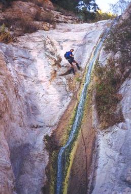
Saucer Branch
| Rating: | |||||||||||||||||||||||||||||||
|---|---|---|---|---|---|---|---|---|---|---|---|---|---|---|---|---|---|---|---|---|---|---|---|---|---|---|---|---|---|---|---|
| | Difficulty:3A III (v3a1 III) Raps:1-3, max ↨70ft
Red Tape:No permit required Shuttle:Optional Vehicle:Passenger | ||||||||||||||||||||||||||||||
| Location: | |||||||||||||||||||||||||||||||
| Condition Reports: | 1 Oct 2022
"Approach up Millard Creek Trail past Dawn Mine to Tom Sloan Saddle took 2:00. I had low expectations for Saucer Branch but it vastly exceeded them, be |
||||||||||||||||||||||||||||||
| Best season: | Never
|
||||||||||||||||||||||||||||||
| Regions: | |||||||||||||||||||||||||||||||
Introduction[edit]
Brennen's beta is well over 20 years old at this point. The canyon is severely overgrown and is not worth doing in its current state.
Approach[edit]
Brennen shuttle is depicted on the kml, you can also do a loop by going through Millard Creek and then across the Tom Sloan saddle. There is a lot of elevation gain when done this way, the way I did it (which I strongly do not recommend doing) had me gain 6000(sic) feet of elevation.
Descent[edit]
Depending on where you choose to drop in there will be a significant bushwalk before you get into the canyon. Once in the upper canyon it is relatively brush free. There are several downclimbs and fallen trees that do slow your progress. As of January 2021 (see trip report) the last third of the canyon is a ridiculously thick mess of canyon kelp. For only one decent rappel... just do Rubio instead.
Exit[edit]
After the third waterfall there is an intermittent use trail that leads to the well established Millard Creek trail. From there it's a simple matter of walking back to wherever you parked your car/shuttle car.
Red tape[edit]
Beta sites[edit]
 Chris Brennen's Adventure Hikes (St Gabriels) : Saucer Branch
 Super Amazing Map : Saucer Branch
Trip reports and media[edit]
Background[edit]
First known canyoneering descent by Mark Duttweiler, Troy Sette and Chris Brennen on Dec.23, 1999.
