Seven Teacups
| Rating: | |||||||||||||||||||||||||||||||
|---|---|---|---|---|---|---|---|---|---|---|---|---|---|---|---|---|---|---|---|---|---|---|---|---|---|---|---|---|---|---|---|
|
| |||||||||||||||||||||||||||||||
| | Raps:5, max ↨60ft
Red Tape:No permit required Shuttle:None Vehicle:Passenger Rock type:Granite | ||||||||||||||||||||||||||||||
| Start: | |||||||||||||||||||||||||||||||
| Parking: | |||||||||||||||||||||||||||||||
| Condition Reports: | 27 Jun 2026
"Seven Teacups is a lot of fun right now. Sporty enough to present good swiftwater challenges and practice but not so high that the group is avoiding |
||||||||||||||||||||||||||||||
| Best season: | Jul-Oct (avg for this region)
|
||||||||||||||||||||||||||||||
| Regions: | |||||||||||||||||||||||||||||||


Introduction
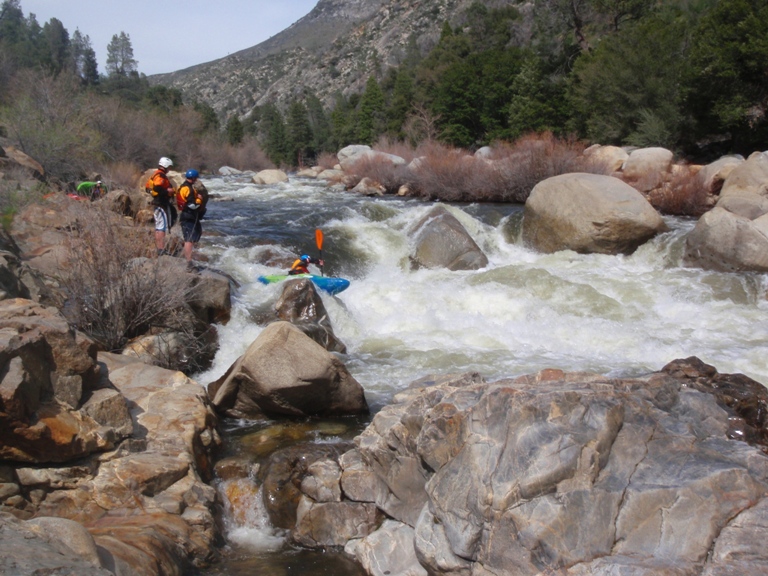
Seven Teacups, often abbreviated 7TC, is a short section of Dry Meadow Creek just before it joins the Kern River and is one of the best Class C canyons in California. This canyon is best descended in summer or fall, or whenever the flow is not extremely high as there are flow-related challenges. The technical descent is relatively short and, because the terrain is relatively forgiving with short jumps and multiple escape points, this canyon makes for a perfect practice ground before attempting longer and more difficult Class C Sierra canyons. But note that once you get into teacup2 and pull the rope, it is extremely difficult to escape the watercourse until after some of the most challenging features in the canyon: the approach to, and descent of, the corkscrew waterfall. In higher flow, safe descent usually requires advanced swiftwater techniques.
Current conditions
When judging flow, remember that trip reports are subjective and often influenced by the skill level of their authors. Actual gauge measurements are good indications, but 7TC itself is not gauged so the other gauges may not accurately reflect the flow level in 7TC. Ultimately, every canyoneer is individually responsible for making the decision to enter a canyon and should not assume the beta they read (including on this page) will accurately reflect the conditions they will actually encounter in the canyon.
Here is the most recent condition report. Click on the date below to view additional reports:
| Date | Quality | Waterflow | Wetsuit | Difficulty | Time | Team | Reported by |
|---|---|---|---|---|---|---|---|
| Amazing | Moderate High | Thin wetsuit | Special challenges | | 7 people Beginner to Advanced | BryceM777 (33 reports),Ryan.k (13 reports) | |
Comment: Seven Teacups is a lot of fun right now. Sporty enough to present good swiftwater challenges and practice but not so high that the group is avoiding all the hazards. Started a little after 9 am and back at the cars around 5 pm. We took the Brennen approach and spotted cars appropriately. People were split between a 4/3 and 3/2 wetsuits. There still is a lot of silt (nothing new there) and only teacup 5 was jumped by our group. In the toilet bowl, only 3 out of 7 could swim out. Crossing the kern also proved a little difficult. The flow is down to a little below 600 cfs but still provides a challenge to swim across. We swam right at the exit with packs and for strong swimmers it posed some difficulty but not too overwhelming. We then had a rescue rope for other members of the group that couldn’t quite swim to the other side. The good news is that downstream of the dry meadow confluence, there is calmer water before the rapids reappear so worst case a less confident swimmer can most likely cross here.
| |||||||


References
Approach
There are multiple approaches to Seven Teacups.
Brennen
Described by Chris Brennen, this route starts at the Jeep trail at 35.9766°, -118.4996° and follows a sometimes-faint trail with full sun exposure 1.83 miles to the first water of Dry Meadow Creek. It can be difficult to navigate, so a GPS is recommended. After the initial 300ft of elevation gain on a 13% grade, the remainder of the route is slightly down hill with a few ups and downs as one navigates along the dry gully. This approach has the least amount of hiking, but most sections of it are cross country which can be quite hard if there has not been any forest fire in a while.
Full loop
For canyoneers without access to two cars to make the shuttle, the road from Johnsondale Bridge to the start of the Brennen approach adds 1.4 miles and 500ft of elevation gain for a total approach of 3.3 miles and 800ft of elevation gain. This has the worst of both worlds and is definitely not recommended.
Bottom-up
The easier and most popular approach is bottoms up. Instead of the Brennen route which circles around the hills on the west side of the Kern, Seven Teacups can also be approached by reversing the exit route to the confluence of Dry Meadow Creek with the Kern, going slightly farther upstream and crossing the Kern (be careful of Respect, a class IV+ rapid a short distance downstream of the Dry Meadow Creek confluence), then climbing steeply (34% grade) 300ft up the west bank of the Kern around the Seven Teacups section on its north side. This bypass route is shown in orange on the map and enters Dry Meadow Creek shortly before the Seven Teacups section, bypassing 0.18 miles of creek travel in Dry Meadow Creek relative to the Brennen approach. This approach is 2.55 miles long and has slightly over 500ft of elevation gain.
When the flow of the Kern is strong, setting a rope across the river may aid in crossing it. Again, be careful of the class IV+ rapid just downstream of the Dry Meadow Creek confluence.
3rd Class Variation
A slight variation to the Bottom-up approach is to climb the knobby face directly to the north of the canyon. Amazing knobs and good friction makes this steep face an extremely pleasant climb for those that are equipped with good shoes and are comfortable with some exposure. Once on the top of the face, continue past some bushes and trees to a (comparatively) featureless slab. Climb the shallow gulley on the left (4th Class), or trend right and climb the obvious right facing dihedral (3rd Class) to the top. From here, you can traverse left back to the water course, dropping in wherever you desire.
4WD
For those that have a 4WD vehicle, it may be possible to bypass crossing the Kern river completely. There is a gate at the start of the 2WD route marked on the map that is sometimes closed. When it is open, this might be the only option to run 7 Teacups when the Kern is flowing 3000cfs or higher. Usually it is possible to reach the Dry Meadow Primitive Campground area with a passenger vehicle, but high clearance 4WD (or hiking) is required for the rest of the approach. The last mile is especially rough. The gate is probably open between Memorial Day and Labor Day. Outside of that range, it is typically closed.
Descent
Walk, wade, swim and rappel down the water course. Jumps and slides are often appropriate, but always have one person check the depth first and that there are no hidden rock ledges. Swimming goggles are very useful, in their absence taking an underwater picture with a waterproof camera can also help discern possible dangers.
Some jumps are shallow but on sandy bottom, so should be safe to L-jump (jump with legs high and land on your butt). But other jumps are "technical", meaning you have to aim and a minor mistake may bring disastrous consequences. In general, if you jump make sure you land in the same spot of the person that jumped in front of you. If uncomfortable or not sure, just rappel.

- First Pool: The canyon starts with a non-technical downclimb into a large pool, that is often used as a warm up jump. After that is a short swim/wade to the start of the "Seven Teacups".
- Teacup1: The first teacup is easily accessed by a short slide 6' depth from the edge, not recommend in low flow. This teacup is split into two by an arch in the middle. The arch is also a checkpoint for the water levels; when the arch hole is completely submerged, the canyon is in high water conditions.
- Teacup2: Rappel off two bolts (installed summer 2019), Slide or jump RDC, 12' deep; this is perhaps the easiest non-trivial jump in the canyon. Alternately, rappel from the arch but use a retrievable anchor to avoid leaving webbing.
- Teacup3: Rappel from a knot chock in a crack LDC (backed up by a climbing nut, installed Summer 2019); jumping this is risky as there is a ledge out of the water just below the anchor. If rappelling from the arch, a hole in the middle of the waterfall can completely submerge a rappeller be hard to get out of in high flow.
- Teacup4: "Corkscrew" rappel 12' off 2 new bolts (summer 2019) and a single old bolt; the crux of the canyon.
- In high water conditions, be careful to avoid being swept over when approaching the anchor.
- Currents here can be strong enough to sweep rappellers off their feet, invert them and trap them under the flow. The serious consequences of being trapped on rope under the waterfall can be mitigated by using a contingency anchor (such as a Figure 8 block) and manning the station from the top being ready to cut the rope in case of emergency.
- Guided rappels will be difficult here due to lack of downstream anchors.
- Some spots in the pool are over the head while others are just knee deep, and they change seasonally, so always send a person down to check for depth before anyone jumps.
- Once in teacup 4, the RDC edge of the pool may be difficult to escape but it is possible to exit by carefully climbing out the edge of the next waterfall (at the end of a short corridor with two small potholes).
- Historically, some chose to climb up on canyon left to the LDC lip of teacup4 (inaccessible from teacup3) to do an optional 20'+ jump into teacup4. As of August 2019 the water is deep enough for this to be safe, but always check the depth before anyone jumps.
- Teacup5, Teacup6 and Teacup7: These teacups can be down climbed on canyon right that, albeit quite steep, is not too hard. There is a single bolt DCR (installed summer 2019) that can be used to get down the steep slab. They can also be jumped by climbing the edge of each waterfall and pushing off from the edge. Waterfalls tend to accumulate rocks and debris under the whitewater areas but are usually deepest in the center of the pool. Approach the edge of a waterfall only if determined to jump, as hesitating at the edge may cause you to slip and fall on rocky ledges with severe consequences.
- Tall Rappel (labeled 1st big rappel in Satellite view): ~60' rappel rigged off of double bolt anchor on LDC, behind 3 trees. Here, the waterfall comes in from the right, into a small pothole and a pinch point with a boulder, known as the Washing Machine. In high flows, this feature could cause difficulties, in which case it can be bypassed by traversing high on canyon left and down climbing down the slabs on LDC.
- Nuisance Rappel: 15' Nuisance rappel off of single bolt.
- Left Turn: Here, the canyon will turn 90 degrees to the left after a big waterfall. This waterfall can be bypassed by down climbing a series of ledges on canyon left, but is more fun to rappel by using two bolts hidden inside a dry small pothole 50' at the top of the drop. This will produce a dry rappel if staying canyon left or wet if staying on canyon right. The wet rappel can be dangerous in moderate to high levels water, so make sure you gauge the water level appropriately before you commit to the wet rappel - anchor has been removed. Wet or dry, you will land in a large pool with a long swim. Jagged rocks in the bottom, be careful.
- Toilet Bowl: At the end of the pool there is a waterfall that flows sideways into a pothole below with a small lip. Rappel into the pothole from a couple of bolts off chains, canyon left. Rappelling into the pothole can be extremely dangerous at high flow, and even at moderate flow the current produced by the waterfall may be strong enough to trap all but the strongest swimmers. For this reason, the first person down should have some flotation in their pack and be ready to brace it while awaiting assistance if unable to escape the pothole. A ledge below is the best place for rescue swimmer.
- Alternately, rappel high off a tree RDC. (bypassing the toilet bowl). Free climb to the tree.
- Alternately, slide from high above the exit of the toilet bowl RDC. Carefully climb down the slanted crack to where it begins to get wet, slide into the chute. You end up just past the toilet bowl exit.
- Escape from the bottom pool can present somewhat of a challenge.
- Last Rappel: when the canyon turns sharply right you will have reached the last rappel. From an anchor on canyon right, rappel as far right as possible along the walls of the canyon until you find a metal chain with a hook anchored in one small pothole along the wall. This will provide a redirection point to safely land into the narrow slot below. If you don't use this redirection you will have to negotiate your way through a very narrow slot with multiple hazardous hydraulics that cannot be seen until one is over the edge. If doing the canyon with novices, it is best to station someone at the pothole with the hook to assist people going through the redirection.
- More experienced canyoneers can bypass this rappel by climbing up a class 2 slab LDC, dropping into the dry gully, and swimming the pothole (not suggested in anything higher then moderate conditions) to a short 15' stem. Make sure to stem as low as possible, and simply fall in and swim out.


Exit
Carefully cross the Kern River just downstream of its confluence with Dry Meadow Creek if the flow is low enough to warrant safe passage. However, it's usually safer to go about 230m / 750ft upstream at a shallower section of the river and cross there. Once on the other side of the Kern River, find the trail and follow it back to the bridge where your car will be waiting.
Special caution
There is an extremely dangerous class V rapid called Carson Falls on the Kern between Seven Teacups and the Johnsondale Bridge. It is not visible from the trail, and doesn't look particularly dangerous. Take whatever precautions are necessary to avoid this hazard as it has claimed many lives, including one of a canyoneer exiting Seven Teacups (more info). Flow information can be found at Dreamflows.
Red tape
The canyon does not require a permit, but finding a campground (especially on Memorial Day weekend) can be a total nightmare.
The Upper Kern area, spanning from north of Kernville to the Johnsondale bridge, has many campgrounds. Some of them can be booked in advance, some are first come first served. Some of them are private and relatively expensive but have incredibly nice facilities, some of them are US Forest and moderately equipped, some of them are free and have nothing more than a porta potty. Please be aware that ALL campgrounds in the area get completely full for memorial day and major weekends in June, with mariachi fiestas up to 3am and beyond in most camps. If you are looking for a quiet camp, try getting as far away possible from the main campgrounds, especially the ones near the lake or river, and choose the secluded primitive locations.
FS Order 0513-22-05 explicitly prohibits camping around the Johnsondale Bridge.
For US Forest campgrounds:
- http://www.dbw.ca.gov/Pubs/KernRiver/KernMap.pdf Map or Kern River US Forest Campgrounds
- http://www.kernvalley.com/news/kerncmp.htm Upper Kern US Forest Campgrounds
- http://www.fs.usda.gov/recarea/sequoia/recreation/recarea/?recid=79571 Kern River US Forest Information
- http://www.fs.usda.gov/Internet/FSE_DOCUMENTS/stelprd3801985.pdf US Forest Visitor Guide
For private campgrounds and motels, search for lodging near "Kernville, CA" on:
There are also campgrounds in the Forks of the Kern area, the area north of the Johnsondale bridge. Lower Peppermint Creek is a paid campground with amenities, but there are also smaller free campgrounds without amenities labeled with numbers (2-5) on the way from Johnsondale bridge to Lower Peppermint Creek.
NOTE: The Chico Flat primitive campground is a little known gem! It's first come first served and completely free. This camp is overlooked by the party goers because away from the river and lack of shade and scorned by families because lack of picnic tables and developed bathrooms. One might be able to find a spot in Chico Flat even late on Friday night of Memorial Day weekend. You may park your vehicle at the ugly campground but then walk 100 yards towards the river to find serene spots on the beach or under shady trees where you can set out your tent. By doing so you will have a peaceful stay even during the worst party night of the year. You may find information on more hidden gems on https://freecampsites.net
Beta sites
- Modern Hiker, with nice illustrations of the technical features
- Alpine Training Services
- Explore Pangea
 Chris Brennen's Adventure Hikes (Southwest) : Seven Teacups
- CanyonChronicles.com : The Seven Teacups
Trip reports and media
Conditions Report (7/14/2019) [Skip to 7 Teacups Segment: https://youtu.be/VwMX02SPgL0?t=27]
- Fourchinnigan
- Pictures from 2012
- Seven Teacups Video by Luca Chiarabini
- Seven Teacups in High Water Video by by Nivalda Pinguet
- JUMP Video by Jake Huddlestone
- Panoramic Picture of the Seven Teacups
- Candition.com : Seven Teacups
Background
Dry Meadow Creek (aka The Seven Teacups) has been a world renown prime location for whitewater kayaking since the 80s. As a canyon, it was first descended by Kevin and Genevieve Branscum, a couple of rock climbers / canyoneers / white water rafters that used to live in Kernville but have since then moved to Bend.