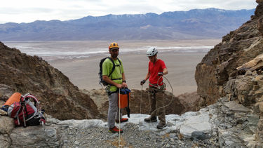
Six Shooter Canyon (North)
| Rating: | |||||||||||||||||||||||||||||||
|---|---|---|---|---|---|---|---|---|---|---|---|---|---|---|---|---|---|---|---|---|---|---|---|---|---|---|---|---|---|---|---|
| | Difficulty:3A III (v3a1 III) Raps:7-8, max ↨120ft
Red Tape:No permit required Shuttle:None Vehicle:Passenger | ||||||||||||||||||||||||||||||
| Start: | |||||||||||||||||||||||||||||||
| Parking: | |||||||||||||||||||||||||||||||
| Condition Reports: | |||||||||||||||||||||||||||||||
| Best season: | Nov-Mar
|
||||||||||||||||||||||||||||||
| Regions: | |||||||||||||||||||||||||||||||
Introduction[edit]
Approach[edit]
From the junction of Highway 190 and Badwater Road, drive about 27.5 miles south on Badwater Road. Note, this is about 10.9 miles south of the Badwater parking area. There is a long, straight stretch of road on the south side of Copper Canyon’s enormous alluvial fan. Park at the east end of this straight stretch, just before the road turns at the foot of the mountain.
Hike north from the parking spot, staying in the alluvial paths just left of the more rocky alluvial fan. After about .6 mile, continue hiking on easy terrain to the northeast, and then north up into a wash. About .1 mile into the wash, look for a dryfall on the right.
About 50 feet past this dryfall, on the same (right) side of the wash, ascend the steep slope. Avoid the tempting smooth terrain on the left (north). Stay to the right and go up the more steppy stuff. About 50 feet up, there is a rock outcrop, and you will want to head for the left side of that. Directly above the rock outcrop, find your way into a very small gully. As soon as the terrain levels out a bit (about 120 feet up), exit to the right and enter a significant and obvious drainage.
Continue up this drainage, bypassing left or right or climbing each dryfall as it is encountered. After about .3 to .4 mile, fork right, into what appears to be a side drainage. Another few hundred feet after that, fork right again. From there, continue up the drainages, forking to the right every time there is a choice, until it levels out at the top, at a minor saddle, just below elevation 1000 feet. From here, the canyon in front of you is High Noon Canyon.
From the level area, angle to the left (northeast) into High Noon Canyon. Ascend directly up the slope on the opposite side. After about 350 feet of ascent, the route will level out. Angle down to the right (south) to cross over a shallow drainage and back up onto the ridge on the other side. Continue east up the ridge until around elevation 1600 feet, where the first option to enter the canyon to the right presents itself. Angle up-canyon as you descend the slope to the canyon floor.
This entrance drops in below the first rappel in Six Shooter Canyon North, but it is the recommended drop-in point. The other option is to continue 700 feet higher, to the next reasonable entrance into the canyon.
Descent[edit]
Starting from the higher drop-in:
Rap 1: 55ft? From cairn.
Starting from the recommended drop-in:
Rap 2: 30ft? Or downclimb.
Rap 3: 35+70=105ft.
Rap 4: 25ft? Or bypass on the left.
Rap 5: 25ft? Or downclimb.
Rap 6: 65ft?
Rap 7: 30ft? From rock pinch.
Rap 8: 40ft?+80ft=120ft?
Rappel length is rope length, not drop height. All rappel lengths are approximate. Some are only estimated, not actually measured. Numbers provided as a rough guide only. Be aware of your surroundings and do not blindly follow any canyoneering info. Max rap length of 120 feet is an approximation.
Exit[edit]
About 20 minutes of easy hiking down alluvial fan.
Red tape[edit]
Beta sites[edit]
Trip reports and media[edit]
Background[edit]
Rick Kent discovered and named the canyon in 2018.
First descent: 23 December 2018. Yannick Chaigneau, Mike Cressman, Lori Curry, Rick Kent, Janice Muscio, Carly Robison, Jackie Snodgrass, Tina Tretina. (Alphabetical order.)
