Skookum Canyon
| Rating: | |||||||||||||||||||||||||||||||
|---|---|---|---|---|---|---|---|---|---|---|---|---|---|---|---|---|---|---|---|---|---|---|---|---|---|---|---|---|---|---|---|
| | Raps:3-6, max ↨120ft
Red Tape:No permit required Shuttle:None Vehicle:Passenger | ||||||||||||||||||||||||||||||
| Location: | |||||||||||||||||||||||||||||||
| Condition Reports: | 27 Feb 2021
"Nice to get back and run the canyon after scouting it in 2018. Had forgotten about all the brush. Flow was on the higher side today (with snow still |
||||||||||||||||||||||||||||||
| Best season: | Feb-Apr
|
||||||||||||||||||||||||||||||
| Regions: | |||||||||||||||||||||||||||||||
Introduction[edit]
Klickitat County is a wonderful place to sit back and feel the freedom of the open range. You’ll get that and more at Skookum Canyon.
Be aware: while Skookum can be exciting and fun in the early season with higher flows, it runs dry by late summer or fall. Not recommended to run in the summer. Expect a fair amount of bushwhacking in the creek which would be even harder if the vegetation was leafed out... so this one is best visited early in the year. There are some nice sections of bedrock occasionally along the descent.
- Ticks apparently can be a problem at certain times of the year.
- There is some poison oak in the lower canyon. (Another reason to visit early in the year.)
Approach[edit]
Park at a pullout just east of Skookum Creek on Hwy 142 east (~3min out of Klickitat Town). Note the berm blocking an access road on the north side. Climb over and hike up short trail to the Company Road (closed logging road). Walk west for 2min to a junction and turn left on old jeep trail straight up the ridge on the east/north side of the creek all the way to the powerlines. Follow the powerline track east and break off down meadowed slopes to the top of R1. The first falls is located just downstream of where the powerline crosses the creek.
- Checkpoint: Before leaving the cars, walk west on Hwy 142 and have a look at the flow on Skookum Creek.
Descent[edit]
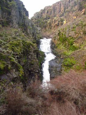
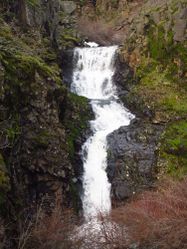
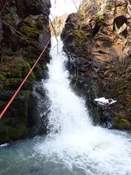
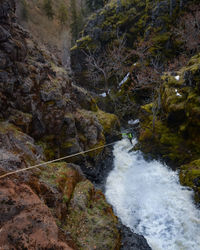
R1- Keyhole Falls 120’ from boulder DCL. This rappel is potentially hazardous and does require a careful DCR to DCL step or jump very close to the lip of the waterfall to rappel down safely. In higher flow, it may be wiser for most groups to avoid. There is ample area at the top to assess. This is the crux of Skookum.
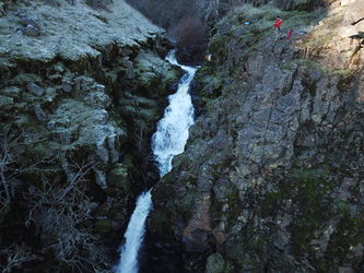
R2- Chutes and Ladders Falls 200’ from bolt station DCR. More rope is required to reach the pool at the bottom, but the pull will suck, particularly in high flow. It may be best not to rappel the final tier and instead pull from a dry platform DCL. You can bypass the last drop by scrambling over a mini-ridge DCL.
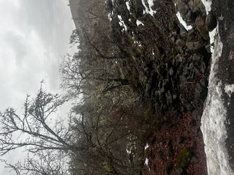
Below R2, the creek becomes a thrashfest for some distance. Continue downstream wherever is easiest, crossing the creek when needed. Eventually locate a game trail DCR that runs along steep slopes which is easy walking, then just cut down to the top of R3.
There's an interesting looking chute not too far above R3.
R3- Skookum Falls
- High flow: Use 2-bolt station high DCR that is well out of the water. (~120ft??)
- Low flow: 2-bolt station low DCR from nice platform in 2 stages. Distance is about 102ft. A doubled 200ft rope will not reach. The first drop takes you into a deep hanging pool and to the flow of the main attraction.
From R3, walk down stream 150 feet until the canyon opens. You have an option to bail out of the canyon here. Game trails will take you up and out of the creek DCL back to the ridge. Other game trails DCR will take you to the top of a plateau area (very thrashy) which then opens and leads to a fast exit.
There are 2-3 shorter drops (10-12ft range) below R3 but they are down-climbable. There may also be some short slides. These have not yet been explored. Creek may be very thrashy in sections. There's also some fairly nice sections of bedrock closer to the Company Road.
Exit[edit]
- Staying in the creek: keep going until you reach the Company Road. Exit on trail DCL and drop down the far side of the road to your car.
- DCL bailout after R3: side hill using pronounced game trails until you reach the old jeep trail and descend to your car.
- DCR bailout after R3: side hill for about 0.3mi, then make your way up through thick brush to the plateau around 900ft elevation. Head directly south across the plateau and drop down open slopes to the Company Road. Walk east, ford the creek, then descend to your car.
Red tape[edit]
None.
Beta sites[edit]
Trip reports and media[edit]
https://m.youtube.com/watch?v=wiAiAsim3oE
Background[edit]
Skookum was first descended in early spring 2019 by Ryan Ernst, Haruka James Clay Lipscomb, and Shawn Bereaux.
