Skyline Canyon
| Rating: | |||||||||||||||||||||||||||||||
|---|---|---|---|---|---|---|---|---|---|---|---|---|---|---|---|---|---|---|---|---|---|---|---|---|---|---|---|---|---|---|---|
| | Difficulty:3A III (v3a1 III) Raps:2-5, max ↨140ft
Red Tape:No permit required Shuttle:Required 20 min Vehicle:Passenger Rock type:Sandstone | ||||||||||||||||||||||||||||||
| Location: | |||||||||||||||||||||||||||||||
| Condition Reports: | 7 Apr 2025
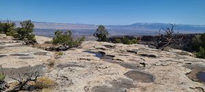
"Concur with another condition report that this is not a destination canyon. The short approach and views are excellent, but this is a cliffaneering ro |
||||||||||||||||||||||||||||||
| Best season: | Any, Hot inSummer
|
||||||||||||||||||||||||||||||
| Regions: | |||||||||||||||||||||||||||||||
Introduction[edit]
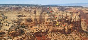
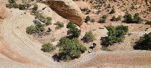
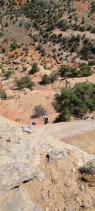
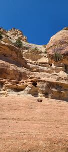
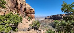
Skyline "Canyon" is a technical cliff route that descends the cliffs above Columbus Canyon in the Colorado National Monument. The route features several back to back rappels through a series of pristine forested terraces before descending a 100 foot crack and ultimately merging with Columbus Canyon for the hike out.
Approach[edit]
Skyline Canyon requires a short shuttle. The exit vehicle should be parked in the Devil's Kitchen Picnic Area parking lot. The starting vehicle can be parked anywhere along Rimrock drive near the beginning of the route shown on the map. Use good judgement when parking along Rimrock Drive, the road features several blind corners and canyoneers should take care to park completely off the road. Refer to the map for approximate location, but parking should be fairly easy to locate. From the pull-off the goal should be to reach the North Eastern most point on the cliffs between Red and Columbus. Follow the map closely to find Skyline's entrance. The first rappel is approximately .25 miles from the parking location.
Descent[edit]
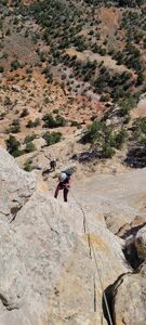
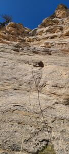
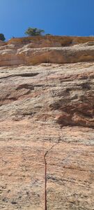
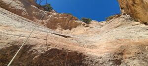
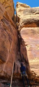
Original Beta The first rappel is 140' from a smallish juniper tree at the top of the cliff. After the first rappel, pull the rope and begin searching for a suitable anchor along the cliff edge. There's only one way to go from here: Down. During the first known descent in November of 2018 the drops were rigged with tubular webbing. If using the same anchors, evaluate the webbing closely. Continue down the cliffs ending the technical section of Skyline by descending down a 100' crack which deposits you slightly west of the drainage for Columbus Canyon. From this point, make your way east into the main drainage of Columbus.
2025 descent update
R1: 90' including 10' to fiddle from a large juniper with webbing at the top
R2: 85' including 10' to fiddle from a tree with webbing. A sharper edge, but with good feet so not as awkward.
R3: 75' including 10' to fiddle from a tree with webbing. It is possible to DC DCL to the ledge below, but a rope is required to rappel that ledge.
DC the few ledges below the bottom of R3. A 140' rope reaches from the R3 anchor to below these DCs on the R4 bench.
R4: 80' from a tree next to the final crack with webbing long enough to place the anchor over the edge.
Exit[edit]
From the terminus of Skyline, make your way east into lower Columbus. Columbus Canyon has several natural springs and flowing but easily avoidable water can usually be found in the drainage. From this point onward the route follows lower Columbus Canyon through several interesting down climbs with the option of one final rappel in the granite. Most parties should be fine with a hand line for this short last descent. There is a good boulder anchor in the middle of the draw that makes a suitable anchor. After the last rappel continue following Columbus past the confluence with Red. Stay in the draw until you see the monument boundary fence. Pay close attention to the monument boundary here. You want to exit Columbus Canyon up a short embankment on the SOUTH SIDE of the monument boundary. There is a well defined trail that leaves the draw on the north side of the fence, but using this trail will require crossing a barbed wire fence to re-enter the monument. Follow the faint trail through the sage and juniper to the south east until you see the east entrance of the monument ranger station. The goal is to ultimately end up back at the Devil's Kitchen picnic area, and your vehicle. refer to the map for exact route.
Red tape[edit]
A Colorado National Monument entrance fee is required to access Skyline Canyon
Beta sites[edit]
Trip reports and media[edit]
https://www.youtube.com/watch?v=Zn7yVrcVjZo&t=389s
Background[edit]
First known descent November 2018 by Bill Szasz, Ellis Thompson-Ellis, and Joshua Ellis. Originally called Gypsy Canyon. It should be noted that the Skyline Canyon technical route is completely visible from Cold Shiver's Point, one of the Colorado National Monument's most popular lookouts, but should not be attempted without proper technical gear and familiarity with using natural anchors.
2025-04 photos and kml added. Ira Lewis, Chris Welsh, Duane & Lyle

