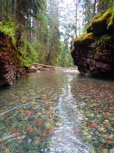
South Fork Mineral Creek (Lower)
| Rating: | |||||||||||||||||||||||||||||||
|---|---|---|---|---|---|---|---|---|---|---|---|---|---|---|---|---|---|---|---|---|---|---|---|---|---|---|---|---|---|---|---|
| | Raps:3-5, max ↨60ft
Red Tape:No permit required Shuttle:Optional Vehicle:High Clearance Rock type:Cutler Sandstone, conglomerate | ||||||||||||||||||||||||||||||
| Location: | |||||||||||||||||||||||||||||||
| Condition Reports: | 31 Aug 2025
"2h for the lower section, 3h total for middle + lower. Enjoyed this section a bit more then middle. A handful of hikes exploring some of the falls as |
||||||||||||||||||||||||||||||
| Best season: | Aug-Sep
|
||||||||||||||||||||||||||||||
| Regions: | |||||||||||||||||||||||||||||||
Introduction[edit]
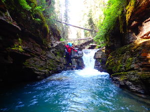
A great aquatic extension of Middle South Fork Mineral Creek, or a fun short loop walkable right from South Fork Mineral campground and accessible with a 2WD passenger vehicle. It is possible to rappel around the more challenging hydraulics.
Beware if rappelling directly through the flow, especially in these two rappels:
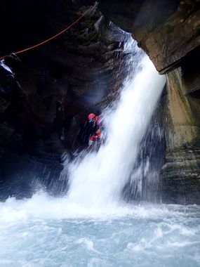
R3 carries an R rating for the required avoidance of being trapped on the far side of a boil plunging 30'. Evaluate this waterfall on your approach hike.
R5 carries an X rating if attempting straight on for a boil at this final rappel in the narrow chute. The dangers of R5 can be avoided by rappelling downstream.
This waterfall is a confirmed nesting site for the Black Swift, listed as a Species of Special Concern by the U.S. Forest Service and U.S. Fish and Wildlife Service. The swifts migrate from Brazil annually to occupy this site from late May until late September, raising a single chick. The swifts are susceptible to disturbance from human activities near their nests, including noise and movement, direct disturbance or destruction of their nests, and trampling of vegetation. Canyoneering/climbing at this waterfall during the Black Swift nesting season (late May - late September/first frost) is likely to cause direct damage to nests, eggs, and young, and disturb adult swifts enough to cause them to abandon their nest and offspring. Click here for more information on the Black Swift.
Approach[edit]
Park your vehicle near where County Road 7 (the road from Silverton to South Fork Mineral Creek Campground) crosses the culvert after the confluence of Ice Lake Creek and Clear Creek.
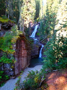
Walk a well-defined social trail on the West side of the creek up canyon. You will have an opportunity to assess the water flow along the whole hike. You can also walk up this road rather than taking the social hiking trails.
Continue upstream after the well-defined social trail on Canyon Left turns into a less-defined game trail after the wilderness campsite between the trail and the 4x4 road. To gain the final distance, access is easier on Canyon Right, so descend to the creek from Canyon Left, cross it, gain the opposite bank on Canyon Right, and go just a little further upstream. You'll see R1/J1 while crossing.
Alternatively, drive a shuttle vehicle to a meadow near the road and approach from canyon left. This is the best option if you start with the Middle section. Rappel off a tree canyon left, and jump in above R1.
Descent[edit]
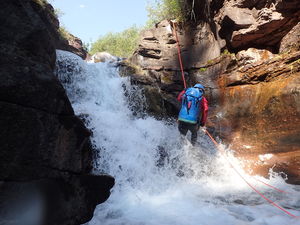
R1/J1: 12' Do not jump the waterfall, instead rappel from a large tree quite a ways back from the falls. Alternatively, the pool after the falls is deep and could be jumped from Canyon Right. Have someone verify the pool depth.
R2/J2: 15' rappel anchors are sparse and a collection of branches from a bush has been slung to be gentle on rappel. This has apparently been jumped: "From left, jump about 8' into a boil. There is a ledge just below the surface on canyon left that jutts out about 2'. What can't be seen is a ledge jutting out on canyon right about 4' underwater. Best to meat-anchor the first person down who can stand on the ledge on the far side (canyon right) so the jumpers know not to jump outwards. The landing zone here is very narrow. Toss your packs first so the pack does not get caught on the lip as you step off and throw you outward towards the other side."
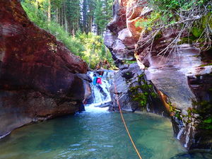
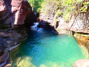
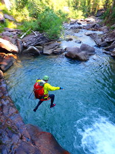
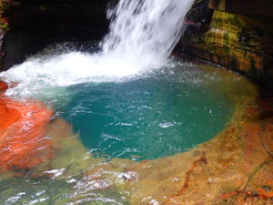
J2: up to 15' After floating and creeking down a couple hundred yards you encounter a wonderful jump opportunity. May be jumped from either side, about 15' high into a relatively wide, serene pool. Test the landing zone depth as always.
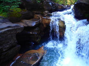
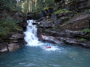
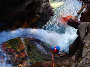
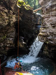
R3: 30' Log anchor, canyon right. Warning: The rappel off the log and then across the concentrated waterfall is an R move. There is a massive boil here to canyon right that can not be seen from the rappel station above. If a canyoneer gets off rope in the boil, or jumps into the boil, quick assistance will be needed to rescue them. They will get pushed up against the back wall. It is not undercut however. It is easy to reach with a rescue rope. To avoid the dangerous cauldron on canyon right not visible from the top, rappel to a small alcove, disconnect and jump over the bottom of the falls in order to catch the downstream flow to get carried away from the boil. Optionally, instead of stopping at the small alcove, rappel down to a ledge about 3 feet above the surface wide enough to stand on, lock off, toss your pack over the bottom of the falls such that it gets carried away from the boil, and duck left under the falls and jump out into the pool.
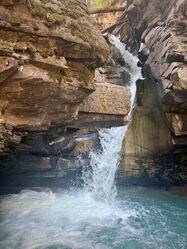
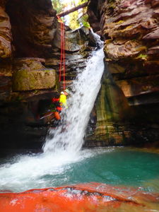
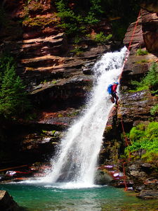
R4: 60' Tree, canyon left, 60' rappel, into shallow pool. Can be done in the falls or dry by staying canyon left.
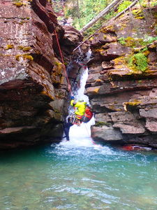
R5/J3: 15' using 30' of rope off a tree, canyon right. Warning: Rappelling R5 directly into the cauldron with intense hydraulics is an X move. The cauldron is likely a death-trap and the most dangerous part of this canyon, with very little probability of self-escape. The boil room walls are undercut on three sides of the narrow chute that leads down stream, but the exit is blocked by a concentrated laminar flow before the calm pool. Depending on water level, there is a strong back current that could trap a canyoner in the boil room. There would be little hope of getting a rescue rope in to them past the waterfall. This boil is easily avoided by rappelling just 15 feet downstream at the constriction where the flow will push the canyoneer to the safe zone. Stem at the bottom and push off in the downstream direction while releasing. Can be jumped using shallow jump technique. Verify depth first.
Exit[edit]
After the final rappel, the creek flattens out into a meandering stream with a multi-color pebble bottom. Hike in the watercourse for 5 minutes, looking to the left when the gorge opens up, then regain the trail you walked in on if you parked your car. If you camped in the campground, continue until you reach a drainage entering from the left, which is West Clear Creek aka Ice Lake Creek. Cross this shallow creek and you will be at the campground. Walk through the campground on the road to respect the privacy of the campers. Across the road from the camp host is the day-use parking lot where your exit vehicle awaits.
