South Fork Mineral Creek (Middle)
| Rating: | |||||||||||||||||||||||||||||||
|---|---|---|---|---|---|---|---|---|---|---|---|---|---|---|---|---|---|---|---|---|---|---|---|---|---|---|---|---|---|---|---|
| | Raps:5 + 4 technical jumps, max ↨60ft
Red Tape:No permit required Shuttle:Optional Vehicle:High Clearance Rock type:Cutler Sandstone | ||||||||||||||||||||||||||||||
| Location: | |||||||||||||||||||||||||||||||
| Condition Reports: | 31 Aug 2025
"1h total for the middle section then hopped up on the road and dropped down into the lower section (3h for both sections). Super slippery rock. Anchor |
||||||||||||||||||||||||||||||
| Best season: | Jul-Sep
|
||||||||||||||||||||||||||||||
| Regions: | |||||||||||||||||||||||||||||||
Introduction[edit]
Should only be attempted by canyoneers with significant swiftwater canyoning training and experience.
This waterfall is a confirmed nesting site for the Black Swift, listed as a Species of Special Concern by the U.S. Forest Service and U.S. Fish and Wildlife Service. The swifts migrate from Brazil annually to occupy this site from late May until late September, raising a single chick. The swifts are susceptible to disturbance from human activities near their nests, including noise and movement, direct disturbance or destruction of their nests, and trampling of vegetation. Canyoneering/climbing at this waterfall during the Black Swift nesting season (late May - late September/first frost) is likely to cause direct damage to nests, eggs, and young, and disturb adult swifts enough to cause them to abandon their nest and offspring. Click here for more information on the Black Swift.
Approach[edit]
From Ouray Hot Springs Park, drive south on Highway 550 for 21.5 miles where you will see a sign for South Mineral Campground. Make a right towards South Mineral Campground on a dirt road, which is County Road 7. Go 4.4 miles to the campground. Park your exit vehicle here at the day-use parking lot on the right.
Getting to the drop-in is only a mile and a half, so this could be done either with a shuttle, or simply by hiking about 30 - 45 minutes. If driving, a high-clearance vehicle is preferred but not absolutely necessary.
From South Mineral Campground, drive or hike 1.4 miles west on the dirt road to a lone stand of 3 small Pine trees on the left. Park here. There is room for 3 cars. Gear up at the car as the approach hike is only 5 minutes. 5mm wetsuit or thicker is recommended.
From the upper car spot hike diagonally southwest down and across a meadow and across one gulley. When you get to the creek you will see a 15 foot waterfall that creates a boil room. This is your drop-in.
Descent[edit]
It is recommended that everyone in your group has a whistle and to go over the whistle signals you will use that day.
Stream Gage Data for Mineral Creek at Silverton, CO: Site 09359010
http://waterdata.usgs.gov/co/nwis/uv/?site_no=09359010&PARAmeter_cd=00065,00060
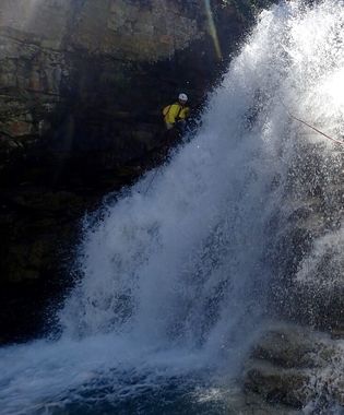
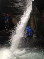
- R1/J1: Small tree canyon left, 12-15 feet. The safest way is to rappel on the downstream side of the constriction - the narrowest part of the walls. The rappel rope can be brought around a rock horn to bring it several feet over in the downstream direction and the rappeller can stand on a rock knob about 2 feet above the surface to push off and release in the downstream direction. The boil room can be jumped into as well. Someone should test the water depth first. There are two common ways to self-escape from the boil room. Swim hard on the left side and grab an underwater corner of the rock with the left hand at the constriction and pull yourself through. Or from the back wall, take a deep breath, dunk underwater, push off the back wall and swim directly underneath the falls and the current should push you out. This has been done successfully many times but there are no guarantees. If neither works, your team mates can throw a rescue rope
- J2: From left or right, a 10' - 15' jump into a shallow pool from one of several perches. Test water depth before anyone jumps. It may be only 6 feet deep and has a pebble bottom. There is a rock ledge jutting out on the right for a lower jumping platform
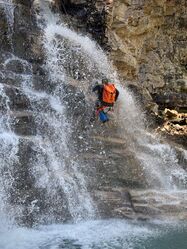
- R1: Log, canyon right, 40' rappel. The safest way down is to stay close to the wall on canyon right. It is very featured. The water is very aerated here and spread wide so not very powerful. The pool was only 3 feet deep but enough to jump on one's back/pack once near the bottom
- R2: Pinch point, canyon right, 35' rappel
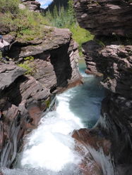
The 5th obstacle of note is a multi-tier cauldron/slide into a pool, which appears to be a nicely contoured slide down a red sandstone chute. Unfortunately, it is not a smooth ride and better to climb down on canyon right. The sandstone is surprisingly grippy here and with the available hand holds is not very difficult to down climb. This drops ends in the Cauldron, which is a swim. Log strainers occasionally block the exit of this narrow section. At least one kayaker has drowned here; a memorial for him is just above you along the rim.
After down-climbing a beautiful 30 foot wide gentle cascade, you will see Porcupine Creek entering from the right. This is the bottom of the middle section. Creek your way down for about 1/2 mile until you encounter another boil and the beginning of the lower section, or hike out creek left to your car.
Exit[edit]
Red tape[edit]
Beta sites[edit]
Trip reports and media[edit]
2014-08-31: Descended at 65cfs. No evidence of a strainer this season in the Cauldron.


