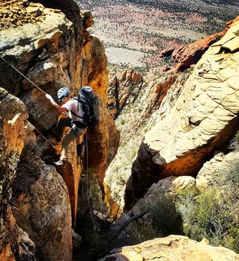
Sun Bear (Full)
| Rating: | |||||||||||||||||||||||||||||||
|---|---|---|---|---|---|---|---|---|---|---|---|---|---|---|---|---|---|---|---|---|---|---|---|---|---|---|---|---|---|---|---|
| | Difficulty:3A IV PG (v4a1 IV) Raps:7-8, max ↨200ft
Red Tape: Shuttle:Optional 20 min Vehicle:High Clearance Rock type:Sandstone | ||||||||||||||||||||||||||||||
| Start: | |||||||||||||||||||||||||||||||
| Parking: | |||||||||||||||||||||||||||||||
| Shuttle: | |||||||||||||||||||||||||||||||
| Condition Reports: | 29 Jan 2023
"The upper part of the approach was covered with ice and icy snow. We fiddled into the canyon and the first rap was full of sheen deep snow. Then it al |
||||||||||||||||||||||||||||||
| Best season: | Oct-May (avg for this region)
|
||||||||||||||||||||||||||||||
| Regions: | |||||||||||||||||||||||||||||||
Introduction[edit]
An extended Sun Bear route from the top featuring 3 Additional rappels, multiple downclimbs, and lots of rugged bushwhacking which makes for a full day. PG rating is for the loose rock especially and steep bushy terrain that requires moderate downclimbs and routefinding.
For a shorter easier day, see Sun Bear (Half)
Approach[edit]
Hike up Bear Mountain to the Sun Bear Chasm on the Left/ West side before the last push to the summit.
Descent[edit]
Drop In
Enter the Sun Bear chasm by downclimbing or using a retrievable anchor.
Find a safe place to take cover while others are on rappel.
R1: 140' into chasm. Watch for hole behind boulder near anchor. This hole can be downclimbed into if desired and you can get on rope from the next ledge.
Then prepare to bushwhack and downclimb quite a bit following drainage to reach R2.
R2: 150' white wall rappel. 170' reccomended for good pull and safe landing.
R3: 35' off tree.
Continue to Lower Sun Bear:
R4: 45' off pine on edge RDC. Followed by a 10' downclimb into a seasonal pool, and some wide stemming will keep you dry.
R5: 15' off tree LDC.
R6: 80' off pine RDC to first ledge.
R7: 110' off boulder to bottom or 80' and downclimb LDC.
Exit[edit]
After last rappel pack up and head down the slick rock drainage. Continue working your way out of the canyon until drainage evolves into a social trail. Take the faint jeep trail on the left heading east and around the large fin on your left. Once you reach the power lines follow them up a hill and to the abandoned homestead.
Red tape[edit]
Beta sites[edit]
 sedonacanyoneering.com : Sun Bear Full
