Temple Canyon
| Rating: | |||||||||||||||||||||||||||||||
|---|---|---|---|---|---|---|---|---|---|---|---|---|---|---|---|---|---|---|---|---|---|---|---|---|---|---|---|---|---|---|---|
| | Difficulty:3A II (v3a1 II) Raps:5, max ↨150ft
Red Tape: Shuttle:None Vehicle:High Clearance Rock type:Sandstone | ||||||||||||||||||||||||||||||
| Start: | |||||||||||||||||||||||||||||||
| Parking: | |||||||||||||||||||||||||||||||
| Condition Reports: | 28 May 2022
"Due to a back injury, we took it at a snails pace. Easy fairly obvious approach. First rappel is a sandy mess showering you with loose soil, may be a |
||||||||||||||||||||||||||||||
| Best season: | Year-round, After rains
|
||||||||||||||||||||||||||||||
| Regions: | |||||||||||||||||||||||||||||||
Introduction[edit]
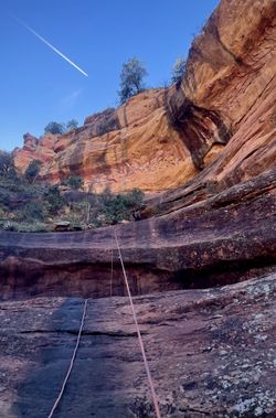
A short, rugged route with a nice final rappel sequence that follows a drainage off the eastern side of a prominence known as Temple of Diana. The canyon lurks in the shadow of Munds Mountain for most of the day.
Approach[edit]
It is recommended to download and follow the KML track if you are unfamiliar with the route. Also, wear pants.
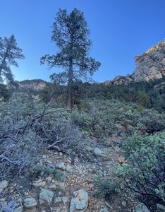
From the parking area, cross the road and enter a small drainage. Hike up the drainage for about 1/3 of a mile, then take a path LUC that leads up the ridge. At the high point, look ahead for a small cluster of pine trees.
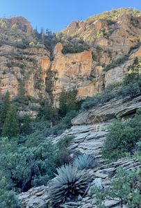
Weave through openings in the manzanita and other shrubbery and ascend the hill towards the rocky ridgeline above. There are one or two short class 3 sections.
Once at the ridge, traverse south then southwest. Maintain the same elevation until you reach the drainage.
Descent[edit]
R1: 25’ off tree RDC.
R2: 30’ off bush LDC.
R3: 150’ off tree RDC. Semi-hard start. Partially free-hanging.
R4: 90’ off tree RDC. Multi-stage.
R5: 35’ off tree RDC.
Exit[edit]
A few downclimbs will bring you to the intersection with Arrowhead. Continue down canyon following the drainage to Schnebly Hill Road. Cross the road and pick up Munds Wagon Trail for a short distance back to your vehicle.
Red tape[edit]
Beta sites[edit]
Trip reports and media[edit]
Background[edit]
Established 11/5/2021


