Terepocki Creek
| Rating: | |||||||||||||||||||||||||||||||
|---|---|---|---|---|---|---|---|---|---|---|---|---|---|---|---|---|---|---|---|---|---|---|---|---|---|---|---|---|---|---|---|
| | Raps:2-4, max ↨82ft
Red Tape: Shuttle:None Vehicle:High Clearance | ||||||||||||||||||||||||||||||
| Start: | |||||||||||||||||||||||||||||||
| Parking: | |||||||||||||||||||||||||||||||
| Condition Reports: | 28 Jul 2025
"Fun canyon! Fun jumps and swims.. The first rappel described in the July 2025 accident report is not the main first rappel, nor is it a very clean |
||||||||||||||||||||||||||||||
| Best season: | Jul-Oct
|
||||||||||||||||||||||||||||||
| Regions: | |||||||||||||||||||||||||||||||
Introduction[edit]
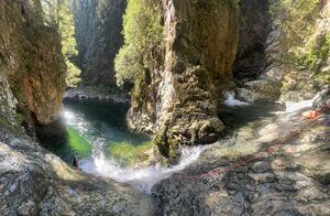
This is a short but beautiful canyon, one of the best in the Mission area. Combine with nearby Lost Creek for a full day of adventure.
The original beta describes a 8km shuttle on 4WD roads and a 2km long river walk to exit the canyon, but that can be avoided using the new exit shortcut shown on the map.
The lowest section of the canyon to the lake seems very interesting but apparently it has never been descended. Both sections (Upper and Lower) are displayed in red on the map, each of them with their own approach (green) and exit (yellow).
Approach[edit]
- Upper: Proceed on the Lost Creek dirt road (2WD, but high clearance is helpful) to the turnoff (logging road) that leads to the approach trail. The Lost Creek road gets progressively worse after the Lost Creek Canyon turnoff, with large and numerous potholes left over from wet conditions. Note that this old logging road that leads to the starting point is currently labeled on the map (and previously in the beta) as 4x4. It is not. But it IS mildly overgrown. Some vehicle scratching is possible. You need high clearance, and reinforced tires (not factory stock!) but not 4WD.
There is room for car camping at the end of the logging road (the hike start), as well as a turn to the left halfway down the road. This latter does require AWD and/or high clearance to pass the 20' entrance to the clearing. Only camping options in the immediate vicinity.
From the end of the road, drop down right through the thick (unknown) trees OR go straight on a very faint and brief trail. Then turn right down steep by semi-open terrain to a aide drainage. Climb out roots near the bottom right and then downclimb briefly to a rock island where you can also jump.
- Lower: Turn left at a turnoff and proceed down a 4WD road until you reach the vicinity of the stream. From here an easy scramble gets you down into the water.
Descent[edit]
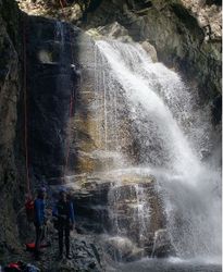
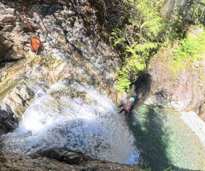
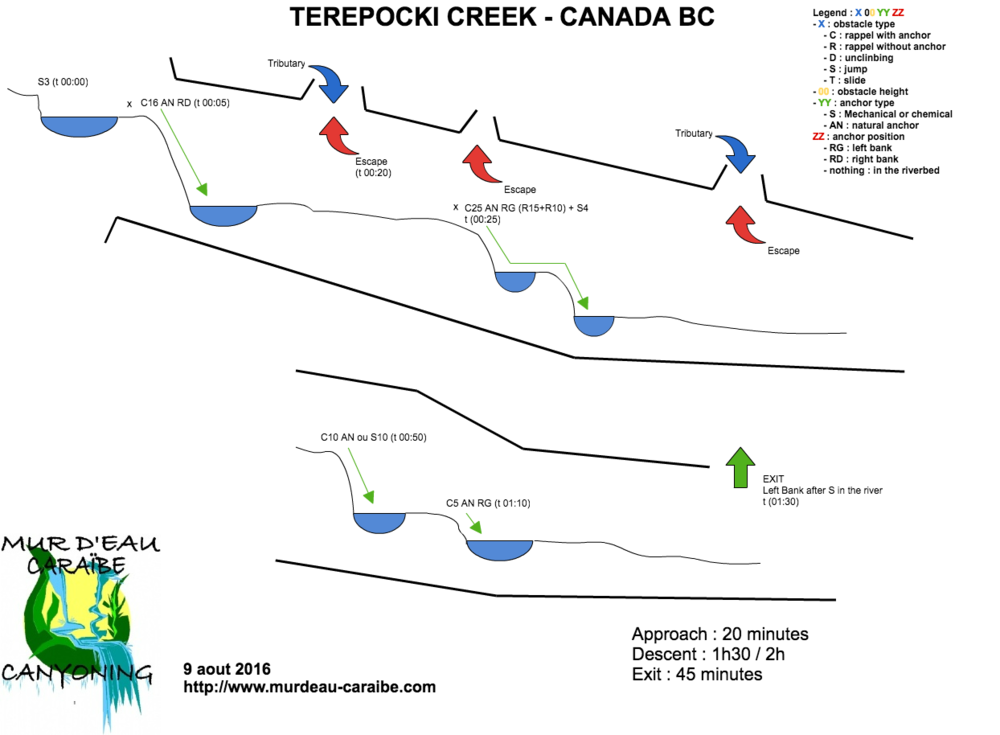
- Upper: There are 4 drops in the Upper technical section up to 25m. There are 2 mandatory rappels, 25m each and 2 jumps, 7m and 5m. On the rappels it may be possible to rappel part way to ledges and jump from there. Pools change, so make sure the first person always checks the depth and possible rocks newly washed down into the canyon.
- Lower: The lowest section has at least 2 more drops and a 100m rappel. Beta sources talk about the lower section but it seems it has never been descended before.
Exit[edit]
Upper: A short distance after the end of the technical section, there is a small and steep gully on the left. As of Aug 2023, there was orange flagging and a rope for a handline at the gully as shown on the map. Follow the handlines up gaining 100m until slightly less steep terrain. Follow flagging after briefly to the old logging road and go left on it. The road soon ends and becomes a well worn trail with frequent flagging. You will come to an obvious (dry) drainage. Cross the drainage and continue following flagging on the opposite side. You will pass an fallen wooden bridge and then go up a steep embankment to the trailhead where the cars are.
Lower: The lower exit is not documented anywhere, a possible exit was identified by studying aerial and topo maps, but this has yet to be confirmed.
Red tape[edit]
Beta sites[edit]
- BC Canyoneers
 CanyonCollective.com : Terepocki Creek
 CanyoneeringNorthwest.com (archive.org) : Terapocki Creek
Trip reports and media[edit]
Background[edit]
Original Track and Waypoint data by Kevin Swanson


