Tiger Wall Canyon (Lower)
| Rating: | |||||||||||||||||||||||||||||||
|---|---|---|---|---|---|---|---|---|---|---|---|---|---|---|---|---|---|---|---|---|---|---|---|---|---|---|---|---|---|---|---|
| | Difficulty:3B III (v3a2 III) Raps:3-6, max ↨140ft
Red Tape:No permit required Shuttle:None Vehicle:4WD - High Clearance Rock type:Sandstone | ||||||||||||||||||||||||||||||
| Start: | |||||||||||||||||||||||||||||||
| Parking: | |||||||||||||||||||||||||||||||
| Condition Reports: | |||||||||||||||||||||||||||||||
| Best season: | Sept-Oct
|
||||||||||||||||||||||||||||||
| Regions: | |||||||||||||||||||||||||||||||
Introduction[edit]
The lower pothole section of Tiger Wall Canyon makes a great addition to Showdown or Upper Tiger Wall.
Approach[edit]
Drive Highway 40 east of Dinosaur, CO turning north at the Canyon Visitor Center onto Harper's Corner Rd for 25.5 miles on pavement. Along the way, a bathroom is available at the Plug Hat Butte parking and dispersed camping is available down Blue Mountain Road.
Late arrivals beware the many deer and black cows on the open range along Harper's Corner Road.
Turn right off the pavement toward Echo Park at Sand Canyon Road, which is easily passable with 4WD HC in dry conditions. Drive Sand Canyon Rd 7.5 miles to the intersection with Yampa Bench Road. Echo Park is to the left. Turn right on Yampa Bench Road for 3.9 miles. Yampa Bench Road is also easily passable with 4WD HC in dry conditions to where it intersects Red Rock Canyon.
Park next to Yampa Bench Road just before Red Rock Canyon.
Hike: 1.9 miles -400' down Red Rock Canyon to the Yampa River. The north side of Red Rock Canyon seems to offer better cattle trails to follow.
At the end of Red Rock Canyon just before a barbed wire cattle fence are some petroglyphs in a sandstone alcove on the north side of the canyon with an inscription from Bert Hadfield in 1919.
Round the corner to the north after Red Rock Canyon opens on the west side of the Yampa River following worn cattle trails. The bench above the river provides quicker travel.
As the bench runs into a tall sandstone cliff and the Yampa turns to the east, either:
- hug the west bank to avoid a full swim, but be careful of thick poison ivy or
- swim directly across the river, which is too deep to touch. Inflate dry bags for floatation.
Note this location on the map to most easily transition between the river bank and quicker trails on the bench. On return, if staying low by the river too long another upstream swim or a short unprotected cliff climb will be required.
If backpacking and preparing to overnight to do more canyons in this area north of the Yampa, camp options exist on the South side of the Yampa before Tiger Wall or across the Yampa North of Tiger Wall.
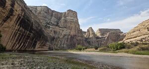
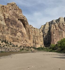
Round the corner back to the west toward Tiger Wall, a landmark black-striped tall north-facing wall. Cross the Yampa to the north side, which is only knee deep and aim uphill toward the approach gully starting at (40.49888, -108.91690).
Descent[edit]
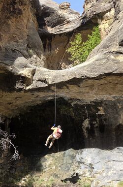
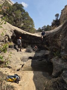
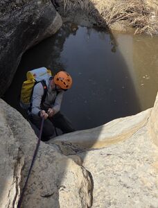
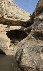
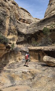
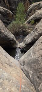
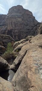
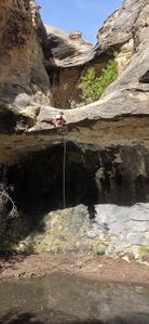
Lower Tiger Wall
R1: 35' rope from a tree DCR for a 15' drop
R2: 12' from a boulder into a waist deep pool or bypass DCR
R3: 50' from a tree above a small waist deep (potential keeper) pothole. Extend to 145' to also rappel R4 into an old pothole that wore through.
R4: approx 50' from a tree DCL or bypass DCL
R5: 45' from a boulder through a waist deep (potential keeper) pothole, over a lip and through another swim or bypass DCR and downclimb a gully back into the drainage
R6: 140' from a tree for three stages. The final pool is avoidable.
Exit[edit]
Exit the drainage DCL where a trail crosses the slickrock before the vegetation thickens near the Yampa. Retrace the approach trail back to Red Rock Canyon.
If considering adding Inlaw Canyon to the day, a path is available on the north side of the Yampa to the bottom of Outlaw.
Red tape[edit]
The North side of the Yampa is closed to access March 1 - August 15 for Peregrine Falcon nesting. This coincides with the Yampa being in a better state for crossing in the fall avoiding the higher river levels during spring melt.
A National Park's pass or a Dinosaur National Monument entrance fee is required.
Beta sites[edit]
Trip reports and media[edit]
Previously descended by Scott Patterson
2025-09-06 Beta added to ropewiki by Ira Lewis. With Carl Bern, Aven Bern, Rob Demis, Jim Rickard, Wayne Herrick
