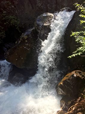
Trinity Falls
| Rating: | |||||||||||||||||||||||||||||||
|---|---|---|---|---|---|---|---|---|---|---|---|---|---|---|---|---|---|---|---|---|---|---|---|---|---|---|---|---|---|---|---|
| | Raps:6-10, max ↨120ft
Red Tape:No permit required Shuttle:None Vehicle:Passenger Rock type:Granite | ||||||||||||||||||||||||||||||
| Location: | |||||||||||||||||||||||||||||||
| Condition Reports: | 27 Aug 2024
"Ran this years run of trinity. It was roaring. Not sure why? We had a bad snow year in Montana, but despite that, I have never seen Trinity run this h |
||||||||||||||||||||||||||||||
| Best season: | Jul-Sep
|
||||||||||||||||||||||||||||||
| Regions: | |||||||||||||||||||||||||||||||
Introduction[edit]
Great Falls Creek is a huge drainage in the Absaroka-Beartooth Wilderness. From the high-Alpine lakes at 9,400 feet in elevation down to the 6,000 foot level the creek is relatively low-angle and choked with logs. Below the 6,000 foot level is where the big action is. This is a big water canyon through August most years. Easy trail approach. Easy trail exit. 6 solid waterfall rappels including the monster Great Falls (rappel #5) and Trinity Falls (rappel #6). The "R" rating is for the big boils at the bottom of Great Falls and at each tier in Trinity Falls which includes a nasty counterclockwise recirculating undercut hydraulic. Please bring bear spray. They are very present on the trail to the canyon.
Approach[edit]
Stop at Great Falls creek parking lot. Walk up the trail and follow the signs. The trail from the parking lot will be a lot of sustained uphill. Expect this to be a 30 minute walk. If you're fit and determined, you'll be there in 20. The trail will begin to switch back by Great Falls creek. Take the steep dirt deer trail that goes straight to the creek. At the bottom you will find the optional first rap above you (title photo).
Descent[edit]
The descent of Trinity Falls canyon is fast and engaging.
From suiting up you may hike upstream to the first visible falls. There is no significant anchors here, so get creative.
R1 (optional): 15 feet from whatever you find.
R2 (optional): Rappel from fallen trees, or live trees both in or out of the watercourse into a waist deep pool. This can be avoided by walking DCR.
R3: With some creativity one can down climb the lookers left side of the stream with rope assistance. However someone has placed a single bolt on the right side of the canyon to stay in the water course, rappel 50 feet.
Down climb under a fallen tree, DLC.
R4: Rappel over a 15 foot drop from a slung ponderosa.
R5: Rappel from a small tree out of the watercourse DRC 15 feet.
R6: 35 feet from a slung ponderosa down a chute. In most conditions, this rappel will be violent! It can be avoided through a traverse and 2 rappels DRC, but should be avoided if possible due to vegetation. This rappel lands into a fast moving chest deep pool.
R7: 16 feet from a tree DCR in partial flow.
An emergency exit can be found here, at the 90 degree turn. Its a 5.3ish 10 foot climb out. But very slippery.
R8: Exit the watercourse DRC in all but low flow conditions. Rappel off a tree DCR 35 feet, and into the brunt of the flow below.
NOTE: An emergency exit can be found by climbing up a ramp DCR and rappelling down to a platform from a bolt, traversing the platform and rappelling off a dead tree to avoid anything but low flow conditions!
R9: Pick a boulder and sling it, rappel down the watercourse into a punchbowl below 20 feet. Expect to deal with the full force of the flow/roostertail. In moderate to high flow, this pool is a boiling hydraulic.
Extend your rope to deal with the next drop (70ish feet). The next drop is a slabby rappel, into a strong bathtub sized undercut reticulating hydraulic. Sending your most experienced/swift water comfortable person first is a smart idea. A guided rappel may prove useful as well, as the pool ends with an immediate 7-8 foot poor over into a thigh deep pool.
Once completed. You are done!
Exit[edit]
The main exit is after rappel 9 at the grotto. Follow the trail that hugs the ridge on the left side. The trail will split, continue downhill. Its a 30 minute flat trail to your car!
Red tape[edit]
Beta sites[edit]
https://www.canyoningthe406.com/trinity-falls-canyon
