Two and a Half Shotglasses (Browns Creek)
| Rating: | |||||||||||||||||||||||||||||||
|---|---|---|---|---|---|---|---|---|---|---|---|---|---|---|---|---|---|---|---|---|---|---|---|---|---|---|---|---|---|---|---|
| | Raps:3, max ↨150ft
Red Tape: Shuttle:None Vehicle:Passenger Rock type:Granite | ||||||||||||||||||||||||||||||
| Start: | |||||||||||||||||||||||||||||||
| Parking: | |||||||||||||||||||||||||||||||
| Condition Reports: | |||||||||||||||||||||||||||||||
| Best season: | Summer
|
||||||||||||||||||||||||||||||
| Regions: | |||||||||||||||||||||||||||||||
Introduction[edit]
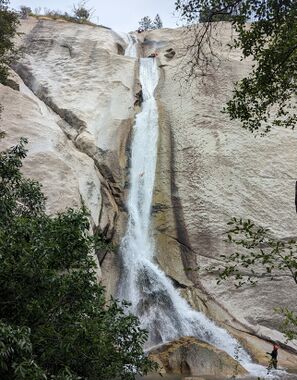
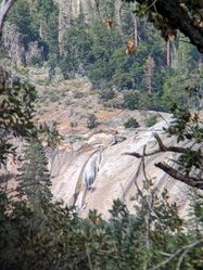
Two and a Half Shotglasses is a short canyon that is reminiscent of a mini version of Seven Teacups. The creek drops quickly through a small series of potholes down a steep granite cliff. The hike in is not too bad and there may be alternatives to the current scramble up.
Water flow can be really intense in the last rappel, so it is recommended to drive a little further up road 6S42 and look at the creek with some binoculars to check the flow before descending.
Anything but low flow is not recommended for beginner canyoneers as the last rappel poses a serious threat of inversion.
Approach[edit]
Follow the trail/ditch all the way to the dam, then go right across and up the bushy/steep hill on the other side.
Descent[edit]
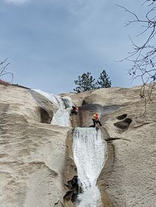
R1: 120ft: Anchored to a tree DCR, and ends right before the first large pothole, where the bolt for the second rap is (DCL).
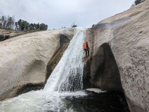
R2: 120ft, Bolt DCL hidden right above the first large pothole. Multi-stage: cross two potholes and end at the R3 anchor, DCL right after the last pothole.
R3: 150ft, Bolt DCL reachable standing on the downstream lip of the last pothole. This rappel is in the flow and can be very intense halfway down, as all the water gets funneled down a chute and onto the canyoneer. High risk for getting flipped upside down and trapped even in moderate flow conditions.
Exit[edit]
After the last rappel, cross the creek and find your way back to the approach road.
Red tape[edit]
Beta sites[edit]
Trip reports and media[edit]
Background[edit]
First descended 07/08/2023 by Feroz, Boof, Epeairs, Jennj, Sqshemet, and Levr.


