Upper Knowles Canyon
| Rating: | |||||||||||||||||||||||||||||||
|---|---|---|---|---|---|---|---|---|---|---|---|---|---|---|---|---|---|---|---|---|---|---|---|---|---|---|---|---|---|---|---|
| | Difficulty:3A III (v3a1 III) Raps:2-5, max ↨220ft
Red Tape: Shuttle: Vehicle:High Clearance Rock type:Sandstone | ||||||||||||||||||||||||||||||
| Start: | |||||||||||||||||||||||||||||||
| Parking: | |||||||||||||||||||||||||||||||
| Condition Reports: | 12 May 2025
"We skipped the Two Stage Alcove Rappel and only did the downclimbs in the first narrows.. Approach: 1hr10min. Descent: 30min. Return: 2hr1 |
||||||||||||||||||||||||||||||
| Best season: | Any, Hot in Summer
|
||||||||||||||||||||||||||||||
| Regions: | |||||||||||||||||||||||||||||||
Introduction[edit]
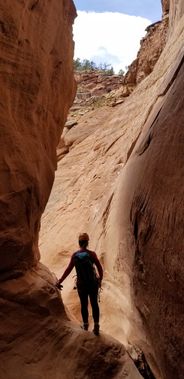
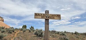
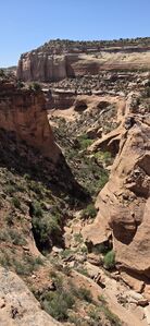
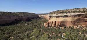
Upper Knowles Canyon is a technical canyon in the Black Ridge Canyons Wilderness area. It features several challenging down climbs, tight narrows, beautiful subway style alcoves, and expansive canyon views, the final rappel is 230ft down a sandstone slab that lands you back at the trailhead. If you skip this last rappel and do the alternate rappel mentioned below, the highest rappel is just over 100 feet.
Approach[edit]
From the Glade Park Store drive north then turn west on B South Road. B South begins as asphalt turns to packed gravel and ultimately becomes dirt before eventually crossing into McInnis Canyons National Conservation Area (NCA). Driving west on D South Rd is another roughly equivalent road, which intersects in B Road South.
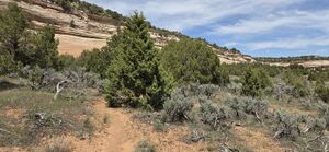
After crossing into McInnis Canyons NCA continue following the road until you see the signed Trailhead for Knowles Canyon. Park here. From the trailhead, follow the well trodden path to the northwest as it meanders around and up the sandstone slab and onto the top of the mesa. Follow the trail until it joins up with an old two track jeep road. At the jeep trail turn right and follow the trail for 3/4 of a mile before leaving the two track and heading north OR continue on the jeep road until it intersects the Knowles drainage. (The slight extra mileage likely offsets the otherwise overland travel).
Refer closely to the map. As you head north you'll cross a drainage, this is NOT Upper Knowles, continue across the first drainage until coming to a second drainage. Find a way into this second drainage and head left down canyon. Within a few minutes you'll come to the narrows at (39.07600, -108.89025).
Descent[edit]
Narrows Downclimbs
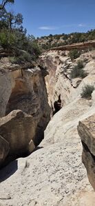
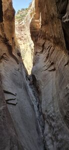
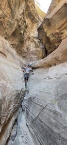
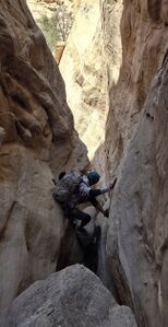
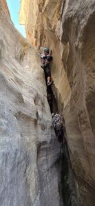
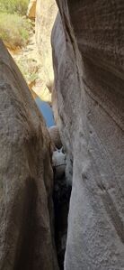
The first obstacle to overcome in Upper Knowles Canyon is a series of downclimbs in the narrows that some will wish to rappel. While the downclimbs in the narrows are only 250' lateral feet, it drops 125' down a nice narrow and challenging sandstone slot. There is anywhere from 0-3 rappels (up to 80ft) in this section depending on the comfort and skill level of the canyoneer. Several chock-stones in the narrows make suitable anchors. The final chamber bells out and makes the most difficult downclimb. A chockstone anchors this last 25' rappel.
Two Stage Alcove Rappel
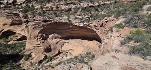
From the narrows follow the wash for approximately 1.25 miles until arriving at the lip of a large overhanging cliff. This is the next rappel. This rappel is anchored from a stocky juniper slightly above the wash on canyon left and should be done in two stages. The first stage of this rappel (100' according to the video) deposits you on a slope of loose rock above a steep sandstone bowl. Pull your rope here and hike up the rocky slope until entering the top of an enormous subway style alcove. Hike down the slope into the alcove then follow the alcove around the cliff through another short section of narrows before emerging from the narrows on the far side of the sandstone bowl from the last rappel. This section can be downclimbed by the skilled, but most will prefer a short 15ft rappel. The anchor for this rappel is a chockstone in the watercourse. Note: instead of rappelling down the lip of the falls you can head south and west to another minor drainage and rappel into a very nice and enclosed alcove which can be followed all the way around (impressive) to the narrows and final rappel.
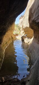
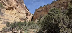
Follow the wash being sure to stop and enjoy the several beautifully sculpted alcoves along the way. Approximately 1 mile from two stage/alcove rappel you'll meet up with a well trodden backpacker trail. Keep a close eye out and refer to the map to be sure not to miss the exit.
Exit[edit]
Follow the backpacker trail out of the canyon until reaching the canyon's rim. Upon reaching the canyon's rim follow the rim east. There are several well worn game trails on the southern rim, and the the going is fairly easy for a while. Follow the canyon's rim east for approx 1 mile, crossing two drainages before finally arriving at a third. At the third drainage east from where you climbed out of the canyon you'll turn south and head up the drainage. Follow the watercourse until an obvious climb out presents itself. Congratulations you're back on top. Hike south across the mesa, crossing the jeep trail from earlier.
When the East-West hiking trail is passed, either follow it East and retrace the approach back to the Trailhead Parking or continue due south cross country to rappel the final headwall by the parking area. If continuing south, hike until you're on the cliffs directly above your car. This point will be a little less than a mile from where you climbed out of the last drainage.
Optional Final Rappel
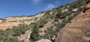
The final rappel is the longest, but the lowest angle. It can be anchored from any number of trees along the cliff's edge. The final rappel is approx 220 feet down a large sandstone slab. This rappel can be skipped by re-connecting with the hiking trail from the jeep trail, but if you have the rope, it's a fun way to end a long day.
Red tape[edit]
Beta sites[edit]
Trip reports and media[edit]
September 2019 First known descent by Ellis Thompson-Ellis and Joshua Ellis
We ran this canyon November 2023. Added webbing to the slot rappel and wished we had more for the second one into the alcove. We underestimated this day and got back to the car in the dark. 10.3 miles for us and some good routefinding!
May 2025: Updated beta, modified kml, added photos. Ira Lewis & Chris Welsh. 4 hrs car-to-car descending just the Narrows Downclimbs and skipping the Two Stage Alcove Rappel.
Background[edit]
First known descent September 2019 by Ellis Thompson-Ellis and Joshua Ellis
