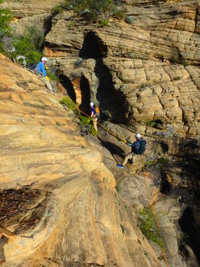
Vultee's Ladder
| Rating: | |||||||||||||||||||||||||||||||
|---|---|---|---|---|---|---|---|---|---|---|---|---|---|---|---|---|---|---|---|---|---|---|---|---|---|---|---|---|---|---|---|
| | Difficulty:3A IV (v3a1 IV) Raps:11-13, max ↨100ft
Red Tape:No permit required Shuttle:Required Vehicle:4WD - High Clearance Rock type:Sandstone | ||||||||||||||||||||||||||||||
| Start: | |||||||||||||||||||||||||||||||
| Parking: | |||||||||||||||||||||||||||||||
| Condition Reports: | 30 Jul 2022
"A long, rugged, and enjoyable back country “cliffineering” adventure with great views and ever changing scenery!. We approached via AB Young trail |
||||||||||||||||||||||||||||||
| Best season: | Spring, Fall
|
||||||||||||||||||||||||||||||
| Regions: | |||||||||||||||||||||||||||||||
Introduction[edit]
A rugged “cliffoneering” canyon route in the Secret Mountain Wilderness north of Sedona. The canyon has a beautiful alcove rappel, a section of shallow narrows with several small pools, and a young aspen grove sprouting in the upper drainage.
Approach[edit]
The approach can be done by leaving a shuttle at the Dry Creek/Vultee Arch T/H or leaving a shuttle at the Vultee Arch T/H at 89A then driving over to hike up the AB Young trail to the drop-in, or do what we did and have someone drop you off up top and pick you up at the bottom later in the day. Hiking Up the AB Young --> down Vultee's Ladder --> Dry creek past Vultee Arch --> over Sterling Pass --> and down to 89a is roughly 10 miles, 10 hours, 3200' of elevation gain&loss.
Descent[edit]
The descent consists of 11 rappels - many of which are close to 100 ft - and the opportunity for two bonus raps up to 170 ft (optional).
Exit[edit]
4WD HC Shuttle: After the narrows, hike down the remainder of the drainage to Dry Creek and turn left finding the trail that weaves alongside the creek and leads back to your shuttle.
2WD Shuttle: Take Dry Creek Trail to Vultee Arch Trail and then continue up Sterling Pass Trail and back down to the 89A.
Bonus rappels: A short distance after the last rap, hike up and over to the next drainage north to perform a 170’ and a 60’ before reaching Dry Creek.
Red tape[edit]
Trip reports and media[edit]
https://m.youtube.com/watch?v=vZDoIC_arI8#menu
03/08/2020 - Ran the AB Young to Sterling pass route, starting and ending at 89a. Pools/narrows section avoidable by exiting the watercourse and climbing down canyon right. Made for a decent&dry but LONG winter route. Some beautiful views from the upper potions of the canyon.
Background[edit]
First descent by Josh Marks, Dinna Marquez and Jay Wisocki
Beta sites[edit]
Trip reports and media[edit]
Background[edit]
Josh M, Dinna M, and Jay W did a first descent on this drainage.
