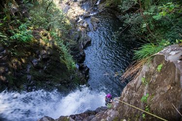
Waikaumalo Creek
| Rating: | ||||||||||||||||
|---|---|---|---|---|---|---|---|---|---|---|---|---|---|---|---|---|
| | Difficulty:3B III (v3a2 III) Raps:7-10, max ↨70ft
Red Tape: Shuttle:Optional 6 min Vehicle:Passenger Rock type:Volcanic | |||||||||||||||
| Location: | ||||||||||||||||
| Condition Reports: | 18 Feb 2019
"We got a ride in the back of a locals pickup truck up the last 1/4-1/2 mile or so of the approach. Everyone had 2+mm shorties except I had a long-sle |
|||||||||||||||
| Best season: | ||||||||||||||||
| Regions: | ||||||||||||||||
Introduction[edit]
Waikaumalo is an excellent canyon with a number of impressive but approachable waterfalls and straightforward logistics. Its very slippery rocks are immune to Stealth rubber, however, and the constant sliding can make for a more strenuous descent than other canyons of similar length. The rap descriptions below keep the rappeller almost entirely out of the main flow of the waterflows, so swift water is not an issue during some flow conditions.
Approach[edit]
Turn off of 19 onto Old Mamalahoa Hwy, pass the main park entrance, cross a bridge, and park in the parking lot next to a pavilion with restrooms; this is the exit of the canyon. Walk down to the stream to see the water level.
Head east on Old Mamalahoa Hwy briefly, then turn right (southwest) on Piha Kahuku and head uphill. Try to pass the noisy dogs as expeditiously as possible, and stay on the pavement to make it clear you are not intending to enter any private property. If you are lucky, a local may give you a ride up part of the approach. Enjoy the excellent view of the ocean. Eventually, turn right on Stone Road. If you are car shuttling, there may be a single parking spot at the sharp left bend in Stone Road as it starts descending to the bridge, but public use of this spot has not been confirmed -- it would be better to hike up and avoid any possible issues.
South fork[edit]
Cross to the far side of the bridge and push through the brush to climb down on the LDC downstream corner, around the bridge foundation. Change into wet suits and technical gear under the bridge.
North fork[edit]
Continue across the bridge to the next drainage and drop in there (not yet confirmed).
Descent[edit]
Note that all lengths below are very inaccurate eyeball estimates. A 200ft rope doubled over was plenty long enough in all cases.
South fork[edit]
Walk about 15 minutes downstream past some nice, smaller waterfalls.
R1: ~25ft from tree far RDC. Possible jump LDC, probably too shallow RDC.
R2: ~70ft from a somewhat-precarious perch high RDC keeps the canyoneer mostly out of the main falls. A handline to the anchor may be useful.
R3: ~60ft two-stage from large rock in water course slightly RDC, or meat anchor from a very convenient rock berm then climb past second stage RDC and jump ~25ft.
The pool below R3 is the confluence with the north fork.
Main descent[edit]
Scramble downstream for a while before arriving at a wide cliff waterfall.
R4: ~45ft from a boring tree anchor far LDC, or find a more interesting anchor near a different part of the waterfall.
R4.5: Jump 8ft, or construct a rock chock anchor RDC of the waterfall.
R5: ~50ft from a tree high RDC.
R6: ~30ft from a rock chock slightly LDC of the leftmost falls, or many alternate anchor possibilities exist.
R7: Carefully downclimb RDC of falls to the second cliff level, then rappel ~50ft from a tree at the downstream corner, landing just upstream of the last small rapids.
R8: ~55ft from a convenient, giant eyebolt in the concrete of an old foundation.
R9: ~45ft from a tree far LDC after downclimbing a bit to reach it (may want a handline).
Exit[edit]
Scramble downstream as signs of humans become somewhat more evident. Just before the stream bends right, find a trail RDC. Follow this short trail back to your car.
Red tape[edit]
Private property is very important in this area; be extra careful not to trespass.
Beta sites[edit]
 CanyonChronicles.com : Waikaumalo Creek
