West Labyrinth (Dinosaur)
| Rating: | |||||||||||||||||||||||||||||||
|---|---|---|---|---|---|---|---|---|---|---|---|---|---|---|---|---|---|---|---|---|---|---|---|---|---|---|---|---|---|---|---|
| | Difficulty:3A III (v3a1 III) Raps:5, max ↨150ft
Red Tape:No permit required Shuttle:None Vehicle:4WD - High Clearance Rock type:Sandstone | ||||||||||||||||||||||||||||||
| Start: | |||||||||||||||||||||||||||||||
| Parking: | |||||||||||||||||||||||||||||||
| Condition Reports: | |||||||||||||||||||||||||||||||
| Best season: | april, may, august, september, october
|
||||||||||||||||||||||||||||||
| Regions: | |||||||||||||||||||||||||||||||
Introduction[edit]
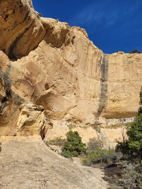
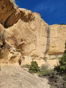
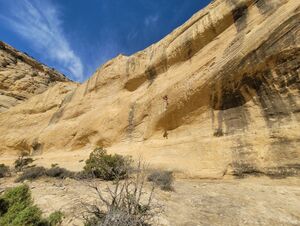
West Labyrinth (Dinosaur) is one of three canyons that feed into Ely Creek Canyon, located in the Jones Hole area, about 5 miles downstream from the confluence of the Yampa and Green rivers. We did this canyon last out of the three Labyrinth canyons and feel it’s better than East, but not a good as Middle. The canyon has 5 rappels to 150 feet and multiple downclimbs, to 15 feet, with plenty of natural anchors. I probably wouldn’t repeat the canyon unless doing all three Labyrinths at one time due to the long, rough approach roads and remote trailhead.
Approach[edit]
Approach Drive (from Diamond Mountain Road – Vernal, UT) Leave the paved road at 40.6038, -109.3089. Head towards Diamond Mountain on well-maintained Rim Road (dirt). Stay on Rim Road for approximately 7 miles until making a right turn at 40.6107, -109.2091. Follow a series of rough roads for the next 10.7 miles, making multiple turns to eventually reach the trailhead. While this section of road is only 10.7 miles, expect an hour or more of driving. CAUTION - Once you leave Rim Road, the roads become successively more rugged, steep, rocky and remote. A high clearance 4x4 vehicle is required. You should be self-sufficient and well prepared; this is a remote trailhead and a long walk if you have problems. Consider traveling this road with multiple vehicles. There’s reasonable camping at the trailhead.
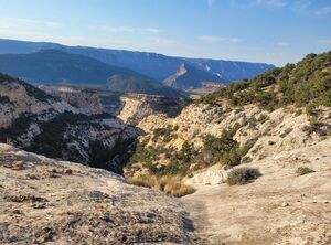
Approach Hike From the trailhead hike east 1.7 miles to gain the ridge above the start of West Labyrinth Canyon. The hiking is generally easy with multiple small canyon crossings.
Descent[edit]
Leave the ridge, dropping down to reach 40.5815, -109.0765 which is the start of the canyon. The first rappel is at the start.
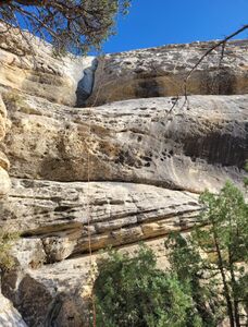
- R1: 120’ from a tree set back40’ from the rim.
- R2: 35’ from a tree.
- R3: 130’ from a tree.
- R4: Bypassed on left (LDC) as the main waterway had poison ivy in the rope path.
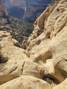
CAUTION for R5 – The drop in the main waterway is well over 200’ in length and lacking natural anchors at the top. We estimate that 250’ – 350’ or more of rope may be required to rappel this drop. It might be possible to break the drop into two rappels with an intermediate ledge, but we did not attempt this as our longest rope was 200’. Instead, we traversed 300’ east to find a shorter rap line.
- R5: 150’ from a tree set 300’ EAST of the main waterway.
- Note: We fiddled all of the rappels with no problem retrieving gear. Canyon was dry.
- Unfortunately, we found 8 dead elk between R2 and R3, some more recently expired than others. We found one additional dead elk at the top of R5.
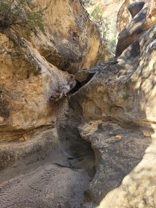
After the last rappel, it’s 15 -20 minutes to a fun and interesting section of slot. The canyon ends right after the slot at 40.5707, -109.0746. This is also the canyon end for Middle Labyrinth.
Exit[edit]
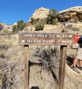
From the canyon end, hike south east 0.4 miles through the creek bottom until it becomes overly brushy. Continue heading south east for 0.35 miles, staying up above and on the south side of the creek to avoid the worst of the brush, until being forced by a cliff face to cross the brushy creek and join the exit trail for East Labyrinth Canyon. Follow the exit for East Labyrinth for 0.4 miles until intersecting the faint trail to Island Park at approximately 40.5644, -109.0628. There’s an old trail sign here. Follow the Island Park trail south (crossing the creek, faint trail) and then head 0.8 miles west on the trail to reach the canyon rim. The Island Park trail is faint, brushy and lightly traveled in spots. Follow the Island Park trail until you have climbed out of the canyon and traversed the rim to 40.5608, -109.0728. From here head NW about 2 miles overland along the canyon rim to reach the parking area.
Red tape[edit]
none
Beta sites[edit]
Trip reports and media[edit]
Background[edit]
We didn’t find any evidence of previous exploration in West or Middle Labyrinth canyons. First known descent October 8, 2024 by Jim Rickard, Wayne Herrick and Rob Demis.
