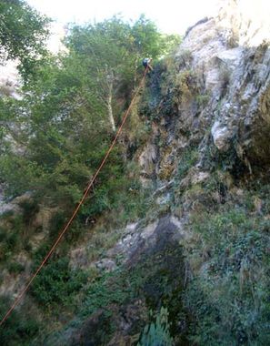
White Oak Canyon
| Rating: | ||||||||
|---|---|---|---|---|---|---|---|---|
| | Difficulty:3A IV (v3a1 IV) Raps:3, max ↨150ft
Red Tape:No permit required Shuttle:Required Vehicle:Passenger | |||||||
| Location: | ||||||||
| Condition Reports: | 28 Aug 2021
"There are intermittent sections of dense brush but theyre not too frustrating to get through and have long sections of pretty easy terrain in between |
|||||||
| Best season: | ||||||||
| Regions: | ||||||||
Introduction[edit]
A short technical section with a few nice rappels including a free-hanging rappel in a sprinkling waterfall. The hike up is mostly exposed to the sun so is best done very early in the day in the summer or when it's cooler out. One must always be aware of the water levels int he Big Tujunga reservoir. Even if it hasn't rained for a while the water levels can be quite high which requires a long swim and the water can be quite cold. If you are unsure on the water conditions it is advisable to bring a pack-raft or wetsuit and a drybag for floatation as well as waterproof headlamps as you may exit in the dark.
Another option for this canyon is to combined it with Upper White Oak to add 6 more rappels but it requires a bit more effort to get to the top and 3-4 hours more time. The best rappels are definitely the last 2 in White Oak.
- As with all the Big T canyons your help is needed to keep access open. This entire area is still seeing a slow recovery from the old station fire which means lots of invasive plants and overgrowth in general can quickly close off access to these areas and/or make your time in them miserable. Consider adding a pair of hand shears and/or small bypass loppers to your gear list when descending these places.
Educate yourself on how and why [1]
BIG TUJUNGA CANYON RESTORATION
Approach[edit]
Descent[edit]
Exit[edit]
Red tape[edit]
Beta sites[edit]
 Chris Brennen's Adventure Hikes (St Gabriels) : White Oak Canyon
 Super Amazing Map : White Oak Canyon
Trip reports and media[edit]
Background[edit]
First canyoneering descent on Aug.26, 2006, by Nathan Schara, Mark Fitzsimmons, Jane Fontana and Chris Brennen.
