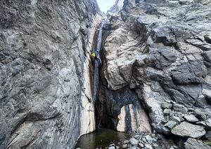
Willow Creek Canyon
| Rating: | |||||||||||||||||||||||||||||||
|---|---|---|---|---|---|---|---|---|---|---|---|---|---|---|---|---|---|---|---|---|---|---|---|---|---|---|---|---|---|---|---|
| | Difficulty:3B III (v3a2 III) Raps:11, max ↨200ft
Red Tape:No permit required Shuttle: Vehicle:Passenger | ||||||||||||||||||||||||||||||
| Location: | |||||||||||||||||||||||||||||||
| Condition Reports: | 14 Feb 2026
"To say that this is one of the lesser Death Valley canyons would be a shame, a shying from effort, or a complete lack of timing for weather and spring |
||||||||||||||||||||||||||||||
| Best season: | Nov-Mar (avg for this region)
|
||||||||||||||||||||||||||||||
| Regions: | |||||||||||||||||||||||||||||||
Introduction[edit]
Willow Creek Canyon is one of the most unique canyons in Death Valley for the simple fact that it has year-round flowing water. There are several avoidable deep pools and countless small to large waterfalls in the middle of a rocky, barren desert. While not technically difficult, this canyon is sure to please any desert canyoneer.
There is a road that goes right to the start of the canyon, and another road near the end. Using a shuttle is the preferred way to do this canyon.
However, if you don't have a shuttle, or prefer a strenuous approach, you can hike the approach, gaining a minimum of 3,ooo feet, or as much as 4,400 feet, all off-trail, depending on which gully you use to downclimb into the canyon. See the Approach section below for details.
Approach[edit]
If you don't want to hike up 4400ft, drop off a car at the exit and drive up to the start (aprox 2h). Because it would take you 2h+2h=4h to retrieve the upper vehicles later, it is best to leave this canyon for a day that you are going to drive out of Death Valley going south.
Descent[edit]
Waypoints in the KML map contain detailed descriptions of all the rappels (courtesy of Bluugnome.com).
Exit[edit]
Red tape[edit]
Beta sites[edit]
 BluuGnome.com : Willow Canyon
- https://www.stavislost.com/hikes/trail/willow-creek-canyon
 Chris Brennen's Adventure Hikes (Southwest) : Willow Creek
 Super Amazing Map : Willow Canyon
 ToddsHikingGuide.com : Willow Creek Canyon
Trip reports and media[edit]
First Known Trip to hike up Willow from the bottom, and avoid the long shuttle option dated 2-19-2010:
https://www.facebook.com/media/set?vanity=scott.swaney&set=a.10164491216522930
Background[edit]
Canyon was already bolted when descended by Mark Duttweiler, John Perry, Bob Greer and Chris Brennen in Jan. 2004

