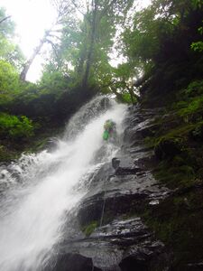
Yaquina River
| Rating: | |||||||||||||||||||||||||||||||
|---|---|---|---|---|---|---|---|---|---|---|---|---|---|---|---|---|---|---|---|---|---|---|---|---|---|---|---|---|---|---|---|
| | Raps:3-4, max ↨90ft
Red Tape:No permit required Shuttle:None Vehicle:Passenger | ||||||||||||||||||||||||||||||
| Start: | |||||||||||||||||||||||||||||||
| Parking: | |||||||||||||||||||||||||||||||
| Condition Reports: | 17 Jul 2022
"Gate was closed, so we had to hike in and out the extra mile along the road. Doesnt look like anyones visited the creek in an age, so we replaced al |
||||||||||||||||||||||||||||||
| Best season: | Jun-Aug
|
||||||||||||||||||||||||||||||
| Regions: | |||||||||||||||||||||||||||||||
Introduction[edit]
This canyon is a surprising gem, outdoing many others in the Oregon Coast Range canyons (ex: Parker Creek). It's short and sweet with 3-4 rappels. The Yaquina runs from its headwaters just upstream of this section all the way to the Pacific Ocean, near Newport. The creek likely runs high during the spring, but drops to become beginner-friendly about June to July. Visit earlier in the season if you like higher water.
- Watershed: 3.45mi^2.
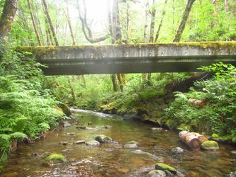
- Checkpoint is the creek just below the bridge.
Directions[edit]
Be aware: Google Maps does not show the road leading to the drop into the canyon. Bring a GPS and map of the area for navigation.
From Corvallis, head west on US-20 for 15.5mi to Blodgett. Turn right here on OR-180 west and continue another 7.5mi to the small town of Nashville. In Nashville, turn right onto County Rd 410 (SR 411) for 3.1mi and turn right again on Green Mountain Road (just after the end of pavement).
- Follow Green Mountain Rd upwards for 2mi.
- At a junction, turn right (onto Harmsen Rd?) for 0.4mi to another junction. Turn left here to find a yellow gate. Park here, but do not block the gate.
According to the original beta, the gate is often open on weekdays, but closed on weekends. If the gate is open, be aware there's no guarantee it will remain so. Drive in at your own risk. It may be wiser to park outside the gate and hike in.
Approach[edit]
From the gate, hike down the road about 0.9mi to another junction. Turn right here for a final 0.2mi down the hill to a bridge crossing Yaquina Creek.
Drop into the creek below the bridge and head downstream. It takes a few minutes to the first technical obstacle. Creek is surprisingly grippy underfoot.
Descent[edit]
Head down the creek enjoying the beautiful sections of bedrock.
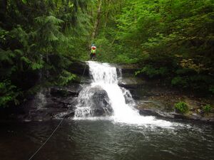
- R1: 15ft from large flat boulder creek-center - or slippery downclimb DCL.
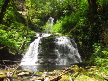
- R2: Upper Yaquina Falls 55ft from tree DCL. Smaller side stream enters DCR.
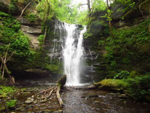
- R3: Lower Yaquina Falls 90ft from tree DCL. Descend through the obvious channel in the watercourse. This rappel is somewhat slabby, but can easily be spotted from a ledge on the left. (A user trail exits the canyon from the top of R3. A hand line was hanging there in 2022.)
- R4: 20ft. Dirty rappel from a tree DCR. (A bolted anchor here would be nice to run the flow.) Be aware: the pool looks jumpable but is deceptively shallow.
Exit[edit]
From the bottom of R4, locate a overgrown vegetated gully DCL. This is exit route. Follow the gully up (easier than it looked in 2022) until a short rock step bars your way. Exit the gully climber's left and do a rising traverse, following elk and deer trails through the jungle, up onto the nose of the ridge. Follow the nose upwards, staying on the crest until you intersect the road above. The bushwhack is strenuous and there are a few steep sections (total gain from the creek: 350ft), but there's plenty of vegetation for handholds.
Once on the road, turn left and follow it back down to the bridge. From there, it's a nice mellow hike back up to the gate.
Red tape[edit]
Caltopo indicates that all the falls are located on private land, but the original beta indicates that the State of Oregon is pursuing a land-swap with the owner. Unclear if this transaction has completed or not. Please respect all postings that you may encounter; there were none in 2022.
- If the gate is open, drive in at your own risk. It may be wiser to park above and hike in to avoid any potential issues.
Beta sites[edit]
 CanyoneeringNorthwest.com (archive.org) : Yaquina River
 mthoodh2o.blogspot.com : A kayak descent of the Yaquina River
