Big Bear
| Rating: | |||||||||||||||||||||||||||||||
|---|---|---|---|---|---|---|---|---|---|---|---|---|---|---|---|---|---|---|---|---|---|---|---|---|---|---|---|---|---|---|---|
| | Difficulty:3A III PG (v5a1 VI) Raps:10, max ↨200ft
Red Tape:No permit required Shuttle:Optional 2 miles Vehicle:High Clearance Rock type:Sandstone | ||||||||||||||||||||||||||||||
| Start: | |||||||||||||||||||||||||||||||
| Parking: | |||||||||||||||||||||||||||||||
| Shuttle: | |||||||||||||||||||||||||||||||
| Condition Reports: | 28 Feb 2025
"Hard to believe it was a February day - warm, bordering on hot, even up top. Togglingworked great at all 11 raps, most had webbing, a couple we ghoste |
||||||||||||||||||||||||||||||
| Best season: | Spring & Fall
|
||||||||||||||||||||||||||||||
| Regions: | |||||||||||||||||||||||||||||||
Introduction[edit]
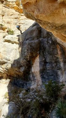
An adventurous and scenic descent from the top of bear mountain. This is one of the more commiting Sedona routes, and begins with steep downclimbs on loose terrain.
As with most of the routes off of Bear Mountain you will earn the views, with a long hike to the Summit. Looking down from the summit will give you a good perspective, of the length and difficulty of this route.
Lots of rappels, feels very remote; wild, raw, and untouched.
The PG rating is for the top third of the route which has high potential for rock fall. This route should NOT be attempted by those new to canyoneering, or in less than perfect weather conditions.
Small groups of experienced individuals, fiddle stick or retrievable anchor, and extra webbing recommended.
Route sees very little traffic, cacti have recently popped up around anchors and trail is not defined. Route finding skills will prove useful. Bushwhacking between raps on the upper third becoming cleaner as the watershed establishes itself and the canyon develops.
Option to set up a shuttle that avoids 2miles of road walking. (See coordinates) high clearance vehicle recommended
Start early! Its a long one!
Approach[edit]
Climb to the summit of Bear Mountain.
Just before reaching the summit start traversing west via a faint social trail to bypass rapping off the summit.
After you navigate down center, past the large fin on the left, the route will begin to open up, offering a series of scenic rappels into various sandstone alcoves.
Descent[edit]
Descent begins by traversing in from the east on a faint social trail just before the final summit push. A retrievable anchor can be set from the summit off a large rock horn for an additional 100' rappel before R1. There is no need for a permanent anchor to access the canyon. Please leave no trace.
R1: 60’
R2: 100’
R3: 50'
R4: 110'
R5: 200'
Section of multiple downclimbs to bypass a few nuisance drops. Stay RDC
R6: 175'
R7: 105'
R8: 95'
R9: 80'
R10: 70'
Exit[edit]
Follow the drainage to the confluence with sunbear canyon. Once the canyon opens up and you've passed the large fin on your left exit the drainage on the left following an old jeep road to the powerlines, take a left at the power lines and follow them up a short hill. Once sunbear homestead is in view break away from the power lines and avoided deep trenches back to the sunbear parking. Or continue to the main road.
Red tape[edit]
Beta sites[edit]
 sedonacanyoneering.com : Big Bear
