Cañon Matatlan
| Rating: | |||||||||||||||||||||||||||||||
|---|---|---|---|---|---|---|---|---|---|---|---|---|---|---|---|---|---|---|---|---|---|---|---|---|---|---|---|---|---|---|---|
| | Difficulty:3B V (v4a3 V) Raps:16, max ↨164ft
Red Tape:No permit required Shuttle:Required 60 min Vehicle:Passenger Rock type:Basalt | ||||||||||||||||||||||||||||||
| Location: | |||||||||||||||||||||||||||||||
| Condition Reports: | 24 Mar 2021
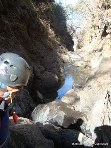
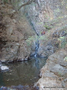
"Dry descent with a few nasty pools to go through. Can be avoided if you re a good climber. Very Nice scenery. With running water a few slides appears |
||||||||||||||||||||||||||||||
| Best season: | Oct-Jun
|
||||||||||||||||||||||||||||||
| Regions: | |||||||||||||||||||||||||||||||
Introduction[edit]
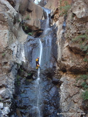
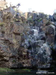
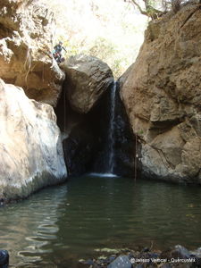
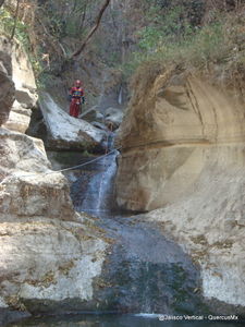
This long canyon is located about 40 minutes NE of Guadalajara on the south rim of the beautiful Rio Verde canyon. It drops steeply with many mainly short rappels reaching the highlight of the trip which is hot spring pools after R13. Conveniently located right there as well is an escape trail, that goes back up to the rim and back to the car, making day trips of this route possible. If wanting to complete the whole canyon with the three additional rappels, one then has to swim the Rio Verde for 3.7km, to get to the next escape / exit trail, which goes up the ridge to the east side of the Aguacate Canyon. Doing the complete canyon requires an over night in the canyon (usually done at the hot springs)
Approach[edit]
After reaching the small town of Matatlán, take a dirt track to the north and park on a corner close to the canyon. Walk the last 550m to the arroyo which starts immediately with R1.
Descent[edit]
R1 - 15m – 2 bolts r.
R2 - 13m – 1 tree r.
R3 - 10m – 1 tree center
R4 - 13m – large rock
R5 - 30m – 2 bolts l.
R6 - 10m –
R7 - 25m – 2 bolts
R8 - 3m – tree
R9 – 6m - tree
R10 – 10m –
R11 – 8m –
R12 - 50m – 2 bolts r.
R13 - 10m 1 bolt l.
Escape Route - left
R14 – 8m – tree
R15 – 8m - 1 bolt
R16 – 4m – tree
Exit[edit]
There are two possible trip plans: one is doing a day trip down to the Hot Springs and exiting just before R14 and returning to your car. This exit requires a 2+ hour climb that is very vertical with challenging and loose class 4 climbing. Numerous climbs are protected with handlines but these are often pretty sketchy and falling apart. This exit is not to be taken lightly. Go slow and take care. The second is doing the whole canyon, which requires then swimming 3.7km in the Rio Verde to find the next escape / exit which climbs the ridge immediately east of the Aguacate Canyon. The complete trip requires an overnight in the canyon, usually done at the Hot Springs.
Red tape[edit]
Beta sites[edit]
 JaliscoVertical.Weebly.com : MATATLAN
