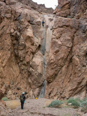
Cerberus Canyon (South Fork)
| Rating: | |||||||||||||||||||||||||||||||
|---|---|---|---|---|---|---|---|---|---|---|---|---|---|---|---|---|---|---|---|---|---|---|---|---|---|---|---|---|---|---|---|
| | Difficulty:4A IV (v4a1 IV) Raps:29, max ↨270ft
Red Tape:No permit required Shuttle:Required 60 min Vehicle:Passenger | ||||||||||||||||||||||||||||||
| Location: | |||||||||||||||||||||||||||||||
| Condition Reports: | 15 Feb 2025
"A fun romp though Cerberus south fork. R1 was potentially needing replacement, but other anchors were deemed sufficient or replaced. Being diligent ab |
||||||||||||||||||||||||||||||
| Best season: | Nov-Mar (avg for this region)
|
||||||||||||||||||||||||||||||
| Regions: | |||||||||||||||||||||||||||||||
Introduction[edit]
Approach[edit]
Descent[edit]
Waypoints in the KML map contain detailed descriptions of all the rappels (courtesy of Bluugnome.com).
Rappel 1: 25'
Rappel 2: 45'
Rappel 3: 45'
Rappel 4: 160'
Rappel 5: 90'
Rappel 6: 150'
Rappel 7: 70'
Rappel 8: 100'
Rappel 9: 35'
Rappel 10: 25'
Rappel 11: 50'
Rappel 12: 15'
Rappel 13: 140'
Rappel 14: 50'+ (Possible down-climb)
Rappel 15: 25'
Rappel 16: 50'
Canyon drops to the right. Climb LDC.
Rappel 17: 70'
Rappel 18: 115'
Rappel 19: 160'
Rappel 20: 75'
Rappel 21: 270' multi-staged. It is possible to break up this rappel into 2 parts making the rope pull easier, but the anchor at the lower stage should be thoroughly inspected before committing. The upper portion is anchored off a pinch point LDC and drops 100' down 2 stages. From here there is 2 pitons on the left. This lower ledge is probably big enough for 3-4 people comfortably. The rappel from this ledge is under 200'.
Rappel 22: 35'
Rappel 23: 60'
Rappel 24: 50'
Rappel 25: 100' multi-stage.
Rappel 26: 270'. 50' overhang at the bottom.
Rappel 27: 80'
Rappel 28: 100'
Rappel 29: 70' multi-stage.
Exit[edit]
Red tape[edit]
Beta sites[edit]
 BluuGnome.com : Cerberus Canyon - South Fork
 Chris Brennen's Adventure Hikes (Southwest) : Cerberus Canyon
 Super Amazing Map : Cerberus Canyon - South Fork
Trip reports and media[edit]
Background[edit]
First canyoneering descent by Mark Duttweiler, Randi Poer, Scott Smith, John Perry, Sonny Lawrence and Chris Brennen on Jan.6, 2007
