Conditions:Suicide Canyon-20250520055035
Latest: |
26 May 2025 (7 mos ago) |
|---|
| Reported by: | Sugi212 (4 reports) | |
|---|---|---|
| Quality: | Good |
|
| Waterflow: | Very Low |
|
| Wetsuit: | None |
|
| Water temperature: | ||
| Difficulty: | Special challenges |
|
| Time:
":00" is not declared as a valid unit of measurement for this property. |
Team: 3 people with experience level Intermediate
Trip report URL:
Comments: First part of the hike was easy. Where where three stream crossings with decently deep water but as long as you pick your path right and use a stick for balance you can get through it with dry feet. The approach path once you diverve from the trail is BRUTAL. Be prepared for long stretches of crumbly uphill and very vaguely marked trail.
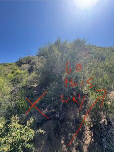
After the third crossing about halfway down the trail that goes through the bend in the river, the metal pipe marking the beginning of the approach trail will be on the right behind a dirt mound. The scramble up to the first telephone pole is super steep and loose but the trail is decently followable. After the first group of poles, follow the ridgeline and there will be another trail at the end of the clearing. There will be what looks like a fork but KEEP RIGHT. The trail starts to switchback here. You will find a fixed rope that will help you climb up to the next group of poles. The trail from the second group of poles is straight through across the clearing from where you entered. It gets a little flatter from here as you cross to the third group of poles. Once you get to the third clearing, hook right and at the far end of the clearing you will find a tunnel through the brush that takes you to the drop in spot. The rope is old and doesn't feed well if you want to rappel but it works ok in low friction mode.
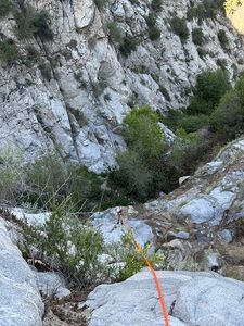
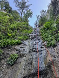
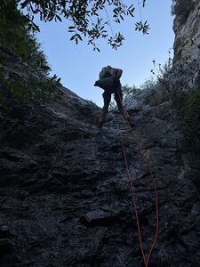
The canyon itself was awesome. There was a little trickle of water throughout, great for filtering since we consumed so much on the climb up. All anchors look solid. There are some small pools, but they're pretty avoidable. Id recommend doing R8 in two parts.
Overall, good canyon, tough approach. Id recommend only doing it if you're in good shape. The white flags marking the trail are virtually non-existent, so if someone brought some tape to remark it, it would make the approach much better.
All condition reports
| Date | Quality | Waterflow | Wetsuit | Difficulty | Time | Team | Reported by |
|---|---|---|---|---|---|---|---|
| Good | Very Low | None | Easy | | 2 people Beginner to Intermediate | Jhoffer (4 reports) | |
Comment: Finding the use trail is the only difficult aspect of this canyon. The start of the trail near 34.27901, -118.21870 is difficult to spot but quite obvious once found. There are a few other "false" trails to the left(east?) of the correct path up the ridge line. These falls trails continue adjacent to the ridge. The current RopeWiki map with the use-trail is quite accurate.
The Canyon itself is pretty but a bit overgrown. No meaningful water but just watch where you step. All of the rappels can be ghosted using a fiddle stick. It wasn't obvious or apparent that R8a and R8b could be done as a single rappel - I'd recommend just doing them separate. I took a couple minutes to try to find the possible R0 but didn't see anything obvious; the bushwhacking and heat discouraged further search. The ascent can be a bit strenuous in the mid-day heat and sun but the canyon itself is in comfortable shade
| |||||||
| Good | Very Low | None | Easy | | 11 people | Eljefe62 (66 reports),Canyoncowboy (35 reports) | |
Comment: Big group on a Thursday night went faster than expected. Plenty of ropes, rallying leadership, and careful sequencing kept passengers in motion for most of the trip.
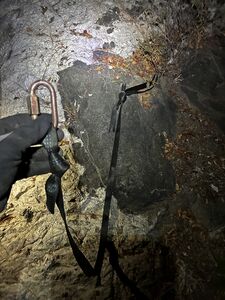
Replaced a couple creative anchors at R3 and R4 with a water knotted loop + master point and a wrap 3 pull 2 respectively. Sharing a picture of R3’s old webbing because it was not something I’d seen before. I assume the builder was short on webbing. | |||||||
| Good | Very Low | None | Normal | | 5 people Intermediate to Advanced | Toddk (17 reports) | |
Comment: A lovely day in Suicide Canyon. Great weather. If you are careful, you can run the entire canyon (including the approach) without getting wet. Approach was easy to follow but some trimming would be helpful, especially at the top of the short use trail up the hill just off the main trail. All anchors were in good shape. 4.5 hours C2C. Lots of PO - look out for it.
| |||||||
| Good | Very Low | None | Special challenges | | 3 people Intermediate | Sugi212 (4 reports) | |
Comment: First part of the hike was easy. Where where three stream crossings with decently deep water but as long as you pick your path right and use a stick for balance you can get through it with dry feet. The approach path once you diverve from the trail is BRUTAL. Be prepared for long stretches of crumbly uphill and very vaguely marked trail.
After the third crossing about halfway down the trail that goes through the bend in the river, the metal pipe marking the beginning of the approach trail will be on the right behind a dirt mound. The scramble up to the first telephone pole is super steep and loose but the trail is decently followable. After the first group of poles, follow the ridgeline and there will be another trail at the end of the clearing. There will be what looks like a fork but KEEP RIGHT. The trail starts to switchback here. You will find a fixed rope that will help you climb up to the next group of poles. The trail from the second group of poles is straight through across the clearing from where you entered. It gets a little flatter from here as you cross to the third group of poles. Once you get to the third clearing, hook right and at the far end of the clearing you will find a tunnel through the brush that takes you to the drop in spot. The rope is old and doesn't feed well if you want to rappel but it works ok in low friction mode. The canyon itself was awesome. There was a little trickle of water throughout, great for filtering since we consumed so much on the climb up. All anchors look solid. There are some small pools, but they're pretty avoidable. Id recommend doing R8 in two parts. Overall, good canyon, tough approach. Id recommend only doing it if you're in good shape. The white flags marking the trail are virtually non-existent, so if someone brought some tape to remark it, it would make the approach much better. | |||||||
| Good | Very Low | None | Special challenges | | 2 people | Willie92708 (1015 reports) | |
Comment: The big "special challenges" were crossing Big T Creek multiple times as the dam is releasing about 50CFS of waterflow (see pic). The approach trail up needs some TLC with the poison encroaching in spots, especially just after jumping onto the ridge itself. SoCal Edison has been working on their power poles, so around each cluster of 3, there are large areas of cleared brush. This makes it harder to find the clearing exit back onto the trail, especially for the 3rd power pole cluster. Also, someone/group obviously did some major pruning work on the white thorn bushes in last 1/4 mile. I did some trimming; maybe 10 minutes total. All I can say about the previous report was they clearly were not on the trail, or they have wildly high expectations of this type of "use" trail.
The canyon itself is in good shape with minimal brush problem and all the anchor are in good shape. The flow was "very low", but still plenty to soak ropes and get feet wet. | |||||||
| Ok | Low | None | Special challenges | | 1 people Intermediate | Canyondozer (8 reports) | |
Comment: Used coordinates listed in description. Trail is just visible, but still somewhat overgrown. Bring a machete for sections. Bring eye protection. Hike up via maxion route is brutual. Recent rains have washed logs and branches into canyon.
All anchors are set with functional webbing, R8B should not be used (just rap from R8A) but now has webbing around tree anchors that are marginal at best.
| |||||||
| Good | Very Low | Rain jacket | Normal | | 8 people | Mikeatran (89 reports) | |
Comment: A nice day doing a lot of trail clearing! The canyon approach is heavily cleared thanks to the grotto folks and also SCEdison! Up to the drop in was very clear and easy to follow; the actual start of the climb needs to be amended with the trail start but once on it it’s pretty clear now with all of the heavy trail work. Replaced 3 or 4 anchor stations; likely another one will need to be replaced relatively soon but the canyon is in very good form and ready for some fun!
| |||||||
| Good | Very Low | Rain jacket | Special challenges | | 3 people | Willie92708 (1015 reports) | |
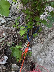
Comment: Big Tujunga Creek is flowing; still easy enough to cross the 3 times without getting feet wet thanks to rocks placed in the creek bed. I had no issue finding the steel pole, and the ramp that starts the trail up the ridge. If you are having problems, follow the beta: "Cross the creek and proceed 250 feet more to 34.279415, -118.218704 , then head off trail, straight south past 4" rusty steel pole and a large downed tree to the ridge about 150 feet away. Climb an animal run that angles up right onto the ridge" at 34.27895, -118.21868. Once on the trail, the "special challenges" began. The whitethorn and other plants have reclaimed walking space above the trail in many spots. I did some trimming, so it's much better now, but we still had to crawl under it in several locations. I also marked the switchback at 34.27628, -118.22011 much better so future parties hopefully will not keep going straight on the animal run and wind up off the trail. The sign at 34.27415, -118.22390 for the split Suicide / Silver on the Side is still there although on the ground and the ink is faded out. The two handline sections are still there (black poly rope and blue webbing and rope). The drop-in still has 2 green rope fixed lines. It needed some help with deadfall and a little trimming; overall was good, but has lots of loose rocks! Once in the canyon, the canyon kelp is thick in places, but overall the travel is easy enough. The significant waterflow made for lush waterfalls. Almost all the anchor webbing was OK; I did replace some of it. The "small" tree for R8a/b is getting pretty big and it has grown and pinched 2 pieces of webbing between a branch and the main trunk. We combined these rappels off the R8 tree, because the webbing was gone off the fig trees for R8b. Exit hike was easy, and the black poly rope hand line rope is still there for R9.
| |||||||
| Good | Low | Thin wetsuit | Special challenges | | 5 people Brand new to Advanced | Austin3623 (16 reports) | |
Comment: Definitely had a fun, but interesting day out in Suicide. We knew ahead of time there would be some extra challenges, and agreed as a group to take it on anyway. Lots of type 2 fun today, but screw it. Said challenges outlined below:
River crossings - Be prepared to cross a very full Big Tujunga Creek minimum three times EACH WAY. The first two crossings are waist high and flowing swiftly but straight forward nonetheless. The third crossing closest to the route is the deepest/heaviest and gets up to chest high in some spots (and impassible whitewater in others). We protected the first and third crossings with a tensioned line and crossed easily without any scares. Finding the ridge - This was our first time doing the route. The RopeWiki GPS file is clearly wrong at the base of the approach, as Willie indicates in the beta. With the creek being safe to cross in very few areas and completely overgrown on the canyon side of the river, we gave it our best shot and found a gully slightly climbers right of the green route. Found ourselves bushwhacking and squeezing between poison oak plants until we climbed high enough to cut left over to the ridge. It was doable, but would not recommend this route for future groups. Heavily overgrown - Dense, leafy vegetation throughout the entire approach and the canyon itself. POISON OAK LITERALLY EVERYWHERE—one of our group members fell victim. Forget the garden shears, bring a machete or power tools. Finding the trimmed tunnel to R1 - Again, our first time on the route, and heavily overgrown. After the power lines, we followed the intuitive trail we were on, which took us to the sign and down to R1. Willie Hunt generously carved out a clean path through that dense area with power tools in the recent past. At the time, we thought we were on that trail, but it had simply grown back since he cut it (there was a clear trail, but everything above the waist was pretty leafy). After talking with Willie, sounds like there’s very likely a cleaner version of the route. If the trail looks dense on the upper section of the approach, take a minute to search for other options. Final note - if you’re familiar with the nuances of the route (specifically the approach), it may be a breeze. Even for us, the extra challenge was fun without being overwhelming for anyone. The rappels are great in flow. Water levels are a Class B shower, similar to San Antonio Falls in September. We were hoping for a little more water on the route but still had fun. Would recommend budgeting extra time for the river crossings, and even more time if it’s your first time doing it. Bring some chopping tools and do anything you can to protect yourself from the poison oak. It’s fucking everywhere.
| |||||||
| Great | Moderate | Rain jacket | Special challenges | | 2 people Advanced | Estunum (34 reports) | |
Comment: With the recent rains we set out to explore Suicide instead of the usual canyons. Water has been the highest I have ever seen it here, as normally there's only a trickle or low flow. The water adds special challenges for the down climbs in particular, but the rappels as well. Lots of recent rockfall, in the canyon and in the approach. In these current conditions, this is a great canyon. In the past the approach takes away from its luster but the new cut path makes it easy. The current water flow rivals those that normally flow low in the area.
| |||||||
| Great | Very Low | None | Normal | | 3 people Beginner to Intermediate | ADubs (14 reports) | |
Comment: Canyon had a healthy trickle of water on almost every rappel except the first. Feet stayed dry, but rope got wet and slimy from the algae and moss. Poison Oak thriving - keep your eyes open, especially in lower canyon. We all found ticks on us from the thick and happy undergrowth.
| |||||||
| Good | Very Low | None | Special challenges | | 1 people | Activedad29 (19 reports) | |
Comment: Thank you to the group that did trail maintenance. I saw previous posts and videos and everyone complained that it was overgrown. Not anymore! You guys/gals did a fantastic job. Dry falls with one or two having a small trickle but still fun. If you happen to see a carabiner with a black ATC and VT Prusik, its mine. Finders keepers I guess. It's somewhere between the bottom of rap 4 and the start of rap 5. The special challenge was the loose and steep climb uphill. If you have a group, be careful not to kick any bolders loose. Enjoy
| |||||||
| Good | Dry | None | Normal | | 4 people Expert to Beginner | Willie92708 (1015 reports),Cesar (21 reports) | |
Comment: There are loose rock on the approach so be careful with how you space your selves on the hand lines. Some of the rocks are large enough to hurt you even when falling short distances. All the anchors and webbing were OK. We found one of the missing bolted stations. We started at 7:30 am with a temperature of 55 degrees, and a high 70 by the end. It got hot pretty quick going up the steep hill hence layers come off fairly quickly. Willie: water flow has stayed about the same (see pic).
| |||||||
| Great | Dry | None | Normal | | 4 people Intermediate to Expert | Willie92708 (1015 reports),Cesar (21 reports) | |
Comment: Cesar: We started the approach at 8 AM. It was a bit around 55 degrees and the layers quickly came off as we started climbing. Willie installed hand lines on two of the steepest sections of loose sand and they are very useful to prevent sliding back down. You will be following the Utility Poles up the ridge. The anchors in the canyon are in great condition and so I is the webbing around some of the trees. Your feet will get wet as there is a nice stream with plenty of fresh water half way down the canyon. The canyon does stay on the cooler side as it is mostly shaded but once out of it, we warmed up pretty quickly. Nice warm beer awaited us at the car. Almost forgot to note, that there is no bushwhacking on the approach. Pretty fast canyon to do in 4 hours without rushing.
Willie: Although the first rappel is totally dry (see picture), it is a bit moist at the bottom. Further down the canyon the flow picks up with each successive drop, until by the last rappel there is several garden hoses worth of water flow. And even though you can keep your feet dry by being careful, there are a few pools, buried in the canyon kelp, deep enough to flood your shoes. | |||||||
| Great | Dry | None | Normal | | 2 people Advanced | Estunum (34 reports) | |
Comment: Metal pole is probably not the best thing to look for from from the trail, it sits in a ditch lower than everything else, so unless you're near it, you won't see it. At 34.27941, -118.21870 there's a clearing, this is where you leave the trail. From here, just head directly south towards the ridge, you'll see a trail up some loose dirt between some oak trees. From here, the trail is a breeze. Huge shoutout to the team that cleaned it up. I had done Suicide 4 times before and each time the approach I swore never to return because the approach sucked that bad. If you've held back because you've heard the stories, this is the time to go. Two hand lines on the way up, and one at the drop in. Once in the canyon everything is straight forward. A couple rappels were shorter than the beta calls, but looks like it was due to sediment. Could use more traffic to stomp out some of that canyon kelp.
| |||||||
