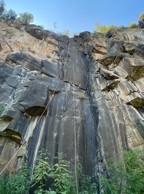
Riley Canyon
| Rating: | |||||||||||||||||||||||||||||||
|---|---|---|---|---|---|---|---|---|---|---|---|---|---|---|---|---|---|---|---|---|---|---|---|---|---|---|---|---|---|---|---|
| | Difficulty:3A III (v3a1 III) Raps:6, max ↨110ft
Red Tape: Shuttle:Optional Vehicle:Passenger Rock type:Basalt, Sandstone | ||||||||||||||||||||||||||||||
| Start: | |||||||||||||||||||||||||||||||
| Parking: | |||||||||||||||||||||||||||||||
| Condition Reports: | 12 Sep 2021
"Time is car to car and includes rebuilding of all anchors and stopping at Oak Creek along the exit to cool/rinse off. All existing anchor material was |
||||||||||||||||||||||||||||||
| Best season: | After rains, winter
|
||||||||||||||||||||||||||||||
| Regions: | |||||||||||||||||||||||||||||||
Introduction[edit]
A rugged canyon off the first bench of Wilson Mountain that’s known to develop ice falls in the wintertime, and which conveniently exits next to Dairy Queen…
Approach[edit]
Pants and long sleeves recommended.
Hike North Wilson Trail from Encinoso parking area to the first bench of Wilson. Turn off the trail somewhere around 34.91549, -111.74072 (or reference KML).
Avoid entering the brushy drainage until nearing the end of the plateau.
Gear up and downclimb through the basalt to the first rappel.
Descent[edit]
R1: 85’ off bush. Position the pull RDC outside of crack.
R2: 90’ off bush LDC. Watch rope near cacti. Partially overhung.
R3: 20’ off rock pinch or downclimb.
R4: 110’ off tree LDC. Locust bush at the bottom.
R5: 30’ off rock pinch or downclimb.
R6: 80’ off rock pinch.
The final rappel is followed by a series of downclimbs.
Exit[edit]
Boulder hop your way down canyon until you reach the 89. Be advised that much of the lower section of the canyon is dense with brush.
Walk ~10 minutes north along the road back to Encinoso TH. During warmer months, you may consider taking the opportunity to stop and cool off at Oak Creek on the way.
Red tape[edit]
Beta sites[edit]
Trip reports and media[edit]
Background[edit]
First descent 8/12/2017 by Bill Langhofer, Josh Hill, and Jeff Funch
