Gap Creek
| Rating: | |||||||||||||||||||||||||||||||
|---|---|---|---|---|---|---|---|---|---|---|---|---|---|---|---|---|---|---|---|---|---|---|---|---|---|---|---|---|---|---|---|
| | Difficulty:3B III (v3a2 IV) Raps:3-4, max ↨148ft
Red Tape:No permit required Shuttle: Vehicle:Passenger Rock type:Sandstone | ||||||||||||||||||||||||||||||
| Start: | |||||||||||||||||||||||||||||||
| Parking: | |||||||||||||||||||||||||||||||
| Shuttle: | |||||||||||||||||||||||||||||||
| Condition Reports: | 25 Apr 2025
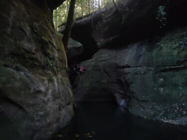
"4 hours car to car. At a quick pace.. Couldnt find first sling so entered canyon from river left. (Opposite above photo) Using tree.. A little |
||||||||||||||||||||||||||||||
| Best season: | Oct-Apr (avg for this region)
|
||||||||||||||||||||||||||||||
| Regions: | |||||||||||||||||||||||||||||||
Introduction[edit]
Finishing at the beautiful Gap Creek Falls, a popular local tourist attraction in its own right with a well marked track to return to the campsite. This canyon is a fairly easy descent with a few short but cold swims likely, even in low water. Navigation is easy but a river bed choked with boulders makes for slow going. Similar in character to the Upper Macquarie Pass canyon.
Approach[edit]
Can probably enter from any of the tributaries. Party entered from the northern most tributary, just off Heaton Road August 2024 with ease. Parking for 1-2 cars was available roadside.
Descent[edit]
Minimal technical ropework needed for all but the last abseil. Gap Creek falls is by far the longest abseil, can have reasonable flow after rain, and has multiple ledges where rope wear may be an issue. Consider bleeding the rope between abseilers for those using SRT.
Gap Creek Falls has a dry line river left and a wet (usually a dribble) line river centre.
Exit[edit]
Gap Creek Falls walking track to Gap Creek Campground.
