Ice Lake Creek (Middle)
| Rating: | |||||||||||||||||||||||||||||||
|---|---|---|---|---|---|---|---|---|---|---|---|---|---|---|---|---|---|---|---|---|---|---|---|---|---|---|---|---|---|---|---|
| | Raps:9, max ↨100ft
Red Tape:No permit required Shuttle:None Vehicle:Passenger Rock type:Cutler Sandstone | ||||||||||||||||||||||||||||||
| Location: | |||||||||||||||||||||||||||||||
| Condition Reports: | 14 Sep 2025
"Amazing canyon with one great rappel after another! Flow was quite high especially after several days of rain/snow prior to the day of our run. Anchor |
||||||||||||||||||||||||||||||
| Best season: | Jul-Sep
|
||||||||||||||||||||||||||||||
| Regions: | |||||||||||||||||||||||||||||||
Introduction[edit]
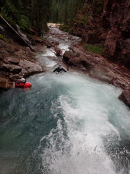
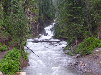
For those canyoneers who like big water, Lower Ice Lake Creek is typically second only to Lower South Fork Mineral Creek in the big water flow category. Not to be missed if you came to the San Juans in search of big water fun. This canyon usually has high flow even in the middle of summer. Many of the rappels can be bypassed, albeit with some effort, and the canyon has multiple escape points.
The checkpoint for water flow is the Parking waypoint, where Ice Lake Creek crosses the road (see map). If too high consider doing the nearby Clear Creek instead, which usually has less flow. In either case, the lower section where the big water is, after the confluence of Clear Creek and Ice Lake Creek, may be by-passed via taking a use-trail alongside the watercourse and down to the road.
Approach[edit]
From Ouray Hot Springs Park, drive south on Highway 550 for 21.5 miles where you will see a sign for South Mineral Campground. Make a right towards South Mineral Campground on a dirt road, which is County Road 7. Go 4.4 miles to the campground. Park your exit vehicle here at the day-use parking lot on the right.
At the west end of this parking area is the trailhead sign for Ice Lake Basin. Hike up Ice Lake Trail for aprox 1.5 miles, then leave the official trail to follow an unmarked side trail down to the creek (see map). Soon after starting up the trail you will cross a rivulet. A couple switchbacks later, you will cross Clear Creek and then a couple switchbacks further yet, you can go off-trail for a few feet to a nice lookout at one of the rappels in Clear Creek. Continue hiking and go over another rivulet. You will get to an open meadow area and see a use-trail heading down to the left, which leads to one of the escape points. Continue up to another use-trail heading off to the left and you may drop in here (37.811459,-107.789689).
For those interested in taking in some breathtaking scenery, continue up the trail for another mile to Lower Ice Lake Basin. You can hear and see Ice Lake Creek on your left and can drop in here and creek your way down to the first rappel also. While in Lower Ice Lake Basin, look to the right to see the pour-off of the creek from Upper Ice Lake Basin. There are several noticeable white falls, shining pure white from the calcium carbonate. Upper Ice Lake Basin is one of the premier hiking/backpacking route in Colorado.
Descent[edit]
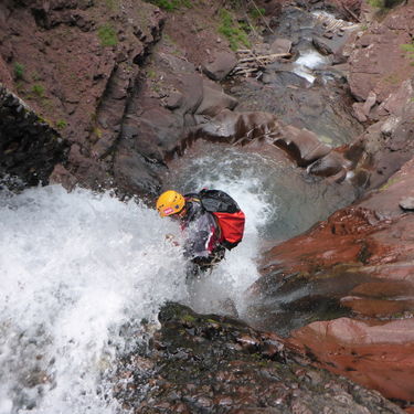
In virtually all of these rappels, while you may be in the watercourse, the falls are spread and aerated and do not pose any noteworthy force on the rappeller. The Middle Section is a great place for those new to rappelling in waterfalls to enjoy a relatively safe route avoiding high-pressure laminar flow on the body that some of the other technical canyon routes in the area offer.
R1: Tree, canyon left, 55ft rappel, elevation 11,083 feet,
R2: Tree, canyon right, 50ft rappel
R3: Tree, canyon right, 45ft rappel
R4: Tree, canyon left, 25ft rappel
R5: Tree, canyon right, 25ft rappel
R6: Log, canyon right, 25ft rappel
R7: Tree, canyon left, 25ft rappel
R8: Tree, high on canyon left, 90ft rappel
R9: Tree, high on canyon right, 50ft rappel
Downclimb to a house-size boulder on canyon left. This is the early exit for those wishing to skip the lower section, which has more flow.
Exit[edit]
From the pool the road can be seen a couple hundred feet downstream. At the road, go left about 1/4 mile to the car parking area.


