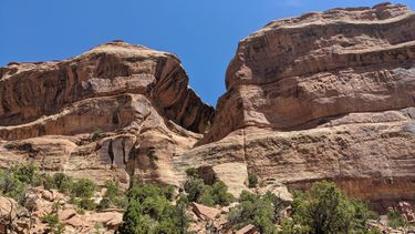
Liberty Cap
| Rating: | |||||||||||||||||||||||||||||||
|---|---|---|---|---|---|---|---|---|---|---|---|---|---|---|---|---|---|---|---|---|---|---|---|---|---|---|---|---|---|---|---|
| | Difficulty:3A II (v3a1 II) Raps:2-3, max ↨110ft
Red Tape:No permit required Shuttle:None Vehicle:Passenger Rock type:Sandstone | ||||||||||||||||||||||||||||||
| Start: | |||||||||||||||||||||||||||||||
| Parking: | |||||||||||||||||||||||||||||||
| Condition Reports: | 4 Oct 2023
"5 hrs car-to-car with a summit of Liberty Cap, drop off the top, and then down through Lower Ute (8 raps total). Definitely combine this with Ute. A |
||||||||||||||||||||||||||||||
| Best season: | Spring or Fall
|
||||||||||||||||||||||||||||||
| Regions: | |||||||||||||||||||||||||||||||
Introduction[edit]
A short alcove system off the southern face of Liberty Cap.
Approach[edit]
Park at Liberty Cap Trailhead off Wildwood Drive.
Wildwood trailhead: 39.06604,-108.66028
Hike Liberty Cap Trail to the summit.
Liberty Cap: 39.05660,-108.66797
Descent[edit]
From the summit of Liberty Cap hike west to the third bowl, contour down and north.
Start of canyon: 39.05728,-108.66993. - UTM 12S 0701613mE 4325716mN
R1: 60’ tree LDC on a shelf above the watercourse. Rope grooves developing at the lip. Don’t pull from directly below the drop or rig retrievable to avoid contributing to the damage. Can also stem/downclimb down 3 obstacles in the watercourse to bypass R1. The downclimbs get successively more challenging and the last downclimb is about 8' of 3-4' wide R rated high stemming 10-15' off the canyon floor to reach the boulder at the base of R1.
R2: 80’ to the flat shelf. The last 5-10’ are slightly overhung. Consider creating a safety line to traverse to reach this anchor or be thoughtful about how to safely approach this semi-exposed anchor. Consider courtesy rigging to avoid contributing to rope grooves that are starting to form.
R3: 110’ tree set back from the lip. Be mindful of rockfall that may lay in the rappel line. Recommend backing up far down the wash to retrieve the rope to minimize rope grooves (or use a toggle/fiddlestick).
Note: Other descent options exist off the back of Liberty Cap proper for the adventurous but may require ropes longer than 200’ and creative anchors.
Exit[edit]
Connect with Ute Canyon trail. Follow trail down canyon back to Liberty Cap or Corkscrew trail then back down to the trailhead.
The exit could also be combined with a technical descent of Lower Ute Canyon…see Lower Ute Canyon for a longer, potentially more worthwhile day.
Red tape[edit]
While the canyon is in Colorado National Monument, the parking is not, and no permits are required for parking.
Beta sites[edit]
Trip reports and media[edit]
Background[edit]
First descent summer 2017 by Scott B, Stephen F, Kyle F, Doug V, Ralph K, Shane F
