Lost Creek
| Rating: | |||||||||||||||||||||||||||||||
|---|---|---|---|---|---|---|---|---|---|---|---|---|---|---|---|---|---|---|---|---|---|---|---|---|---|---|---|---|---|---|---|
| | Raps:3-5, max ↨100ft
Red Tape:No permit required Shuttle:Optional 10 min Vehicle:Passenger | ||||||||||||||||||||||||||||||
| Location: | |||||||||||||||||||||||||||||||
| Condition Reports: | 13 Sep 2024
"We paired this with Quartzville for a full day in canyons! The new approach seems like the way to go! we got a prius almost all the way up. Youll lea |
||||||||||||||||||||||||||||||
| Best season: | Jun-Sept
|
||||||||||||||||||||||||||||||
| Regions: | |||||||||||||||||||||||||||||||
Introduction[edit]
Lost Creek is located within Willamette National Forest in Linn County, Oregon. The final narrow gorge in Lost Creek very scenic and worth the effort. The canyon is easy in low to moderate water flow conditions, but in high water flow conditions it can be very exciting and/or dangerous. So make sure you check the waterflow before attempting this canyon. Lost Creek is easily combined with Parkett Creek or Quartzville Creek for a full day of canyoning.
- The checkpoint is where the creek crosses under the bridge at the exit of the canyon.
- Watershed: 2.7mi^2. The watershed is generally north-facing with the highest point at about 5k' elevation.
Approach[edit]
Directions[edit]
From Marion Forks, head south on Hwy 22 for 2.9mi. Turn off right/west on FR-11 and follow for 6mi to a five-way junction. At the 5-way jct, take a slight right onto FR-10 (which is not the hard right, but the second right) and follow it downhill for 2.9mi to a bridge that crosses Lost Creek and park.
Hiking In[edit]
There are at least two options for the approach:
1) New Approach. To run the best part of the canyon without a shuttle, hike north the bridge about 0.5mi and up a fire road on your left. After about an hour from the car (2.75mi), reach the end of the fire road. From here, bushwhack downhill to your right to a small creek which leads to the confluence as shown on the map. Suit up at the confluence. (Be aware: winter 2020 brought down an extreme number of trees across the road, on the bushwhack, and at the confluence. Work is being done to clear the fire road, but it may or may not be clear all the way to the end.)
2) Classic Approach. This route is slightly longer than the new approach, adding a short bushwhack, and some extra creek walking to reach the confluence. From the bridge, shuttle or hike back up the road 1.7mi to a junction with an unnamed road, bearing back sharply right. A map / GPS may be handy here to keep you on track as there are several old logging roads in the area. This unnamed road can be driven with a high clearance vehicle that you don't mind getting pinstriped by vegetation. If you're not happy about driving the unnamed road, park at the junction, and hike in the rest of the way. Follow the road to a big turnaround at its end. At the far end of the turnaround, break off into the forest. There is a very faint use trail, but it's a bit overgrown. Otherwise, bushwhack wherever is easiest. You'll cross one minor gully, probably dry, then cross the next one to drop down into the upper tributary of Lost Creek. You should come in just above R0.
Descent[edit]
Optional R0: Two stage rappel from a tree DCL. This rappel can be broken into two if you want; for the second part use a log mid-creek.
- R0a: 60ft (18m) from tree DCL.
- R0b: 15ft (4m) from log creek center. Can also bypass on steep slope DCR. Do not jump -- the water is shallow.
Head downstream to the confluence. (As of 2023: the streamwalk between R0 and the confluence is a bit of a woody mess. The new approach might be better?)
From the confluence, the character of the creek changes and there are long stretches of beautiful bedrock to hike on; likely some of the easiest creek-walking you'll ever find in the Pacific Northwest. The bedrock is a curious red color and is littered with bright turquoise and red pebbles. There are a couple pools and one short slide along the way.
WARNING: Before you enter the gorge at (R1), check water levels. In high water flow, this area can be very dangerous due to the narrow channel of water and fallen logs.
- R1: 25ft (9m) from a log DCL or boulder in the middle of the creek. The drop can also be downclimbed DCR.
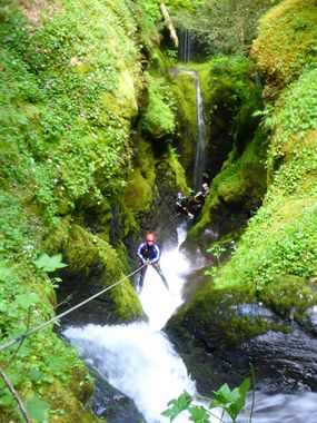
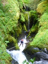
- R2: 100ft (30m) from a tree DCL on a low-angle slope. This is goes into a narrow chute with a few small waterfalls. In high water flow conditions, this can be quite challenging. In low water, it can be downclimbed by skilled members of your group.
- NOTE: As of 7/26/20 there is a log part way down the chute that can catch ropes when pulled from below (we found a cut piece of rope). It's better to do this as ~50' rap and pull from near the log. Downclimb the rest of the chute into the pool at R3.
- R3: 25ft (6m) from a logjam DCR at the end of the chute. The rappel may be awkward depending on conditions. It may be possible to carefully shimmy down a log on the right.
There are two minor logjams to downclimb before easy open walking to the exit.
Exit[edit]
Walk downstream 2min to the bridge where the vehicles are parked.
Red tape[edit]
None.
Beta sites[edit]
 CanyoneeringNorthwest.com (archive.org) : Lost Creek
Trip reports and media[edit]
High Water Level/Flow - Cold water:


