Martinez Canyon
| Rating: | |||||||||||||||||||||||||||||||
|---|---|---|---|---|---|---|---|---|---|---|---|---|---|---|---|---|---|---|---|---|---|---|---|---|---|---|---|---|---|---|---|
| | Difficulty:3A IV (v3a1 IV) Raps:10, max ↨200ft
Red Tape:No permit required Shuttle:None Vehicle:High Clearance Rock type:Granite | ||||||||||||||||||||||||||||||
| Location: | |||||||||||||||||||||||||||||||
| Condition Reports: | 12 May 2020
"Rather a complex data point as condition reports go - the upper half of this trip was a side drainage of Martinez that turned out to have four rappels |
||||||||||||||||||||||||||||||
| Best season: | Nov-Mar (avg for this region)
|
||||||||||||||||||||||||||||||
| Regions: | |||||||||||||||||||||||||||||||
Introduction[edit]
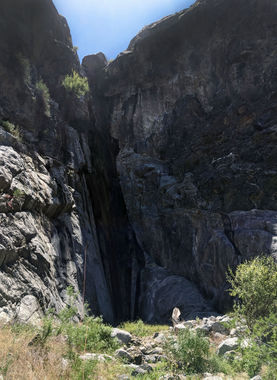
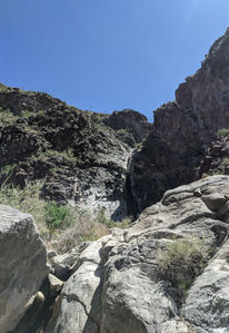
A prominent drainage that drops from its namesake Martinez Mountain to join Guadalupe Creek in its lower reaches, this canyon ends with several large, sculpted rappels above the Martinez/Guadalupe confluence.
Approach[edit]
Several variations of the approach to this canyon have been documented; all involve off-trail hiking, scrambling, and boulder hopping. The first descent party started at the Guadalupe trailhead and climbed Martinez Mountain before dropping into the canyon at 5741' elevation. The next year, they returned and dropped in at approximately 3900' elevation (33.57672, -116.31683), bypassing the first two rappels but saving a significant amount of elevation gain and loss on the approach.
It is also possible to ascend the ridge just north of (and parallel to) Guadalupe Creek, before crossing the Guadalupe Creek drainage itself at approximately 33.591600, -116.317668 and then following the ridge west of Martinez Canyon. While this route was originally plotted to access a separate feeder drainage of Martinez with a technical section of its own, it can be shortened to an ideal "sneak" route for parties wishing to access only the lower Martinez rappels with relative ease and expediency.
Descent[edit]
(All rappel lengths are approximate. All anchors are natural and may not be present as described following rockfall or flash flooding. Comfort with inspection and construction of natural/marginal anchors is mandatory.)
According to members of the first descent party, the upper section of the canyon contains four rappels (R1-R4) to a maximum of approximately 50' each.
- R5 120' from a rock cairn in the watercourse.
- R6 200' from a mesquite tree canyon left. Take care to avoid lodging your rope or pull strand in the narrow crack canyon right of the lip.
- R7 120' from a pinch in the watercourse.
- R8 15' nuisance rappel from a slung horn canyon center.
Martinez Canyon then joins Guadalupe Creek, sharing its final two rappels:
- R9 180' from a slung boulder canyon right. Inspect the awkward 10-foot downclimb below the first stage before pulling your rope, or remain on rappel.
- R10 65' from a pinch canyon right.
Exit[edit]
Follow the Guadalupe Creek wash back to the trailhead parking area at 33.59899, -116.28380.
Red tape[edit]
Beta sites[edit]
Trip reports and media[edit]
Background[edit]
First explored by Steve Irvin, Aysel Gezik, Randy Weishaar and Ania Moll in 2014; repeated from a different drop-in by the same party, plus Norma Ryan, in 2015.

