Mystic Falls and Lake Fork Falls
| Rating: | |||||||||||||||||||||||||||||||
|---|---|---|---|---|---|---|---|---|---|---|---|---|---|---|---|---|---|---|---|---|---|---|---|---|---|---|---|---|---|---|---|
| | Raps:1-4, max ↨165ft
Red Tape:No permit required Shuttle:None Vehicle:Passenger | ||||||||||||||||||||||||||||||
| Start: | |||||||||||||||||||||||||||||||
| Parking: | |||||||||||||||||||||||||||||||
| Condition Reports: | 8 Jul 2021
"Quick little two rap jaunt with easy exit. Left a fixed rope for the big rap and retrieved during the hike out |
||||||||||||||||||||||||||||||
| Best season: | Jul-Oct
|
||||||||||||||||||||||||||||||
| Regions: | |||||||||||||||||||||||||||||||
Introduction[edit]
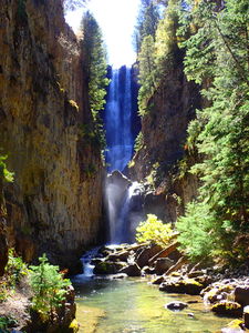
While Mystic Falls has been on Colorado postcards for decades, many don't know where this particular gem is found perhaps due to the fact that the Lake Fork of South Fork San Miguel River splits just above the private property in the small town of Ames and on many maps only Lake Fork Falls is shown and Mystic Falls isn't indicated or named. It probably helps that even the town of Ames doesn't show up on many maps.
This waterfall is a confirmed nesting site for the Black Swift, listed as a Species of Special Concern by the U.S. Forest Service and U.S. Fish and Wildlife Service. The swifts migrate from Brazil annually to occupy this site from late May until late September, raising a single chick. The swifts are susceptible to disturbance from human activities near their nests, including noise and movement, direct disturbance or destruction of their nests, and trampling of vegetation. Canyoneering/climbing at this waterfall during the Black Swift nesting season (late May - late September/first frost) is likely to cause direct damage to nests, eggs, and young, and disturb adult swifts enough to cause them to abandon their nest and offspring. Click here for more information on the Black Swift.
Be respectful of private property in this area This route utilizes a well used trail that stays out of locals' backyards however please keep voices low when near homes when turning back up the ridge to the top.
Approach[edit]
Drive south from Telluride or West from Ophir to the small town of Ames.
2WD Passenger car: park at the power station. This power station was the first alternating current power station in the world. Parking here adds a little less than half a mile with only a 177ft vertical gain. Follow 4WD HC directions:
4WD High Clearance: turn left up a dirt road immediately past the power station. Pass a green residence on the left and an old brown cabin on the right. When the dirt road forks, go right and park at a large circular parking lot which affords a view of Lower Lake Fork Falls.
Descent[edit]
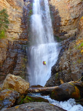
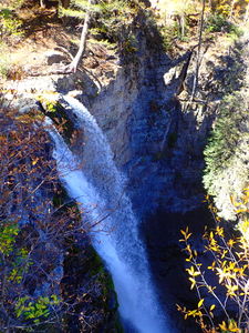
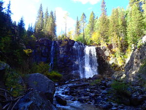
Lower Lake Fork Falls
Walk 5min from the parking lot.
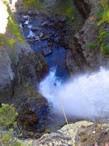
R1: 100ft waterfall, but using 165ft of rope fixed to a pine tree in line with the cascade.
Rappel the to bottom and exit via a trail on canyon right. Cross Lake Fork back to the middle ridge and turn left at the trail intersection. Do not continue downstream into the private property of Ames. From the intersection, go uphill back to the start and retrieve your rope.
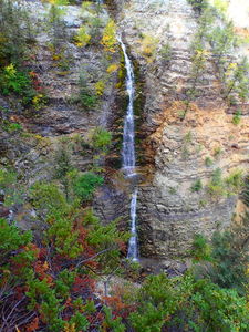
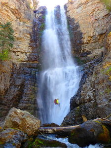
Mystic Falls
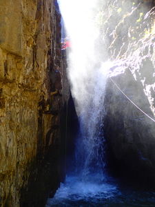
Also 5min from the parking lot, Mystic Falls is just past the top of Lake Fork Falls and drops on the other side of the ridge trail used for the return.
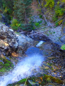
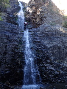
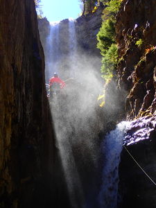
R1: 140ft, fixing a line from an overhanging pine tree on Canyon Left. Beware knocking loose rocks on those rappelling or on yourself while rappelling and use careful rope placement for the first 15 feet.
R2: 35ft, from webbing slung from a pine tree Canyon Right. Pull and repackage your rope from R2. Hike out on a trail on Canyon Right that will start up the ridge to the right. Do not continue downstream into the private property of Ames. From the intersection, go uphill back to the start and retrieve your rope.
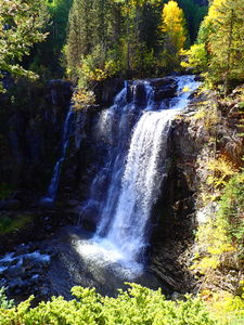
Upper Lake Fork Falls
Accessing this waterfall from the bottom: Follow a trail on Canyon Left (right upstream) from the top of Mystic Falls. When a 10ft wide waterfall presents itself, bypass this short waterfall on Canyon Left and climb around to view Upper Lake Fork Creek falls from below. To gain access to the top, scramble up a gully on Canyon Left just downstream from the short 10ft wide falls and walk through the aspen forest above.
It might be possible to car shuttle with two 4WD HC vehicles leaving one vehicle at the parking space overlooking Lower Lake Fork Falls and driving the other further up the dirt road above Upper Lake Fork Falls then hiking a short distance on the Galloping Goose Trail to start at the creek.
R0: Upper Lake Fork Falls = 50ft
Exit[edit]
From the top of Mystic Falls or Lower Lake Fork Falls, walk 5min in your wetsuit back to the parking lot.
Red tape[edit]
Beta sites[edit]
Trip reports and media[edit]
Sept 2018: Lisa Purdy and Ira Lewis added photos, kml, and created this ropewiki beta entry. This has been previously descended at least a few times and photographed many many times.
