Rio Negro (Inferior)
| Rating: | ||||||||||||||||
|---|---|---|---|---|---|---|---|---|---|---|---|---|---|---|---|---|
| | Raps:12, max ↨98ft
Red Tape: Shuttle:Optional Vehicle:Passenger | |||||||||||||||
| Start: | ||||||||||||||||
| Parking: | ||||||||||||||||
| Shuttle: | ||||||||||||||||
| Condition Reports: | 23 Sep 2023
"Great canyon. We descended this twice during the 2nd intl rendezvous in 2023, so that some late arrivals would get the chance to do it. The water was |
|||||||||||||||
| Best season: | ||||||||||||||||
| Regions: | ||||||||||||||||
Introduction[edit]
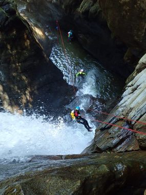
Rio Negro is an outstanding canyon full of jumps and aquatic rappels, through a smooth rock drainage. There is one rappel towards the end that is recommended to rig as a guided rappel.
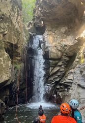
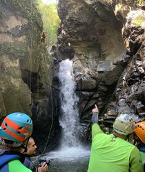
This beta describes the lower (Inferior) section. Just above this is a middle section that has no known descent. It would not take much more effort from the top of the hill just before dropping down to the starting point for this section, to continue up and to the northeast along the same ridge and drop into the middle section. Google Earth shows just over 0.5km and +120m. A drone would be good to fly here to scout although it might be hard to see through the foliage. The waterfall above the suit-up spot (mentioned in the Approach section) is very enticing to rappel!
Rated PG due to the drop with the guided rappel. This is a very forceful drop even at low water levels without setting up the guideline.
Approach[edit]
You can hire a taxivan in Coroico to drive you to the parking for the start, and you can call again when finished to have them pick you up. Beware that cell service can be spotty down here. From the parking point on the map, hike down the road a couple hundred meters to a trail heading down to the right. Follow this down to a creek, then follow the creek downstream 30m or so to where you bushwack back up the hillside to the right. Eventually you join a faint old trail, crest the ridge, and drop down to the basin where you suit up. GPS is best here or reach out to El Vagante for guides.
After suiting up, it is worth going upstream for about 1 minute to a really nice waterfall marking the end of the middle section.
In 2019 for the first int'l rendezvous we had a different approach, marked 'Alt approach' on the .kml. This approach did not require a shuttle. Hike down the washed out road from the 'Shuttle' point on the map, cross the river, and then follow the GPS track up to join the faint trail in the other approach. In 2019 just after crossing the river there was a clearing and a picnic area, but in 2023 it is abandoned and extremely grown over so that might be why they prefer the newer approach requiring a shuttle.
Descent[edit]
You start in a beautiful narrow mouth that leads eventually back to the main river. The rappels are one after another intermixed with many jumps into pools. Crystal clear water. The canyon has two delicate and technical parts, one in the start and the other in the middle. Almost all the jumps have the option to rappel.
Exit[edit]
You will finish about 200 meters downstream from the abandoned road heading back up the hillside to the west. The pool at the junction of Rio Negro and El Vagante River is a popular spot for people to come and swim, and is featured on local tourism posters.
Red tape[edit]
Permission required to descend. Please see Coroico region page for more information.
Beta sites[edit]
Trip reports and media[edit]
Background[edit]
First descended Nov 2017 by Juan Carlos Rio Bello, Victor Sanchez, Lucio Jorge Mendoza, Eduardo Gomez Perez, and Javier Gil.


