Salmon Creek (Upper)
| Rating: | |||||||||||||||||||||||||||||||
|---|---|---|---|---|---|---|---|---|---|---|---|---|---|---|---|---|---|---|---|---|---|---|---|---|---|---|---|---|---|---|---|
| | Difficulty:4B IV R (v5a2 IV) Raps:9, max ↨230ft
Red Tape:No permit required Shuttle:Required 75 min Vehicle:4WD | ||||||||||||||||||||||||||||||
| Location: | |||||||||||||||||||||||||||||||
| Condition Reports: | 30 May 2021
"We only did the headwall but it was awesome. Most of our team was already pretty beat up from the previous days so we went quite slow on the hike in a |
||||||||||||||||||||||||||||||
| Best season: | Mar-Oct
|
||||||||||||||||||||||||||||||
| Regions: | |||||||||||||||||||||||||||||||
Introduction[edit]
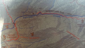
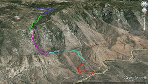
There is an Upper and Lower section that can be done in different days or joined together in one long day. Please note none of them is very interesting at low flow, but at good flow they are said to be really nice. The flow can be visually inspected from the Checkpoint marked on the attached map, which is where the main road crosses over Salmon Creek.
Salmon Creek is less stable than nearby Dry Meadow Creek (Seven Teacups), so it is difficult to catch it at good flow (not too high and not too low). For example: On October 2009 the creek was displaying high water conditions while on June 2013 it was down to a trickle. Waterflow analysis for this canyon is displayed at Salmon Creek (Lower).
Approach[edit]
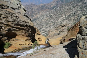
You will need a shuttle to reach Upper Salmon. Leave a car at the bottom and drive up the marked black route to the Salmon Creek Falls trailhead. Some choose to do this the night before the descent, camp at Horse Meadow and start early the next day. The trail to Salmon Creek Falls takes you down to some swimming holes and eventually to the top of the upper falls, where the technical section starts. There is a trail that access the Middle Entry/Exit point, see map, that marks the exit for the Upper section and the start for the Lower section.
Descent[edit]
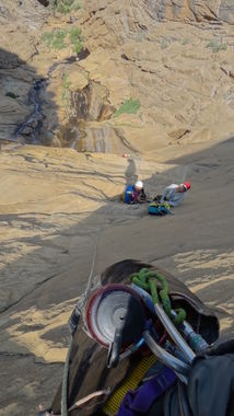
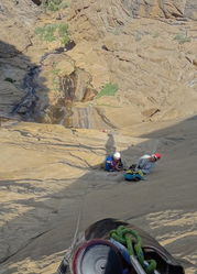
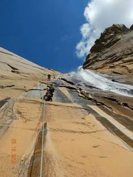
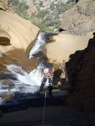
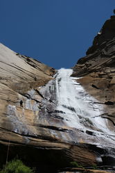
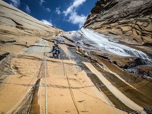
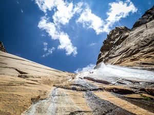
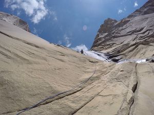
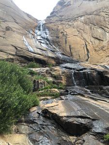
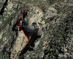
Measurement are approximate, beta for Lower Salmon Creek is included for reference or combining both in a single day. Upper Salmon Creek: R1-4 are the big headwall sequence, and R2-4 is the main 600 foot headwall.
- R1: 180' Natural anchors options DCR include: Feed through in the rock wall, wrapping a boulder (or 2), or doing a sketchy down climb to a small pine tree. First person down is most likely going into the waterfall, possibly the full brunt if the person slips trying to rappel off plumb. Pull down may be difficult as the rap traverses RDC around a corner to large R2 ledge; extend the anchor for LAMAR.
Recent comment on Facebook about this: The first rappel was off a 5 foot tall pine tree RDC. We removed it and built a new one by wrapping two large boulders about 15 to 20 feet higher up the wall. So the rappel is now longer, but safer. It is also now a bit closer to the watercourse allowing you to rappel the waterfall if you wish. Top 60' of rap into a pool below then traverse around the corner to R2 anchor.
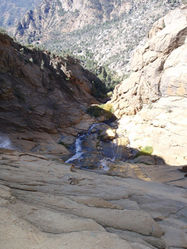
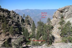
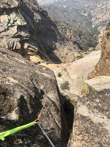
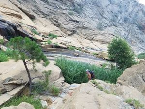
- R1 alternate 220': Instead of hiking down into the creek bed and bushwhacking on the approach, angle up on the ridge (see pic below), following a couple rock cairns to a big pine tree. Less than 100 feet further you reach the wall edge with various options to build anchors. Looking down the wide chimney corner you can easily see the R2 anchor below (see pic below). In high flow, building an anchor here allows you to do the entire headwall out of the main flow. In low flow, doing it this way allows for dry or nearly dry rappels to the headwall bottom. Also, setting fixed lines here makes a direct path down 800 feet to the bottom of R4.
- R2: 165' Pull down may be difficult as the rope is on the sloping slab with a few cracks, consider extending the anchor for LAMAR & keeping the rope clean.
- R3: 110' 2 bolts on a small ledge about 24" wide that only has space for 2 people
- R4: 220' 2 bolts from very small ledge about 4x12, landing onto a steep slick rock
At the bottom of R4, you can climb the gully RDC (see pic below) following the numerous rock cairns and exit the headwall area to earthen saddle above the approach hiking trail. Access the gully near a lone small tree, or the water plant thicket with one large tree (see pic below). This exit wanders around a bit, but generally is easy hiking up steep grade with minor scrambling, minimal fall exposure and nearly zero bushwhacking. Figure 30 minutes climbing fast or 1 hour taking your dear sweet time.
- R5: 90' high anchor around a boulder DCR in a “slot” that seldom sees any flow, landing in 2-3 feet deep pool.
- R6: 230' large boulder DCL over slick rock below a massive boulder. Rap is down a crack with several cascades and 2 pools. hydraulic potential at high flow. A few options with some slippery down climbs may have made this a 50' rap. Depending on rap count, there is a bolt on the underside of a rock LDC as you head toward the narrow crack just above the pool. Caution on the RDC is very slippery after the crack downclimb and small brush would not make this a route to choose.
- R7: 70'
- R8: 60' small tree DCL at the top of the cliff
- R9: 50' may be a down climb or wrap a boulder higher up.
- Lower Salmon Creek Falls starts at the bridge of the Rincon Trail: See Salmon Creek (Lower)
Exit[edit]
- The Upper section ends at the bridge at the Rincon Trail which is also the start of the lower section. (also know as the Middle Entry/Exit point). If doing only the Upper section, you can park the exit shuttle vehicle at the Rincon Trailhead.
- The Lower section ends when the river intersects a dirt road and the concrete wall. If you are going to do both the upper and lower (or just the lower) you can park the exit shuttle vehicle there instead of at the Rincon Trailhead.
Attached below you can also find a capture of a paper map. Make sure you understand the attached KML map and the GPS routes it displays.
Red tape[edit]
Beta sites[edit]
Trip reports and media[edit]
Background[edit]
A small team of people led by Matt Maxon realized the first documented descent in 2009. The Everytrail link points to the account of this historic event.
