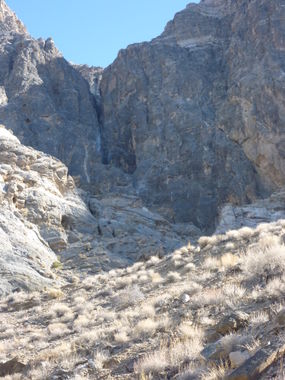
Sand Witch Canyon
| Rating: | |||||||||||||||||||||||||||||||
|---|---|---|---|---|---|---|---|---|---|---|---|---|---|---|---|---|---|---|---|---|---|---|---|---|---|---|---|---|---|---|---|
| | Difficulty:3A IV (v3a1 IV) Raps:12-16, max ↨150ft
Red Tape:No permit required Shuttle:None Vehicle:High Clearance | ||||||||||||||||||||||||||||||
| Location: | |||||||||||||||||||||||||||||||
| Condition Reports: | 14 Feb 2021
"Didnt need to replace any anchors. 2-3 have noticeable UV fading, but still serviceable for this trip. Rappel near the end had a pothole with water |
||||||||||||||||||||||||||||||
| Best season: | Nov-Mar (avg for this region)
|
||||||||||||||||||||||||||||||
| Regions: | |||||||||||||||||||||||||||||||
Introduction[edit]
Sand Witch is the sister canyon to Pagan Canyon which a canyoneer crosses on approach. It is located at the very end of the rough dirt road to Eureka Dunes, but before any special vehicle capability is needed.
Approach[edit]
Drive past Eureka Dunes dry camp as far as is convenient and park in one of many large camping turnouts. The route is not appreciably longer if starting slightly further north than the KML indicates, and the the road can be impassable to normal vehicles after it turns south.
Make a GPS beeline to a ridge separating Pagan Canyon on the left from Sand Witch on the right. The final drop of Pagan Canyon will be obvious on the left as you climb the ridge above it and the ridge narrows to a saddle. Scramble up and over the ridge descending slightly into Pagan Canyon. Cross Pagan Canyon and head up the ridgeline just up canyon. Look for weaknesses in the cliff bands and target them, generally staying slightly right of the ridgeline. At the prominent cliff band just above 5000ft, contour around the cliff band into Pagan Canyon losing as little altitude as easily practical. If targeted well, you will enter Pagan Canyon directly across from a large gulley. Cross Pagan and ascend the gulley, taking the right major branch. Cross the saddle at the top of the gulley and descend into Sand Witch.
Descent[edit]
R5 has the potential to stick ropes; be careful of the pull. All rappels are single-stage except the pothole rappel near the end.
Many rappels (including the 150') have the anchor right at the lip which makes pulls easier but would make use of a Fiddlestick difficult.
Exit[edit]
If you parked near where the road turns south, stay right as the canyon opens up and gain ~6ft to see your car in the distance.
Red tape[edit]
A Death Valley National Park pass is required in this area.
Beta sites[edit]
 Super Amazing Map : Sand Witch
Trip reports and media[edit]
FIRST DOCUMENTED DESCENT TRIP 1-18-13:
- 5-21-16 - subsequent descent done for beta update:
subsequent descent done 5-21-16 by Scott Swaney team for beta update
Background[edit]
Originally explored by Scott Swaney and team on 01-18-13 See more details on Trip Report above
