Sarcophagus
Jump to navigation
Jump to search
| Rating: | |||||||||||||||||||||||||||||||
|---|---|---|---|---|---|---|---|---|---|---|---|---|---|---|---|---|---|---|---|---|---|---|---|---|---|---|---|---|---|---|---|
| | Difficulty:3A III (v3a1 III) Raps:6-7, max ↨82ft
Red Tape:No permit required Shuttle:Required Vehicle:Passenger Rock type:Sandstone | ||||||||||||||||||||||||||||||
| Start: | |||||||||||||||||||||||||||||||
| Parking: | |||||||||||||||||||||||||||||||
| Shuttle: | |||||||||||||||||||||||||||||||
| Condition Reports: | |||||||||||||||||||||||||||||||
| Best season: | Dec-Nov
|
||||||||||||||||||||||||||||||
| Regions: | |||||||||||||||||||||||||||||||
Introduction[edit]
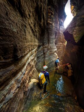
Sarcophagus canyon can be done all year round due to its low flow (a small trickle in normal conditions) and features a sequence of drops through an impressive but short constriction. No wetsuit required. The walk out, which is long and scrubby, will have you questioning if the canyon is worth repeating.
Approach[edit]
- A car shuffle is required
- Leave a car at the Pierces Pass picnic area carpark at -33.570410, 150.338810
- Park your other car at Bells Line of Road & Mt Wilson Road intersection at approximately -33.545871, 150.336095
- Download the GPX or work out our own route to the start at -33.5693, 150.3235
- A faint track is present for approximately 80% of the route in
Descent[edit]
| Number | Metres | Location | Note |
|---|---|---|---|
| 1 | 5m | RR | Right hand branch of confluence of two small gully lines. You can also bypass this small drop if you enter via left hand branch which only requires a small scramble down. Right hand branch is prettier and more canyon like. From the top it looks like a deep pool but you can land on the river left and walk around the pool. |
| 2 | 15m | RC | Sling on large log. Awkward overhang at start of drop. Finishes in small shallow pool. |
| 3 | 15m | RL | Finishes in small shallow pool. Emergency exit opportunities exist between P3 and P4. |
| Walk approximately 100m downstream. There are two small drops of approximately 2m or 3m, first one finishing in a deep pool and the second one in shallow water. These can be avoided by walking around on the river right (common route). | |||
| 4 | 20m | RR | Sling on broken tree on river right. Finishes in deep pool but can easily be avoided on the river left. |
| 5 | 10m | RR | Anchor on RR wall. This drop used to be combined with P4 and was approximately 30m in total. Finishes in shallow pool, deepest part can be avoided on the river left. |
| 6 | 25m | RL | Finishes in deep pool. Can be bridged with enough skill and body height. Consider rigging guided rappel using P7 anchor for party members who need assistance staying dry. |
| 7 | 20m | RL | Down the slot... dry finish. Recommend dangling backpack underneath you. This is the 6th pitch in Richard Pattison's video. The log in video is gone. You can exit river left at the bottom on P7. |
| 8 | 45m | Optional. Anchor off a large tree. |
Exit[edit]
- Exit river left at bottom of P7
- The beginning features a high risk traverse with brittle chossy rock. Rigging a traverse line to safely bring your party across is STRONGLY recommended.
- Continue along cliff line for approximately 1km until you reach the bottom of Yileen canyon
- Continue along Yileen canyon exit track until you reach the Pierces Pass picnic area carpark
