Sardine Creek
| Rating: | |||||||||||||||||||||||||||||||
|---|---|---|---|---|---|---|---|---|---|---|---|---|---|---|---|---|---|---|---|---|---|---|---|---|---|---|---|---|---|---|---|
| | Raps:5-16, max ↨90ft
Red Tape:Closed to entry Shuttle:Optional 0 min Vehicle:High Clearance | ||||||||||||||||||||||||||||||
| Start: | |||||||||||||||||||||||||||||||
| Parking: | |||||||||||||||||||||||||||||||
| Shuttle: | |||||||||||||||||||||||||||||||
| Condition Reports: | 31 Jul 2020
"Very low water. Not very exciting. Many different combinations of rappelling and downclimbing possible depending on water level and skill. 5:50 for bo |
||||||||||||||||||||||||||||||
| Best season: | Jul-Sept
|
||||||||||||||||||||||||||||||
| Regions: | |||||||||||||||||||||||||||||||
Introduction[edit]
Current Status: Closed. This creek was overrun by the Beachie/Santiam Fire in Sept 2020 and has been closed. Please check on local closures before planning a trip to this area. When the area eventually reopens, use extreme caution when descending the creek. Between landslides, fallen trees, and loose rocks, this area may be unstable and dangerous for years to come. The canyon may have changed dramatically. Do not rely on the beta below being accurate.
- Update 2025: According to Santiam State Forest the area is "closed until further notice."
Sardine Creek is a tributary of the North Santiam River that flows into the western end of Detroit Lake. There at at least three options here:
- Upper Sardine - a strong team could combine both upper & lower Sardine in a single day.
- Lower Sardine
- East Fork Sardine - a lesser tributary which has been broken out onto its own page. Some canyon groups will run the east fork, then the last few rappels on Lower Sardine.
If running lower Sardine early in the season, it may be prudent to check the flow on the final rappel (Chasm Falls - R16) that is visible a short distance up the road from the Parking Exit point. At high flow, this pothole can be a serious hazard. Sardine seems to drain out pretty quickly and often has low water by July or August.
(Be aware: some of the trip reports and reference photos on this page are for the East Fork, not the Main Fork. This was done before the east fork was broken out into its own page in 2022.)
Approach[edit]
Drive up Sardine Creek Rd and leave a vehicle at your planned exit. Pre-fire, the lower part of Sardine Creek Rd was a bit rough but could be driven carefully with a 2WD vehicle. High clearance or 4x4 may be recommended, however.
- Upper Sardine: leave your shuttle car at the Middle or Lower Parking.
- Lower Sardine: leave your shuttle car at the Lower Parking.
Depending on your plan, you will likely want to do one of the following:
- If running lower Sardine, drive (or hike) up to the Middle Parking and hike in on the old road to the Middle Entrance.
- If running upper Sardine, drive (or hike) to the Upper Parking. (Hiking is doable, but a bit long. Pro: you don't need to backtrack to get a vehicle at the end of the day.) If driving: the upper section of Sardine Creek Rd is 4WD and was in bad shape pre-fire. An easier (mostly) 2WD approach would be to backtrack out to Hwy 22 and take French Creek Rd up from near the Deetroit bridge up past Tumble Lake. Con: a one-way shuttle will take about an hour. (This is the same shuttle for the East Fork of Sardine.)
Descent[edit]
Upper Sardine[edit]
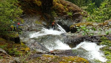
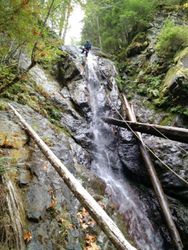
The upper main fork is, hands-down, the best part the Sardine complex. It's pretty non-stop action. Con: It takes more effort to reach.
From the parking at the end of FR 535, bushwhack directly north into the forest a hundred yards or so. Vegetation was relatively thick in 2019 per an old clearcut. When you can, angle down to your left to drop into the creek. Takes about 5min. Head downstream through a logjam. The creek abruptly clears out and is easy traveling from here to the very end.
- Short downclimb or two.
- Weird Ramp Falls: 20ft. Downclimb DCR.
- R1: 2-tier - 35ft, then 15ft ramp. Very deep pool between tiers.
- R2: 2-tier - 30ft, then 20ft.
- R3: two-tier ramp, about 40ft high.
- short ramp, followed by short drop - easy downclimb.
- R4: 12ft step.
R5-R7 come in quick succession. Might be possible to combine anchors for some of these:
- R5: 40ft. A tributary enters DCL at the bottom, making this a double waterfall. You could rappel the tributary if desired. Opens out onto a large bedrock platform at the bottom.
- R6: 30ft.
- R7: 20ft.
- 10ft step, downclimb DCR.
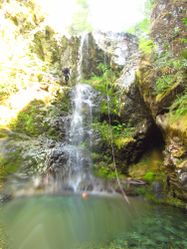
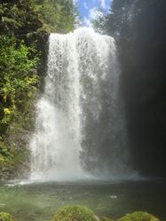
- R8: Upper Sardine Falls 60ft. Tallest rappel on upper Sardine.
- R9: 40ft.
- R10: 40ft. Watch for rope-eating cracks on this one. We stuck a rope.
Head downstream until the vegetation closes in. This thicket is easily bypassed by jumping out of the creek on the DCL side. Bushwhack for all of two minutes to circumvent the thicket and get back in the creek. Continue downstream another 5min to the place where the 4WD road crosses Sardine Creek. This is the "Middle Entrance". It's end of Upper Sardine... and the beginning of Lower Sardine. You can either: 1) exit here via the road, or 2) continue on down Lower Sardine to make a full day of it.
Lower Sardine[edit]
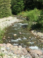
This section of creek has some nice waterfalls, but they're much further apart than the upper section. Expect more creek-walking. In mid-summer, you may find the creekbed dry at first. Continue downstream and water will soon appear.
- R11: 10ft downclimb or rappel
- R12: Sardine Falls. 90ft rappel from tree DCL. Beware: a rope-eating chockstone at the top.
Below R12 is a gigantic house-sized monolith that the creek diverts around. The creek divides many times, plunging through a giant boulder garden below the monolith as it seeks the canyon floor. It's possible to downclimb this section (DCR?) or find a nice place to rappel from. One party rappelled 30ft from a dead log DCL side of the boulder. Another group went DCR around the boulder, then cut back to canyon left for a rappel 100ft into a pool. Your rappel count here may vary depending on your chosen path. For the purposes of this description, we'll count the boulder garden as R13.
Just below the boulder garden, the East Fork enters on the left.
- R14: 50ft from tree DCR. At the bottom, there is an optional exit up to the road
- R15: 25ft rappel from tree DCR (or downclimb). Consider having your best climber meat anchor the rest of the team. A safety line might be all you need.
- R16: Chasm Falls 30ft rappel from tree DCR into a pothole. WARNING: This pothole can become a dangerous hydraulic in high flow. If the rappel looks too much, there's an easy exit DCL up to the road from the top of this rappel.
Exit[edit]
Below R16, there are a number of places to exit the canyon up to the road. One good option is to bushwhack up a dry rocky tributary (DCL) about 500ft downstream from the base of the falls.
Red tape[edit]
None.
Beta sites[edit]
 CanyoneeringNorthwest.com (archive.org) : Sardine Creek
Trip reports and media[edit]
 Karl Helser's NW Adventures : Lower Sardine Creek
 Karl Helser's NW Adventures : Upper Sardine Creek
Background[edit]
- The first descent of Lower Sardine is not known.
- Upper Sardine was first descended in July 2019 by Kevin Clark and Keith Langenwalter.
