Sayarim Canyon Extended (South Fork)
| Rating: | |||||||||||||||||||||||||||||||
|---|---|---|---|---|---|---|---|---|---|---|---|---|---|---|---|---|---|---|---|---|---|---|---|---|---|---|---|---|---|---|---|
| | Difficulty:3A III PG (v4a1 III) Raps:5-7, max ↨70ft
Red Tape:No permit required Shuttle:None Vehicle:Passenger | ||||||||||||||||||||||||||||||
| Location: | |||||||||||||||||||||||||||||||
| Condition Reports: | 27 Dec 2025
"Pretty standard run through Sayarim South Fork for what seems to be our now annual trip through. All anchors were in good condition and thankfully cai |
||||||||||||||||||||||||||||||
| Best season: | Winter
|
||||||||||||||||||||||||||||||
| Regions: | |||||||||||||||||||||||||||||||
Introduction[edit]
This is the original route I wanted to do for Sayarim Canyon in 2019 and I can’t be happier I now did! The upper section has so much more to offer. Keep on reading and check out the pictures…
First Known Descent: 1, 6, 2021 First Known Descent Members: Eshed Bootel, Nicole Bootel, Matan Bootel, Nadav Bootel, Gil Chotam, Ty Chotam, Jodi T.
Approach[edit]
Getting There: From the 190 and Badwater Rd. junction in Death Valley (36.4484, -116.8528), drive South for about 3.9 miles. Park on the East side of the road (36.4122, -116.8456).
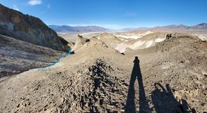
Approach: Walk East on the North side of Gower Gulch into the canyon bypassing the lower waterfall on the left (North). After 2 miles (36.4144, -116.8209) turn right at a fork, leaving Gower Gulch. Stick to the right on the immediate second fork(36.4136, -116.8205). A 3rd fork and Right here: 36.4110, -116.8207 and shortly after the 4th and 5th forks and Rights at 36.4102, -116.8218 and 36.4098, -116.8233. At this point you will be climbing to “Saddle 1” in a pink gully. For a bonus amazing vista point walk a few feet north from the saddle before descending to here: 36.4102, -116.8240.
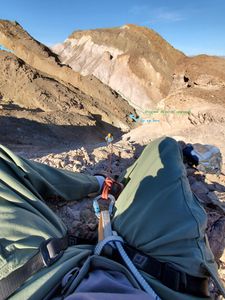
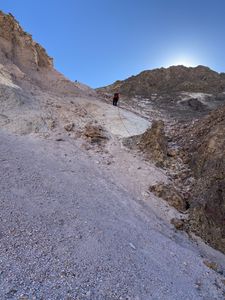
At Saddle 1 I sat down on a rock as a Meat-anchor and the group rappelled about 160’ on a slippery slope in another pink gully. I then walked down - WATCH YOUR STEP! Once at the bottom and looking down-canyon, you will see a small brown waterfall to your left. This is where you want to go up again (36.41013, -116.82482). DO NOT continue to the next pink gully - this will take you to the original, shorter Sayarim canyon, missing on the good stuff. Climb up 3 small (5’) falls and then up to Saddle 2 (36.40971,-116.82669).
Descent[edit]
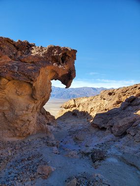
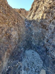
Going down a white gully from Saddle 2, you will quickly enter a narrow slot (reminded me of some Anza Borrego slots). A short walk in the slot and you are standing above a 10’ drop. It is an awkward and sandy down-climb (You might want to consider rappelling). You will then crawl under “Leaning rock” to arrive at “Hanging rock 1”. Here again you have a choice between a somewhat scary down-climb to the left under the rock, or rappel above it RDC. A few more feet and you’re crawling under “Hanging rock 2”. About 1400 feet later you will encounter the beautiful “Eagle rock” and behind it the 70’ waterfall of the Extended Sayarim canyon. After this rappel you are joining the original Sayarim Canyon. Go to that page for the remainder beta.
Waterfalls:
| Number | Tiers | Total height | Anchor (looking down stream) | Anchor Gear | Rope* |
|---|---|---|---|---|---|
| 1 | 1 | 70' | L - Tunnel in rock | 15-20’ Webbing or rope | 160' |
- Rope - Recommended length based on rappel height and distance between tiers (when applicable) and to anchors x 2
Waterfall notes: 1. It’s a great high anchor point, but beware: The exit is in a wired angle and straight into an overhang.
> After this, you still have the rest of the Sayarim Canyon waterfalls.
Exit[edit]
From the bottom of the last rappel it’s a short walk back to the car.
