Bearwater Canyon
| Rating: | |||||||||||||||||||||||||||||||
|---|---|---|---|---|---|---|---|---|---|---|---|---|---|---|---|---|---|---|---|---|---|---|---|---|---|---|---|---|---|---|---|
| | Difficulty:3B III (v3a2 III) Raps:3-5, max ↨70ft
Red Tape:No permit required Shuttle: Vehicle:High Clearance Rock type:Sandstone | ||||||||||||||||||||||||||||||
| Start: | |||||||||||||||||||||||||||||||
| Parking: | |||||||||||||||||||||||||||||||
| Condition Reports: | 3 May 2025
"Bearwater is fun. Lots of downclimbs with a few rappels and some creativity needed for rigging rappels for questionable downclimbs. Bearwater is an ea |
||||||||||||||||||||||||||||||
| Best season: | Spring/Fall
|
||||||||||||||||||||||||||||||
| Regions: | |||||||||||||||||||||||||||||||
Introduction[edit]
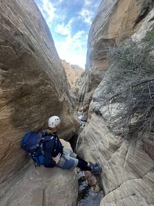
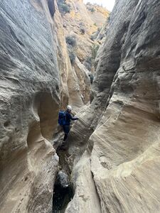
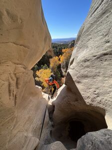
A nice sandstone canyon in the Willow Creek Wilderness Study Area just northeast of the town of Dinosaur, CO. The canyon becomes narrow at various points as it runs south off of the mountain down towards HWY 40. While the narrows are never particularly deep or tight, the canyon still has some interesting features to enjoy.
May 2025 update:
- The dirt BLM road from Harpers Corner Rd to the parking area will be muddy and hard to drive after rain.
- Ticks have been seen on Spring trips in the canyons in the Willow Creek Wilderness Study Area.
- Mormon Crickets are often seen in the Fall. While these may be unsettling to some, they don't bite.
Approach[edit]
The trailhead is in the same area as the one used for nearby Snake Drop canyon. From hwy 40, drive north on Harpers Corner Road for 5.9 miles to a dirt road that is found on the right. Follow the dirt road east along the top of the mountain for 2.4 miles. While the same parking for Snake Drop can be used, we parked and started our hike at a pullout a little before the trailhead currently listed for that canyon. Please note that there is private land just east of the trailhead, so take care to identify where that is and avoid crossing into it on the approach.
From wherever you park, use GPS to navigate southeast until you find an old road / trail that runs north-south along the ridge just east of Bearwater canyon. This trail is quite visible from satellite maps and is not too difficult to locate. Along the way you will cross over a small stream originating from Bearwater spring. Following this stream would eventually lead you to the canyon, but we elected to find the old road for ease of travel and to avoid long sections of bushwhacking in the creek.
For our initial exploration/descent, we followed the old road south until reaching a side drainage that intersects with the main canyon right around the point where the canyon narrows consistently (40.287246, -108.891353). Drop into the side drainage where possible and follow it to the intersection of the main canyon.
If starting the canyon from above this point, there may be a couple of places where ropes may be necessary. On our exploration, we descended from the confluence of the side drainage and did not investigate upstream.
May 2025 update: We descended the entire drainage instead of making use of the old road, but this isn't recommended. We found a 15' loose downclimb and a first rappel (R0) with trickle of a waterfall in May at (40.29318, -108.89316). R0 is 55'-65' depending on the anchor, shorter using a pine DCL. However the brush is thick and spiny and not at all worth the effort.
Instead, hike the path along the old road as mentioned by the exploration team. However, enter a little higher to where slickrock begins in the drainage at (40.28879, -108.89196) to add (1) rappel and (5) downclimbs. Note: this final part of the approach in the kml is unverified, but is likely something like what is drawn will go.
Descent[edit]
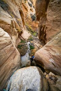
At the confluence with the main canyon, the first thing you will likely notice is the presence of running water. This is the same stream from Bearwater Spring that you crossed over during the approach hike. This flow is possibly year-round, given that we found flow in late October and that the origin is a spring. While the flow rate at various times of year is unknown, during our descent the flow was minimal and provided no additional risks.
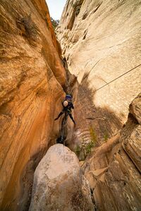
Shortly after proceeding down-canyon, the first mandatory rappel is encountered. R1 is roughly 20-30 feet, which we anchored off a small, but solid rock embedded in the watercourse just before the edge of the rappel. Given the size and location of this anchor rock, it should be inspected carefully before use to ensure its stability. Other anchor options would include building a deadman anchor or a large dead tree found quite a ways up-canyon. If using rocks for your anchor, choose wisely, as many of the boulders in the area are made from soft and brittle sandstone. R1 had minimal flow that caused no issues, but could change in difficulty in high flow situations.
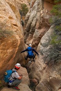
Shortly after R1 is a fluted drop of 10-20 feet that can be down-climbed.
Further down canyon, the stream disappears underground and was not seen again by us until after the final rappel. This was about half-way down our route and was followed by a more open area where escape is possible on the left.
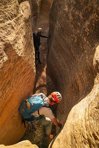
Continuing into the lower section, a few down climbs are encountered, one of which we rigged for rappel off of a small tree above the watercourse RDC. This drop would likely not be too difficult to down-climb, but we were unsure of the stability of the chokestone footholds at the top so elected to rappel. The tree anchor was difficult to reach and most parties would likely prefer to meat-anchor and partner assist instead. This drop is probably about 15-20 feet total.
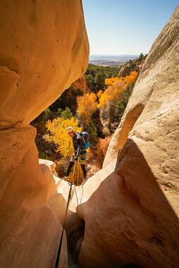
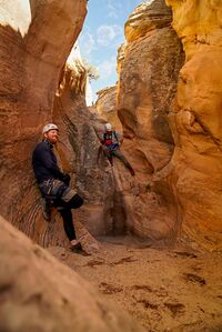
The second and final mandatory rappel is found at the end of the narrow sections where the canyon opens up and changes character. While shallow, the canyon forms a series of bowls above the final drop that are quite pretty. R2 is 55'. We built a deadman anchor with good geometry in the final bowl above the drop.
May 2025 update: starting where the slickrock begins in the drainage at (40.28879, -108.89196) we encountered the following obstacles:
DCs: 10' & 15' w/ rabbit hole
R1: 25' from a rock pinch in the boulders a few feet below the edge DCR. Beware of bees in the bush at the top DCL. The bold may DC this drop.
DCs: 30' two-stage, 12' w/ chock stone, 10'
Passed the incoming side drainage where the exploration team began at (40.28725, -108.89135)
Downclimbs in the next narrows
R2: 15' from a rock pinch close to the edge DCR (was R1)
DCs: 20' under a rock, past a giant conglomerate boulder, 2x 5', 10', 10', 2x 5'
DC: 20' with an awkward start that may be a potential rappel from a meat or natural anchor.
R3: 70' length includes 15' rope for the fiddle and 15' webbing from a deadman buried in the back of the final room furthest from the lip after a few short DCs.
NOTE: it may be possible to escape the canyon in the final narrows up a large crack DCL before the final drop.
Exit[edit]
After the final rappel, proceed down canyon for a few hundred feet and exit up the ridge on the left to the old road / trail. Follow the old road north and retrace your path to your vehicle.
May 2025 update: immediately after the final rappel, climb up the incoming drainage DCL. As soon as feasible, climb up on the right slope (East) and hop on the old road to the north, which is a great path to regain elevation back to the car.
Recommended: hike up the old road to the top of Kingsnake Canyon at (40.29071, -108.88585) and descend that canyon as well!
Red tape[edit]
Beta sites[edit]
Trip reports and media[edit]
First known descent in October 2023 by Peter Jans, Ross Bernards, and Andy Lillibridge.
2025-05: Second known trip through. kml and rope lengths added. Ira Lewis & team.
Background[edit]
Bearwater Canyon was named after the spring that drains into the canyon.
