Wicked Canyon
| Rating: | |||||||||||||||||||||||||||||||
|---|---|---|---|---|---|---|---|---|---|---|---|---|---|---|---|---|---|---|---|---|---|---|---|---|---|---|---|---|---|---|---|
| | Difficulty:3A III (v4a1 IV) Raps:7, max ↨185ft
Red Tape:No permit required Shuttle:Optional 15.3 mi Vehicle:High Clearance Rock type:Sandstone and Granite | ||||||||||||||||||||||||||||||
| Start: | |||||||||||||||||||||||||||||||
| Parking: | |||||||||||||||||||||||||||||||
| Shuttle: | |||||||||||||||||||||||||||||||
| Condition Reports: | 13 Nov 2025
"Updated the main page to sync the original 2019 beta and 2023 comment and added a new exit path, which does not require a shuttle using the Morning St |
||||||||||||||||||||||||||||||
| Best season: | Feb-May, Oct-Nov
|
||||||||||||||||||||||||||||||
| Regions: | |||||||||||||||||||||||||||||||
Introduction[edit]
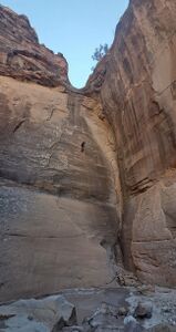
This route is located in the McInnis Canyon National Recreation Area, which abuts the Colorado National Monument to the west. While some amazing rappels are located within Wicked canyon, everyone is less enthusiastic about the exit options.
Options:
- Spot a shuttle vehicle at the Devils Canyon Trailhead parking lot in Fruita. There are bathrooms here. People have car camped here for convenience, although it is very cold due to the proximity to the mighty river nearby.
- Skip the shuttle and add a lot of elevation gain by linking up with the Morning Star climber exit. Add a descent of Morning Star to the day since this exit goes right by the start of Morning Star.
Approach[edit]
Drive up RimRock Drive through the western entrance to the Colorado National Monument. Just past the Upper Liberty Cap Trailhead, turn east on N 16 1/2 Rd at (39.05534,-108.74167). Take the next right onto Black Ridge Rd at (39.05483, -108.74462), which is a public use 4x4 road, which may or may not be in great condition. Turn right at Radio Tower Rd and park at (39.0650, -108.7563), just before the gate leading to the Black Ridge Lower Access Road, which is only seasonally from Aug15 - Feb15. It is easiest to just walk the Lower Access Road a short distance.
Hike down the Lower Access Road. Head right and depart the road at (39.06755,-108.76070) onto an abandoned Jeep road down to 6500 feet and then head east into the drainage.
Descent[edit]
Original beta:
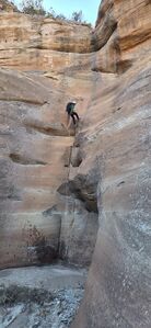
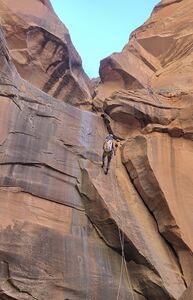
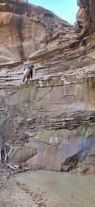
There are no permanent anchors. Put your Fiddle Stick, Smooth Operator, CEM or releasable Bowlin skills to work and let's keep this one in it's pristine Leave No Trace state. Three rappels in the upper section: two 65-foot, 2-tier drops and a 75 foot rappel. Four rappels in the lower section: 75-feet, two 120-footers, one 60-foot. Adjust rope length, sharp edges. One of the 120-footers has small ledge, could be better done as 180-footer.
Beta updated 2025:
R1: 75' from a tree DCL including 10' for the fiddle for two stages 15' then 25'. The second stage can be downclimbed DCR or DCL.
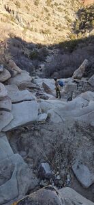
Walk a third of a mile in the stream bed with several small downclimbs.
R2: 40' from a tree DCL including 10' for the fiddle for a 30' drop. Followed immediately by R3.
R3: 75' fiddling a webbing anchor around a boulder for a clean line down the vertical drop.
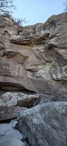
R4: 80' from a tree set back 40' for a 40' drop with an awkward lip. Avoid the awkward lip with a shorter rappel using trees DCR or DCL.
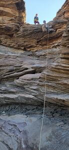
R5: 185' fiddling a small tree DCL including 5' for the fiddle for the full length of the drop. It is reported there is webbing on a tree on a ledge 30' below to break this into two stages.
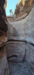
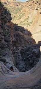
Stem a short narrows after the canyon turns sharply to the right.
R6: 70' from a slung chockstone at the end of the narrows. It's better to not extend this anchor.
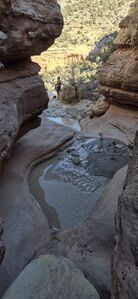
R7: 65' from a tree DCR or from webbing around a pinch in the center of the stream course. The tree DCR gives a better line to avoid mud below.
Exit[edit]
Car Shuttle exit
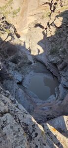
At roughly 5 miles, the exit hike is no joke. About half-way down you may encounter an ancient miner's cabin on a bluff in the middle of the canyon. After this you will descend a granite layer which changes the topography and drainage characteristics dramatically. The granite will require some mildly spicy downclimbs and there will be many pools of unknown depth during the winter season. If you can locate either D3 or D4 trail at some point, the going will get much easier. Finally, you encounter the 4X4 road that leads back to the parking lot and is peppered with many informational signs along the way.
Morning Star climber exit
There is additional bushwhacking and downclimbing after the final rappel.
Exit the drainage at (39.08824, -108.76041) to return to the top vehicle parked near the radio towers and start of the Lower Black Ridge Rd gate at (39.06480, -108.75620). Climb up the ridge to the northwest, wrapping the corner below the prow into the Morning Star drainage. Trend uphill gaining levels as available to intersect with the Morning Star climber exit.
While this presents another option, it may be as equally challenging an exit as the long hike out on the D3 or D4 trails. However, the benefit is the ability to pair with Morning Star if there is enough time in the day and the crew has energy for the climber exit a second time. The Morning Star climber exit doesn't present significant exposure.
The non-shuttle return is 3.35 miles and gains 1,610'. A team of five completed this return in 3hr 15min.
Red tape[edit]
None.
A National Park Pass is not required to pass through the Colorado National Monument on park roads. Tell the ranger at the entrance gate you are driving up to Glade Park.
Beta sites[edit]
Trip reports and media[edit]
Background[edit]
Canyon discovered by Erek Burek. First known descent 4 February 2017 by Lilia Gilbo, Michael Pintal, and Logan DeGrand.

